Paul Pottinger’s Adventures from the Top of the World

Jump to helpful navigation →

Archives

Challenger 2020: Day 3

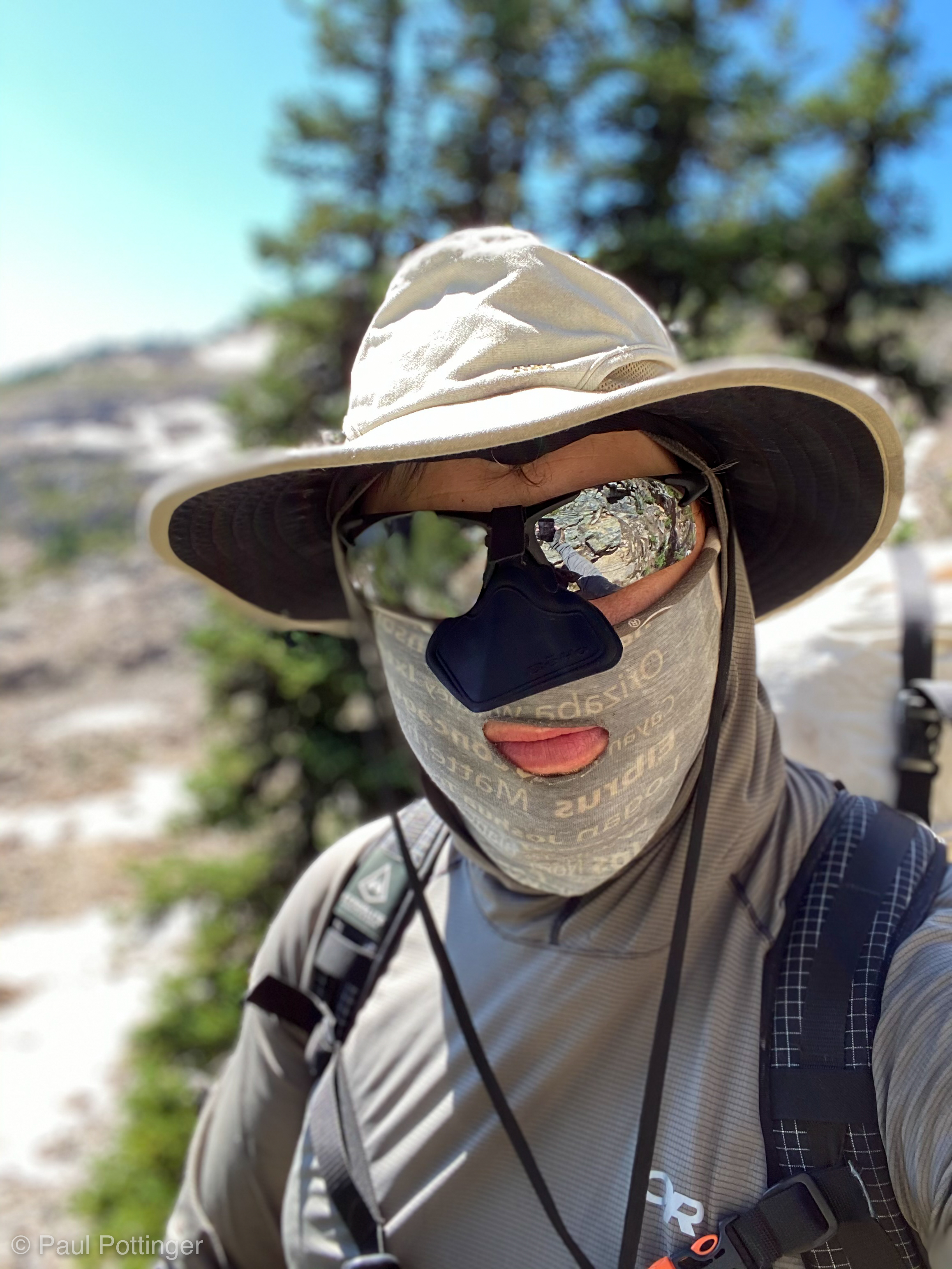
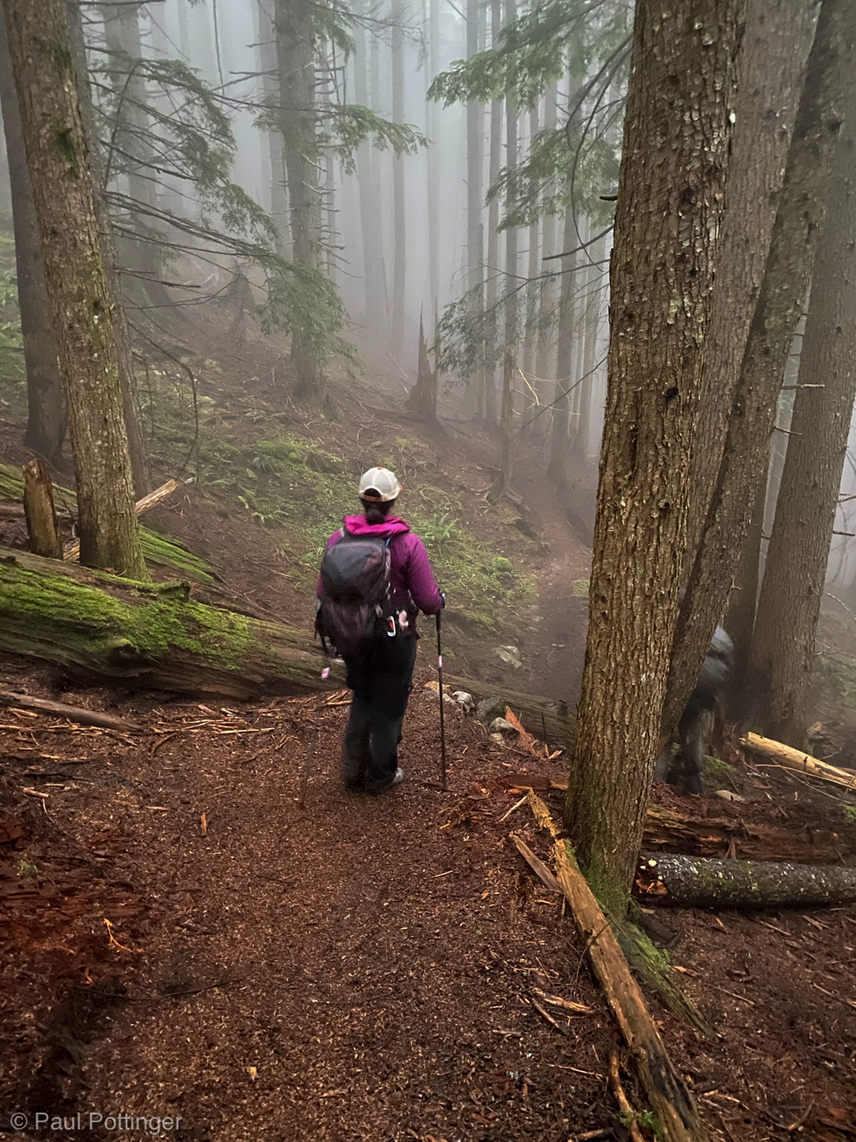
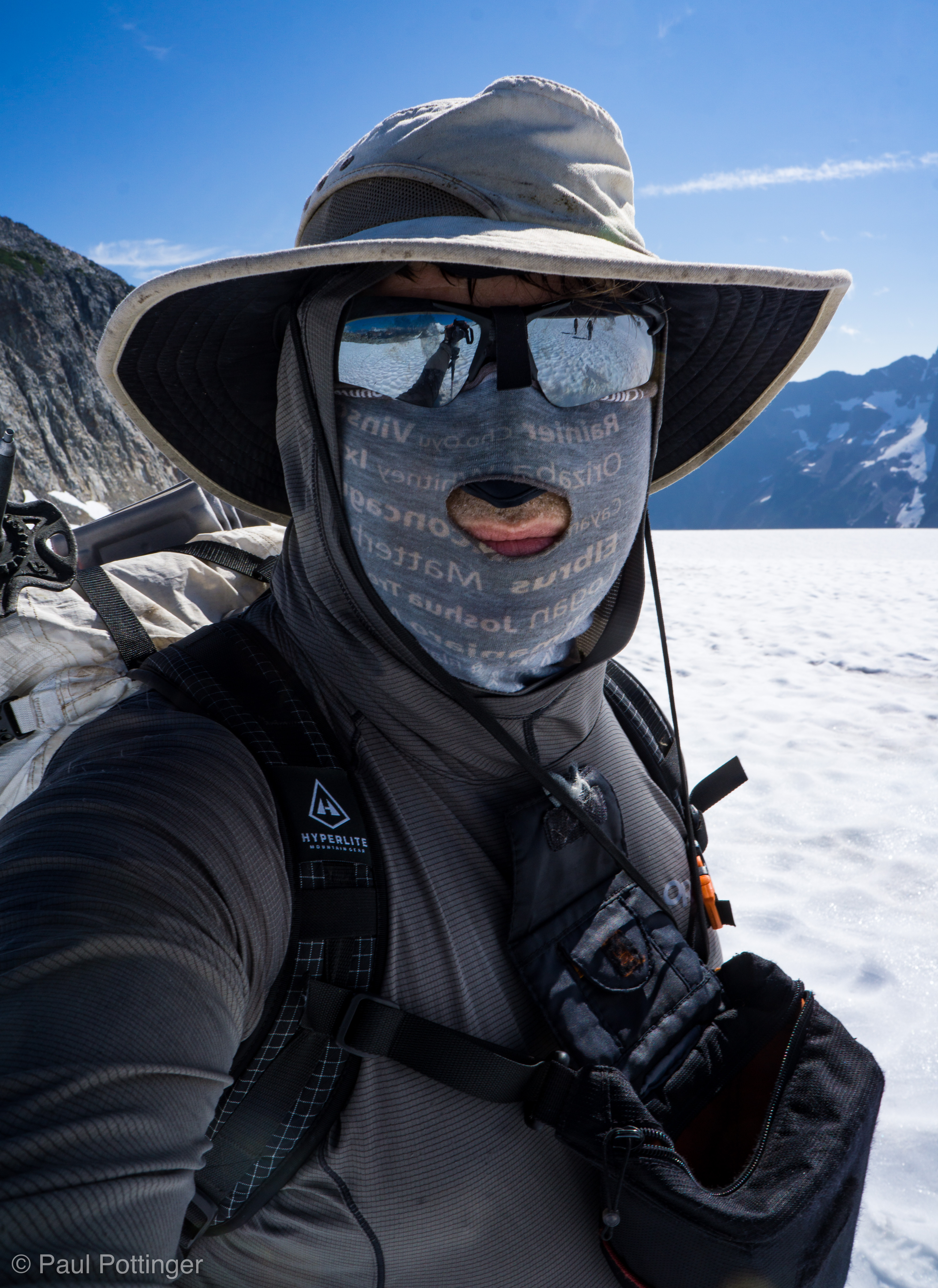
I slept fine… Not well,  but fine. Creepy nightmares stalked me, as often happens on summit morning, no doubt a sign of deep stress and anxiety working its way through my system. The upper mountain would go, but how much would it hurt getting there and back? Would I have the stamina to make it out and back in a reasonable time, or would we epic? These were the unanswerable questions I wrestled with. Time will tell. Indeed, I woke a few minutes before the alarm was set to trigger at 3:45 AM. Sleeping naked in the bag had been a luxury, and now I had to face the reality of wet, smelly clothes which were still damp from being soaked through with sweat the prior day. My sun shirt smelled unspeakably bad, like something from a dark realm of Dante’s inferno. Somehow, getting into that shirt was worse than putting on the moist socks and underwear. It will all dry with body heat. This is Challenger. It’s worth it. Do it.

Video of our summit approach:

Our camp, in the pre-dawn light. Thank you, iPhone auto exposure!
The moon calls to us, “Come and catch me, if you can.”

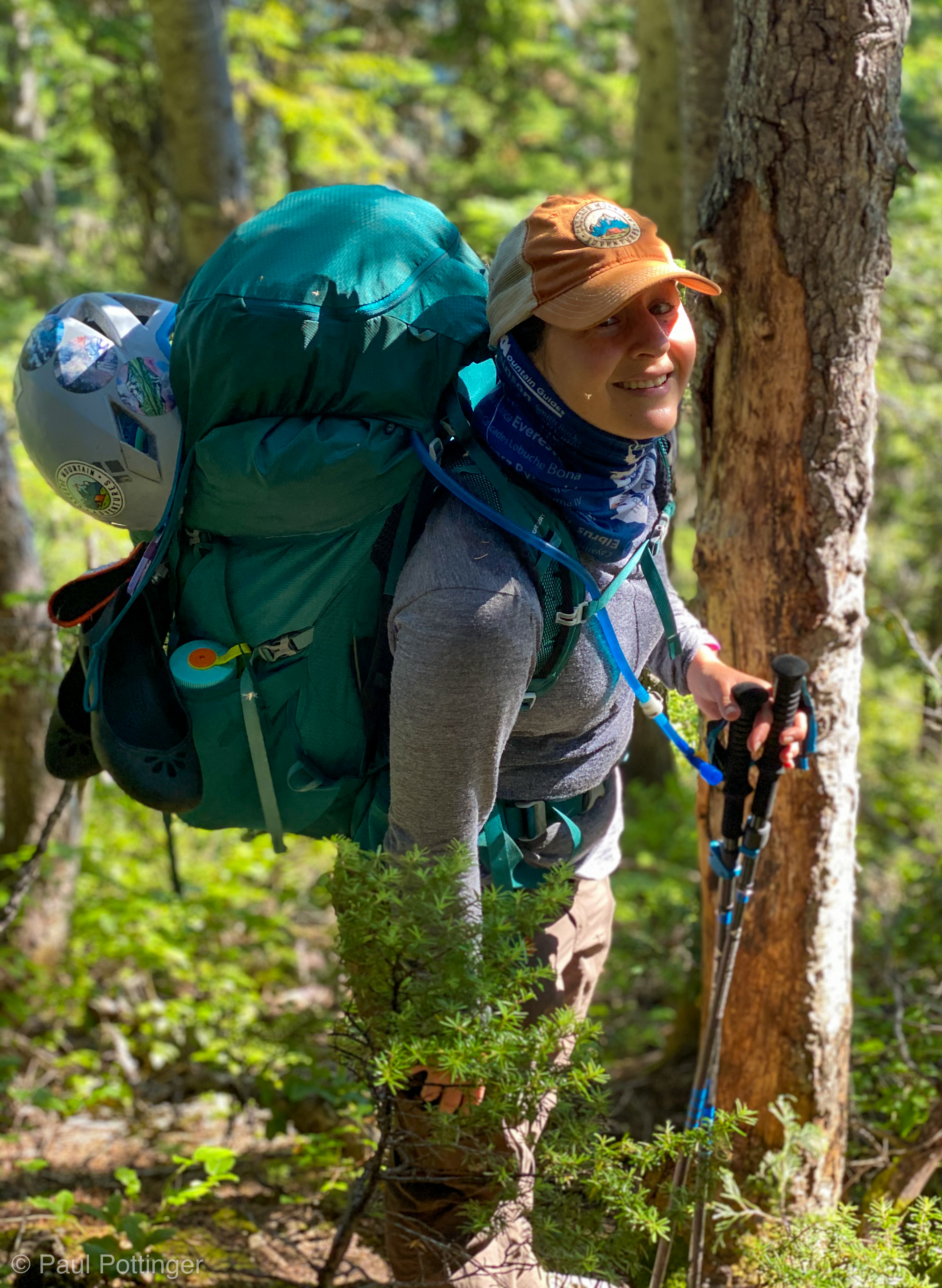
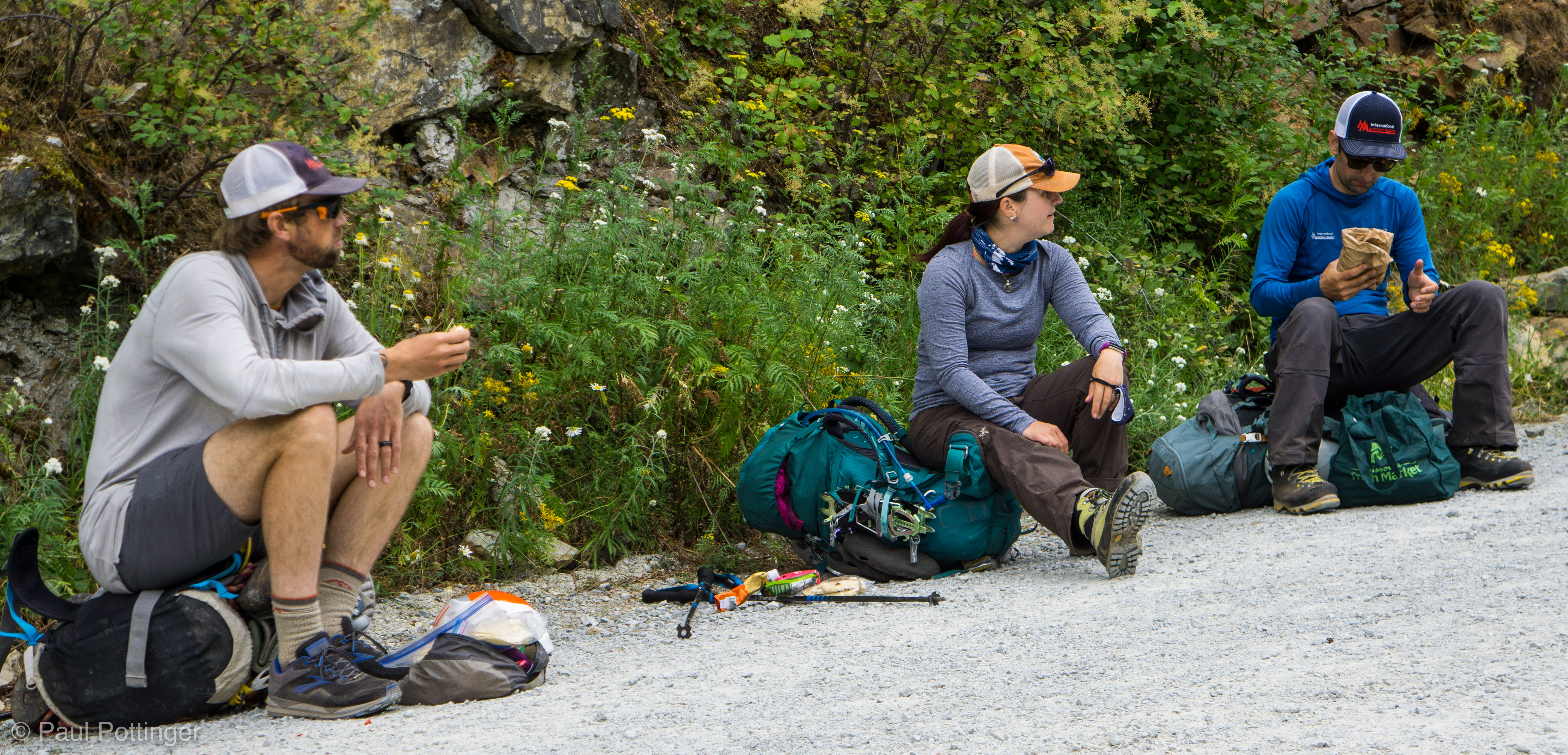
The lowest point of the trip happened when we got out of our tents: Teresa was out for the summit bid. She had suffered a serious injury recently, and even attempting this trip was probably madness. She is tough as hell… and also smart as hell, and knows when to listen to her body, which that 4 AM was telling her NO SUMMIT FOR YOU. Common sense and self-awareness are among her many fine qualities that I admire, and which I lack in great abundance. We were a tight team, we were in this together, and summiting without her felt wrong. But there was no convincing her. She was at peace with it. She would have the day to rest, recover, and enjoy the solitude of a spectacular campsite. I had the rest of the day to catch up with her decision, mentally and emotionally.

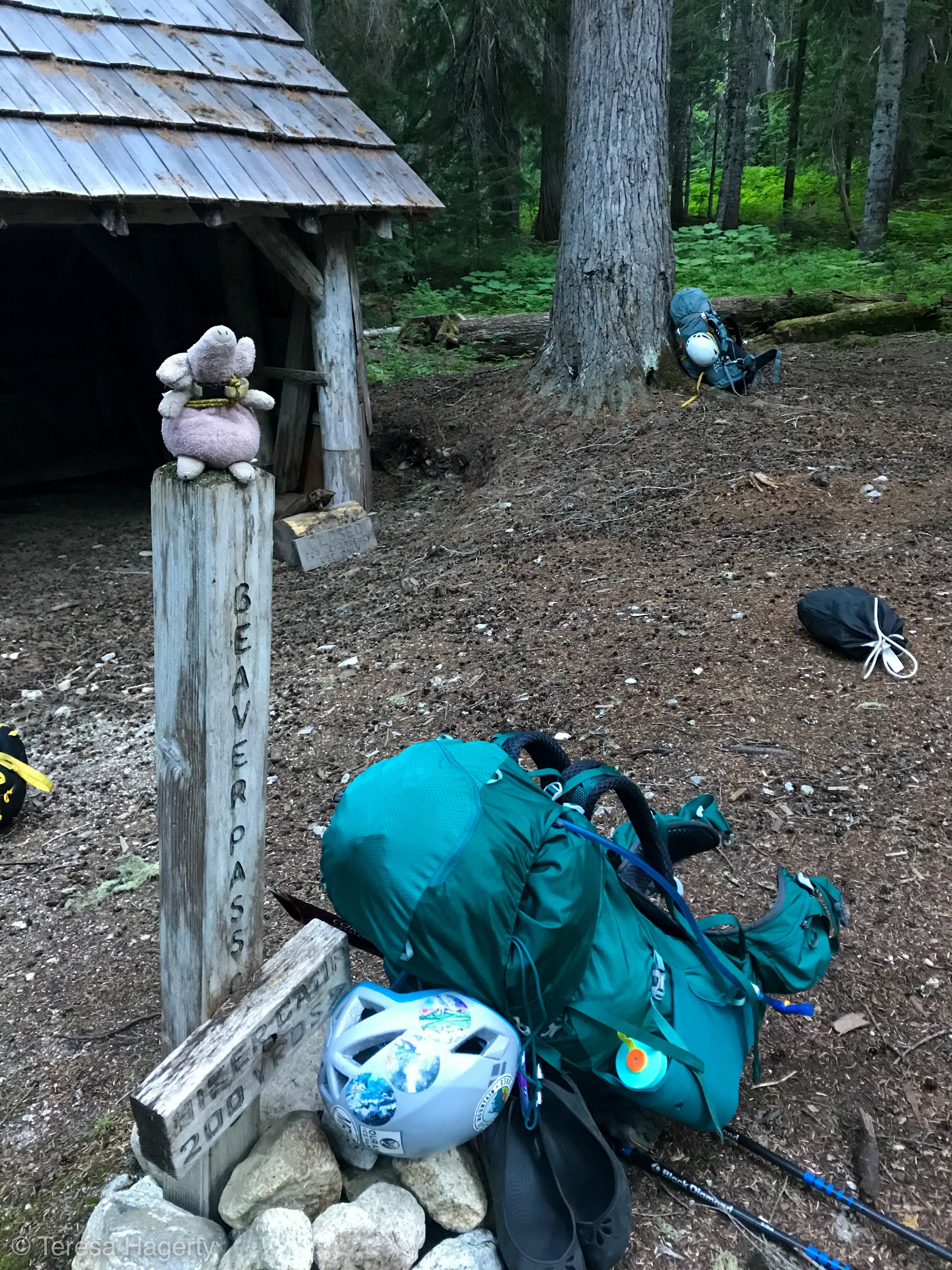
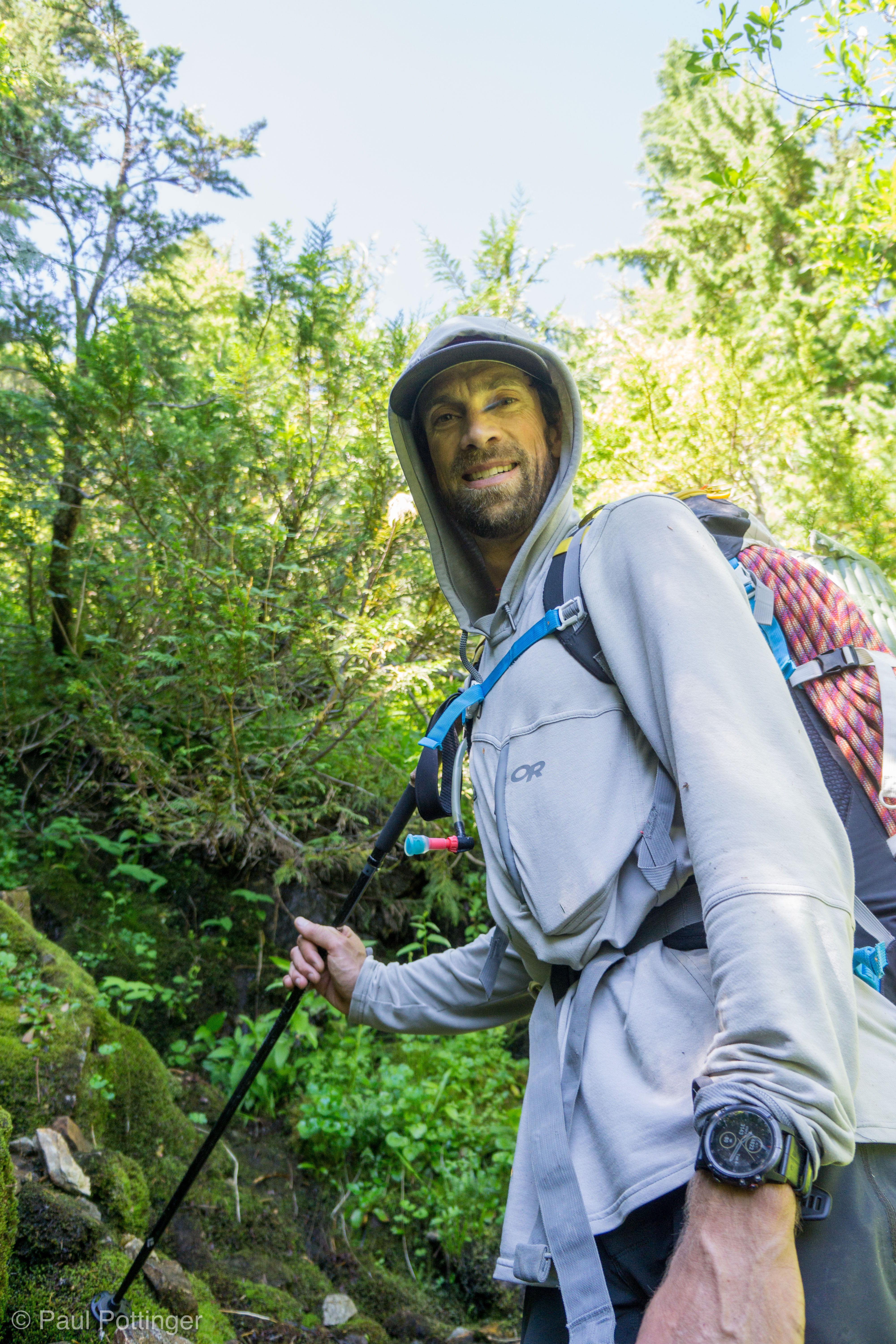
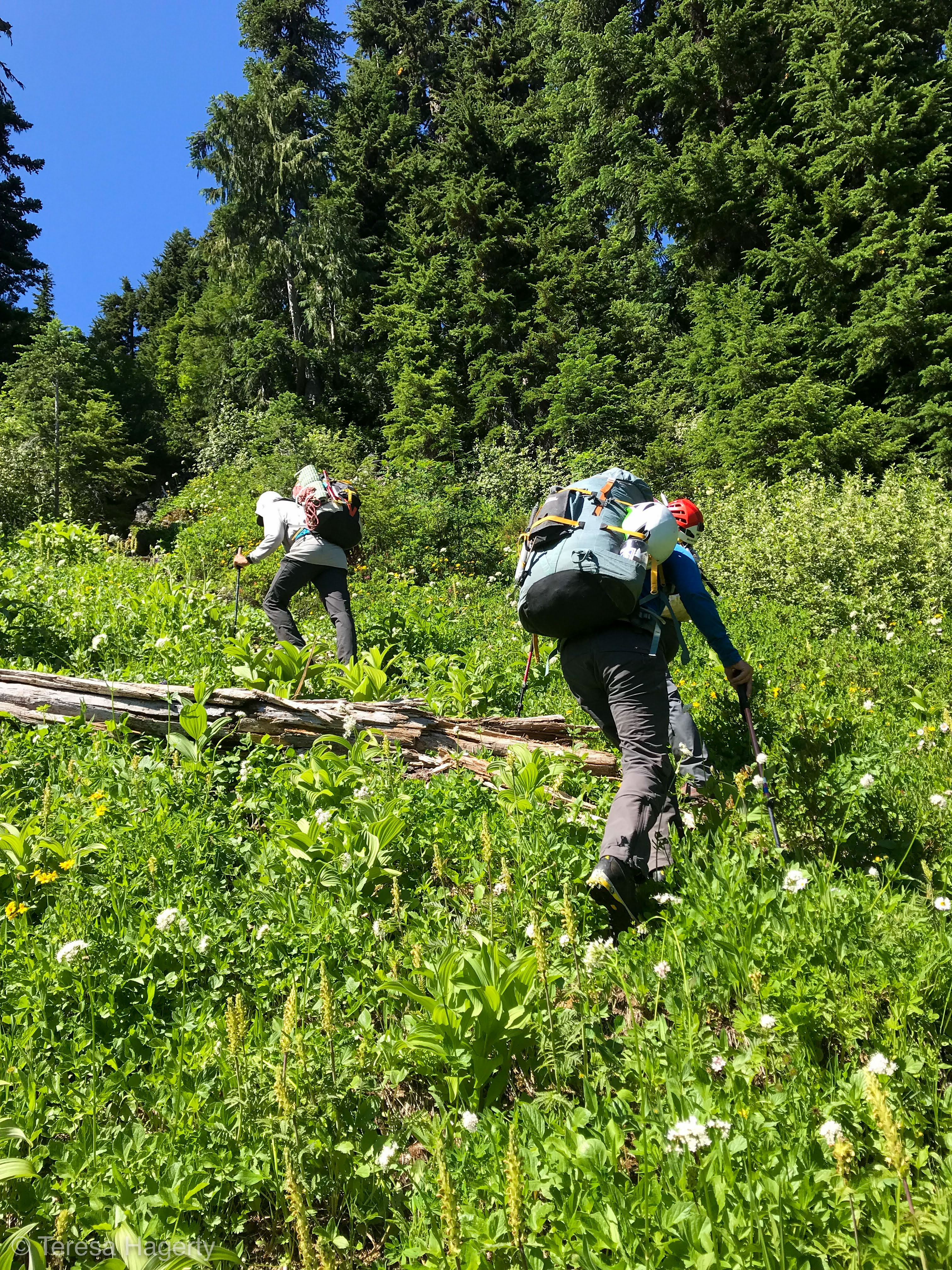
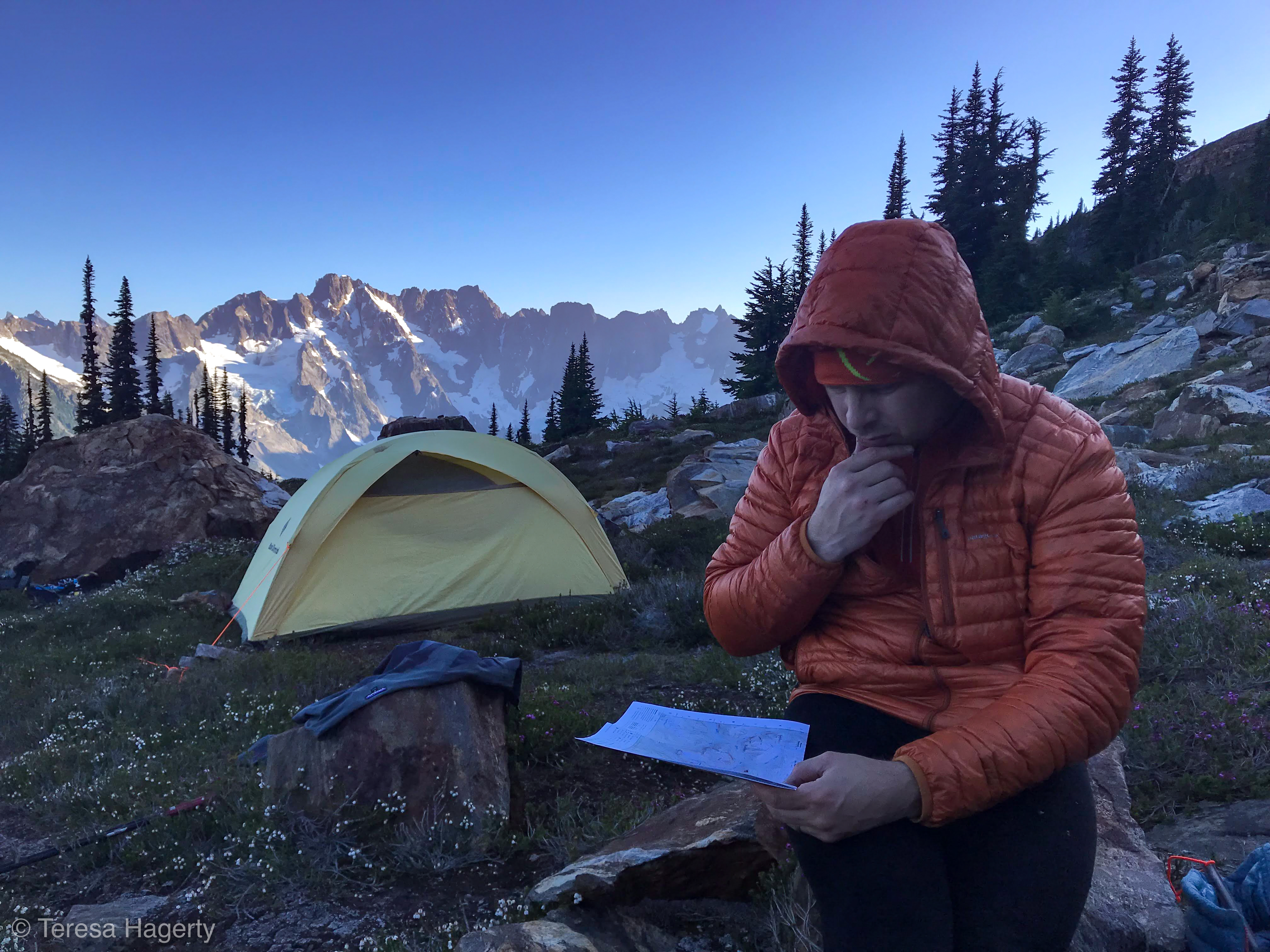
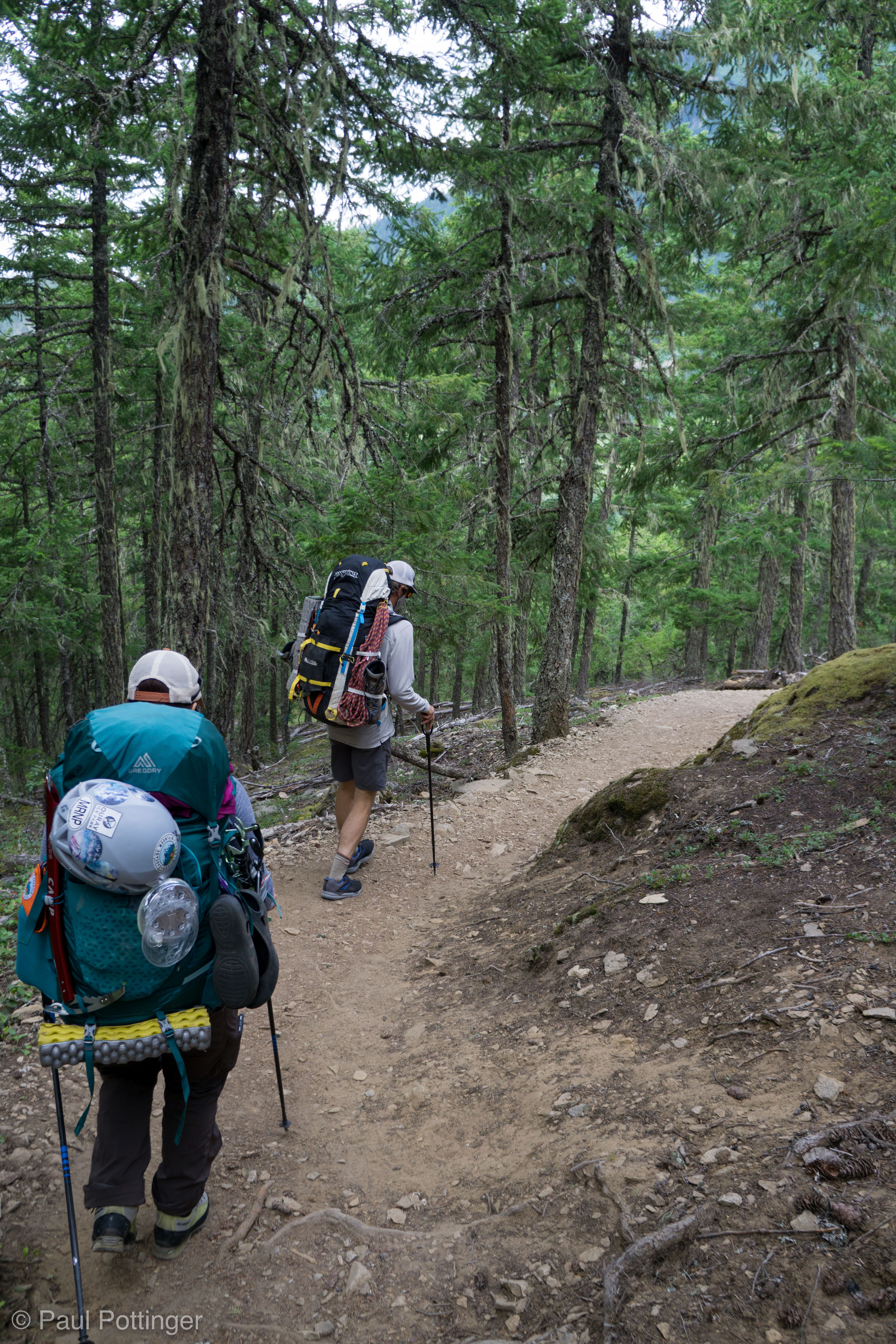
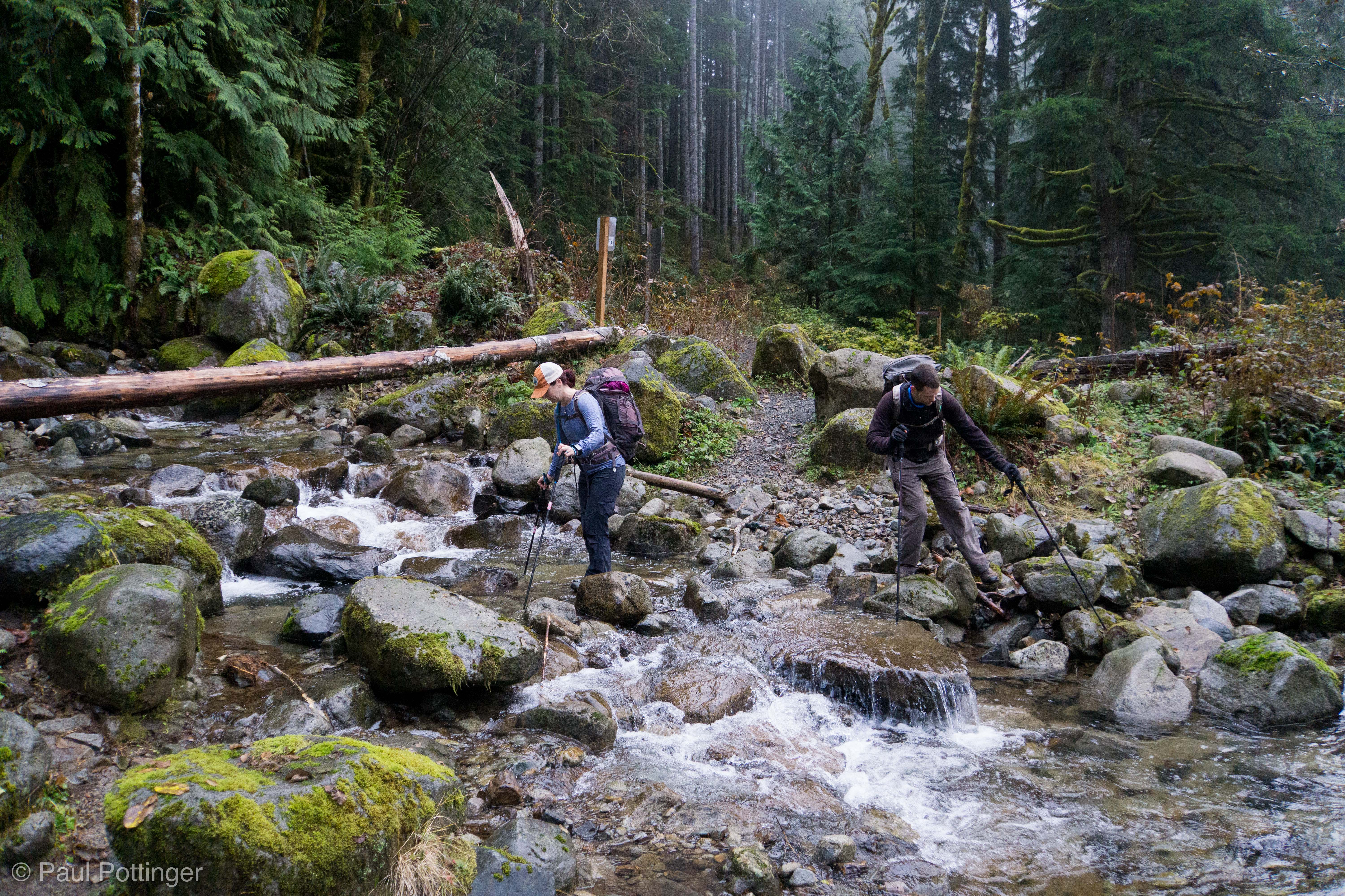
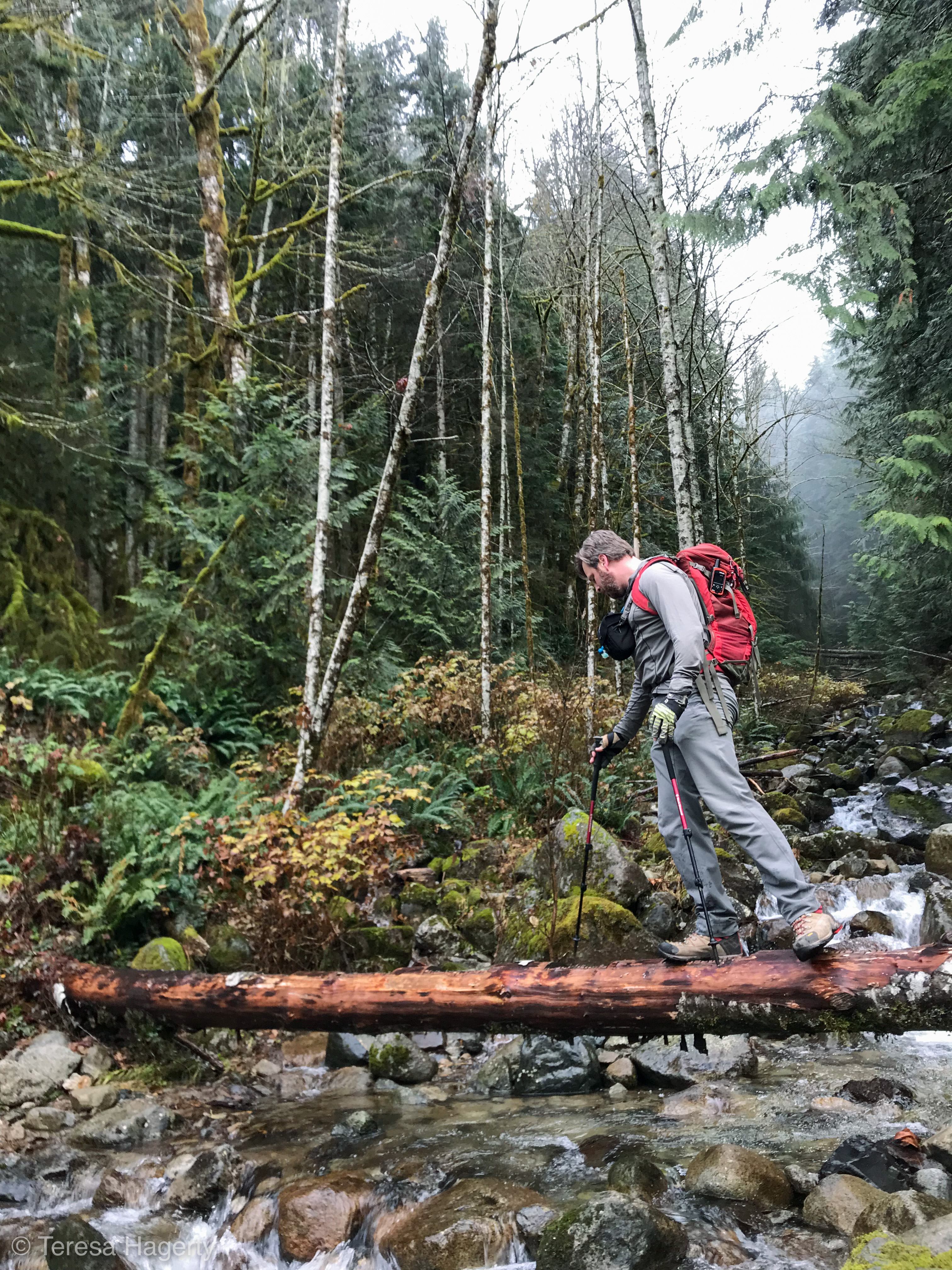
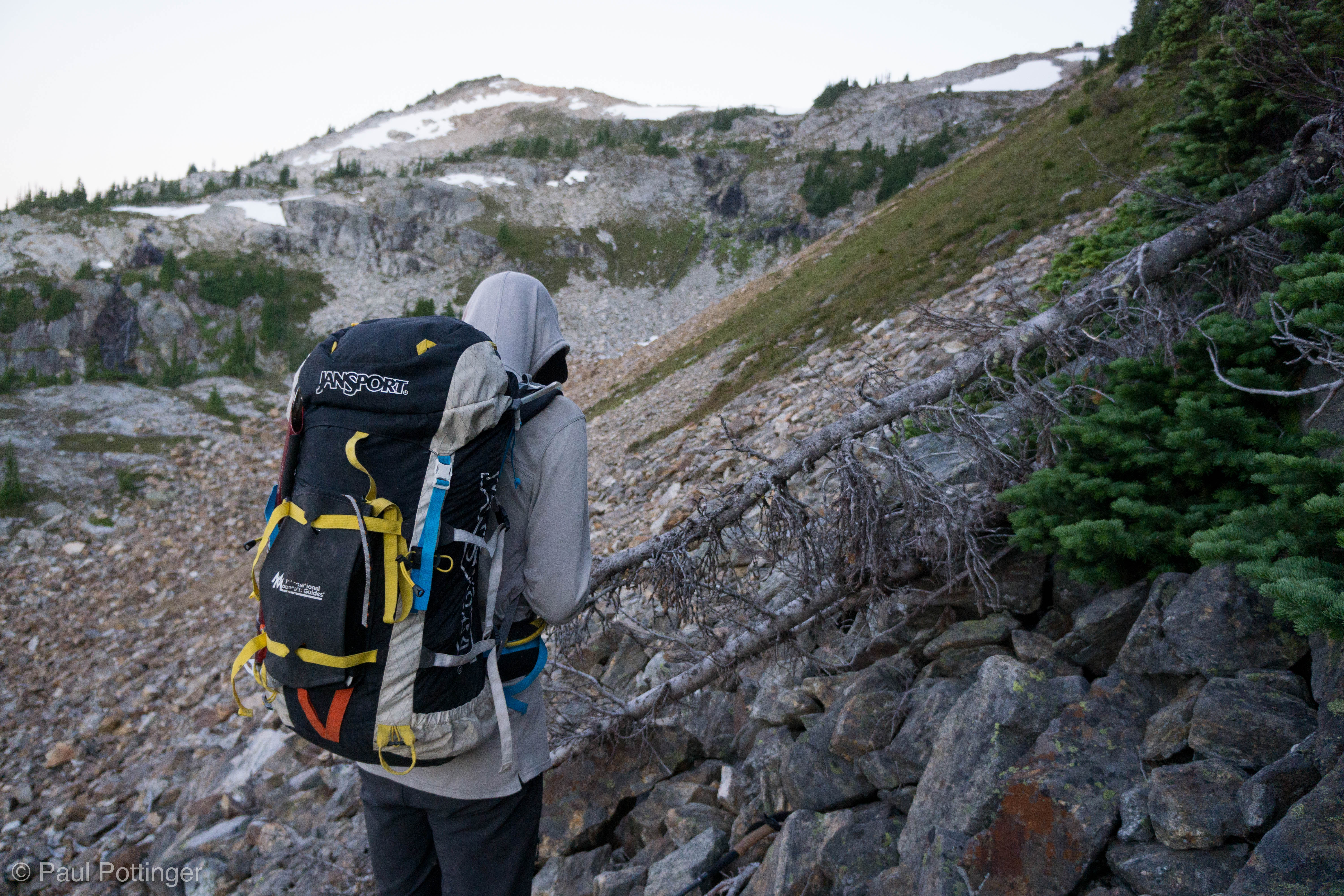
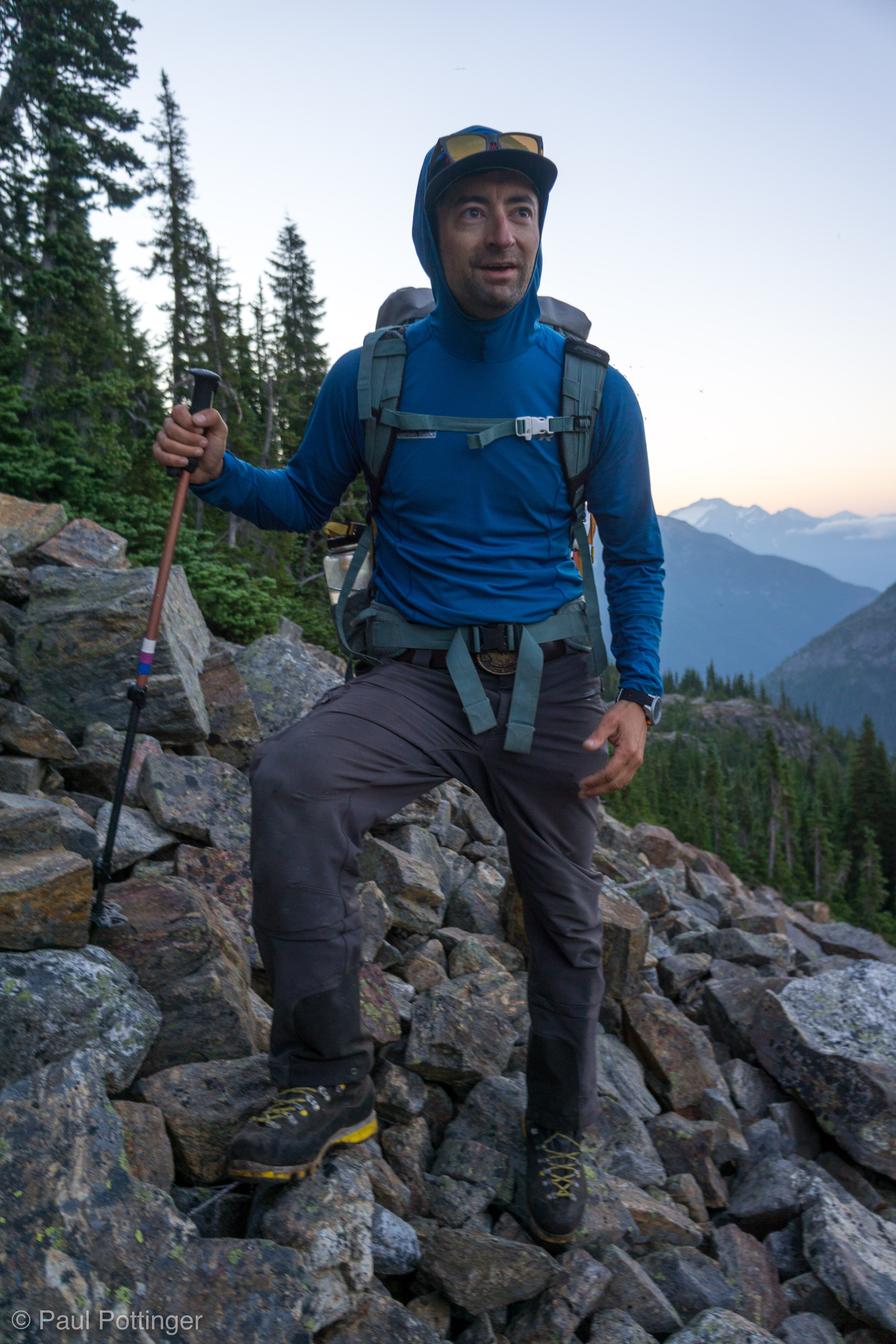
The usual pre-departure business proceeded without a hitch… until we realized that our water source had run dry, because the sun was no longer melting the snowpack above. We had enough for breakfast, and to get us to the next source that must be waiting for us above. Leaving camp for the summit with half a liter felt strange… I think Justin and Forrest had run totally dry, which must have felt very strange. It’s the Pickets. It’s worth it. Do it. And off we went. The target was to depart at 5 AM… we made it out at 5:15.

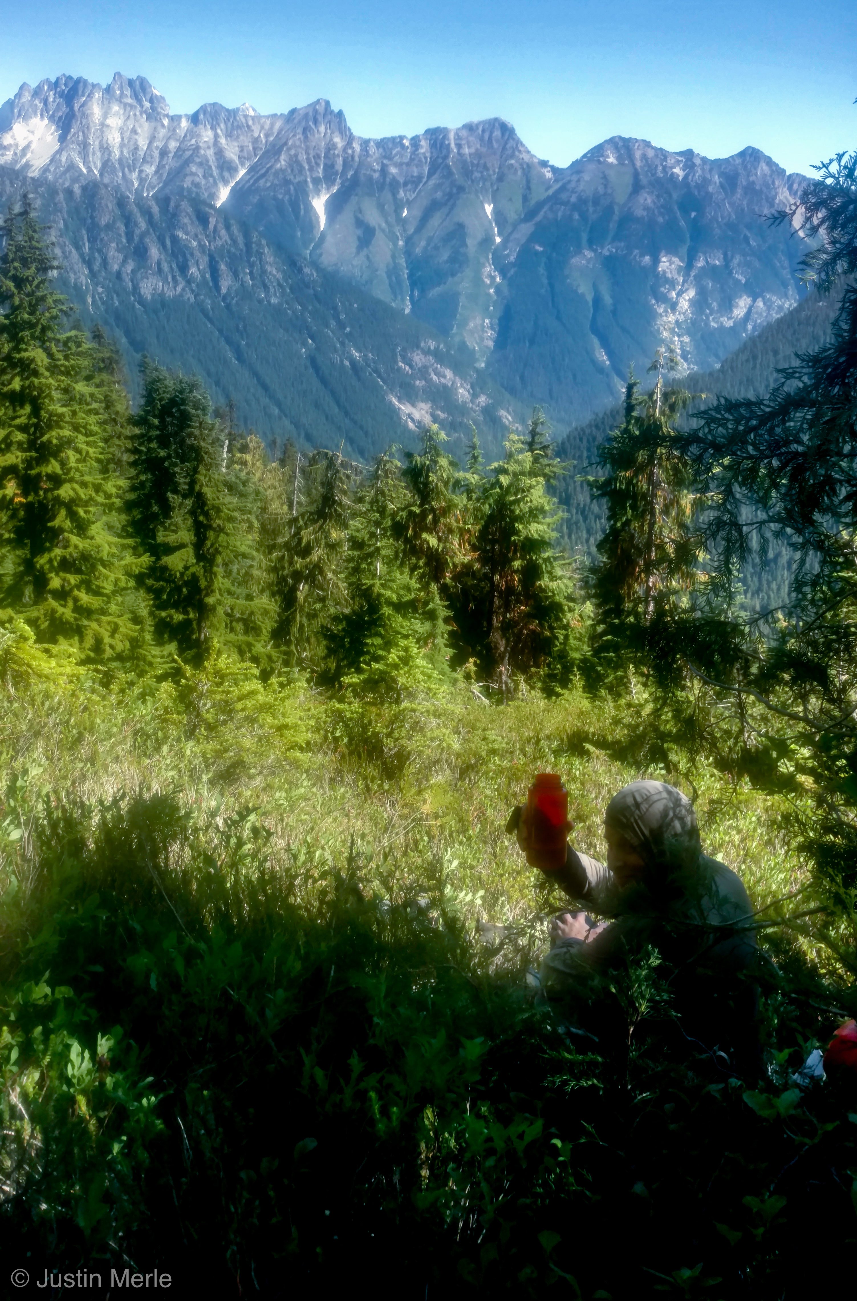
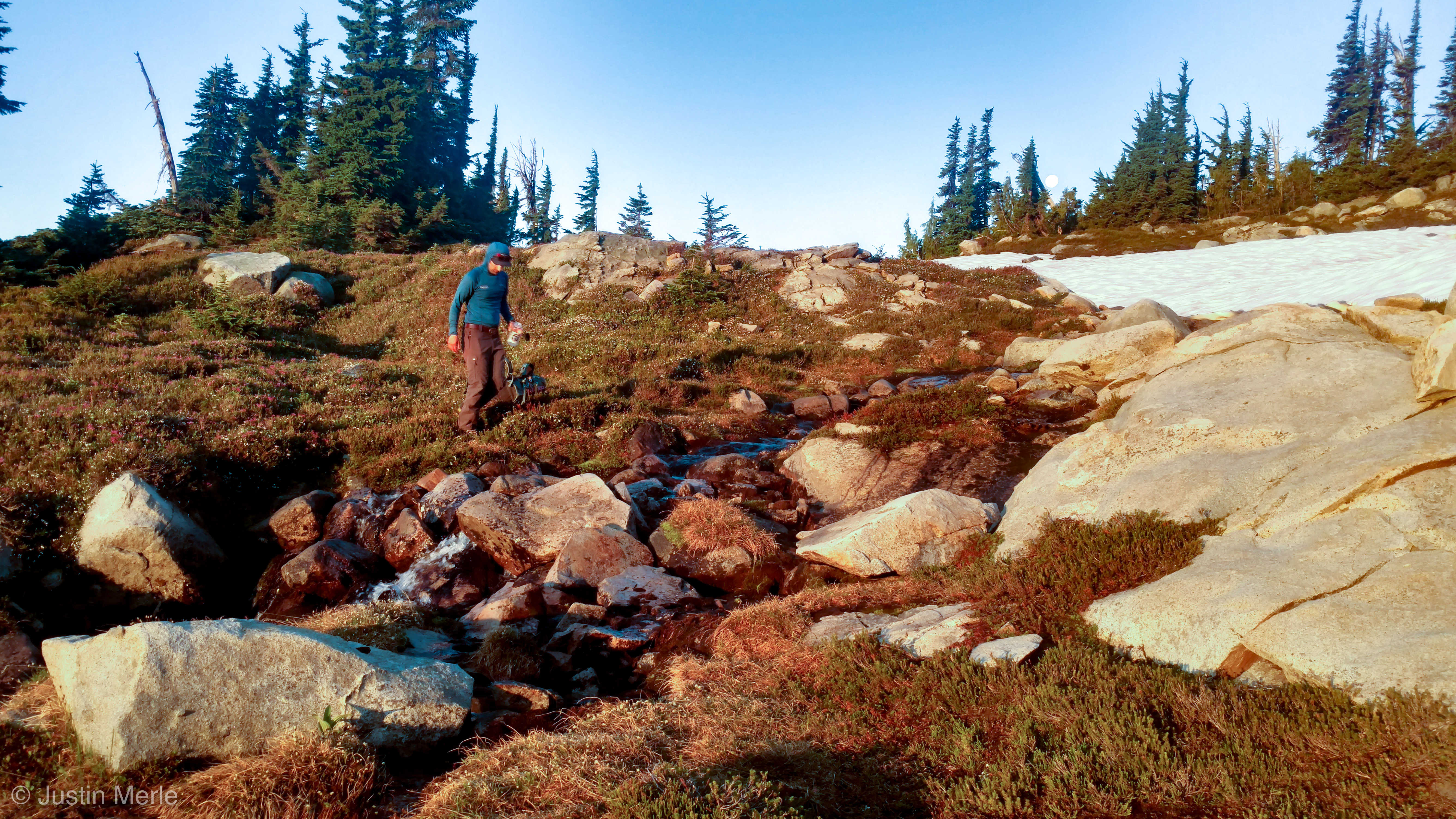
And, sure enough, we found water within an hour.

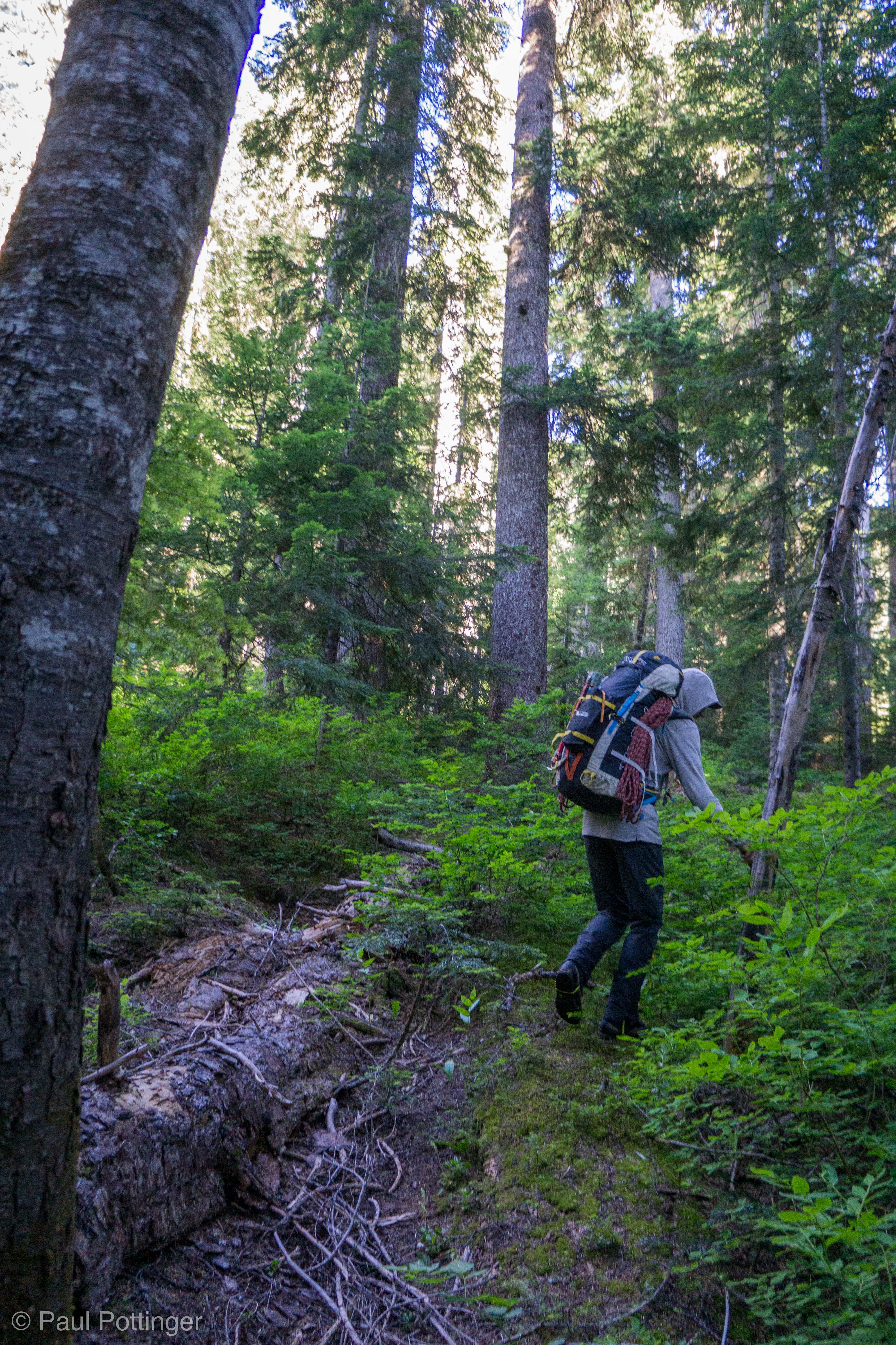
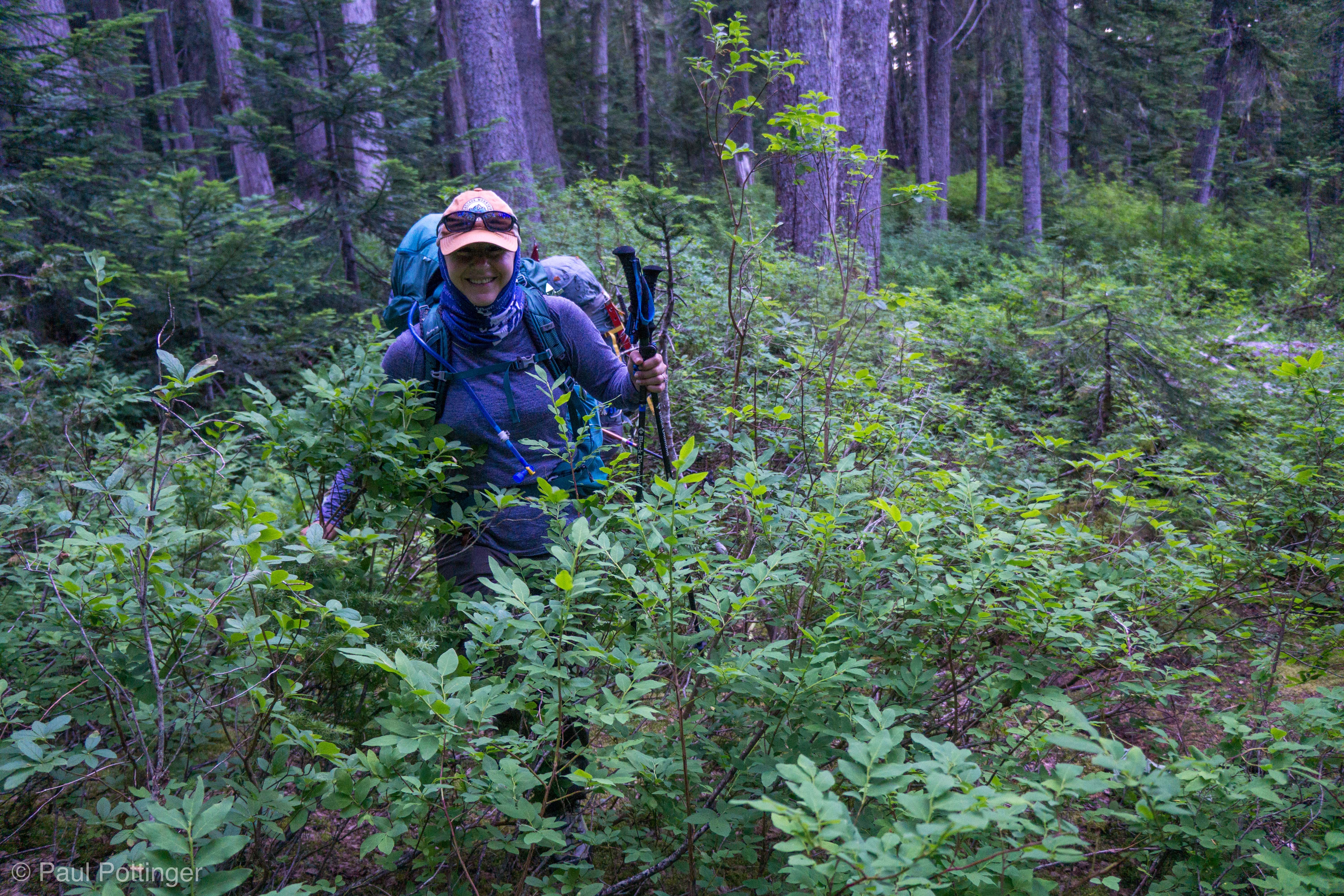
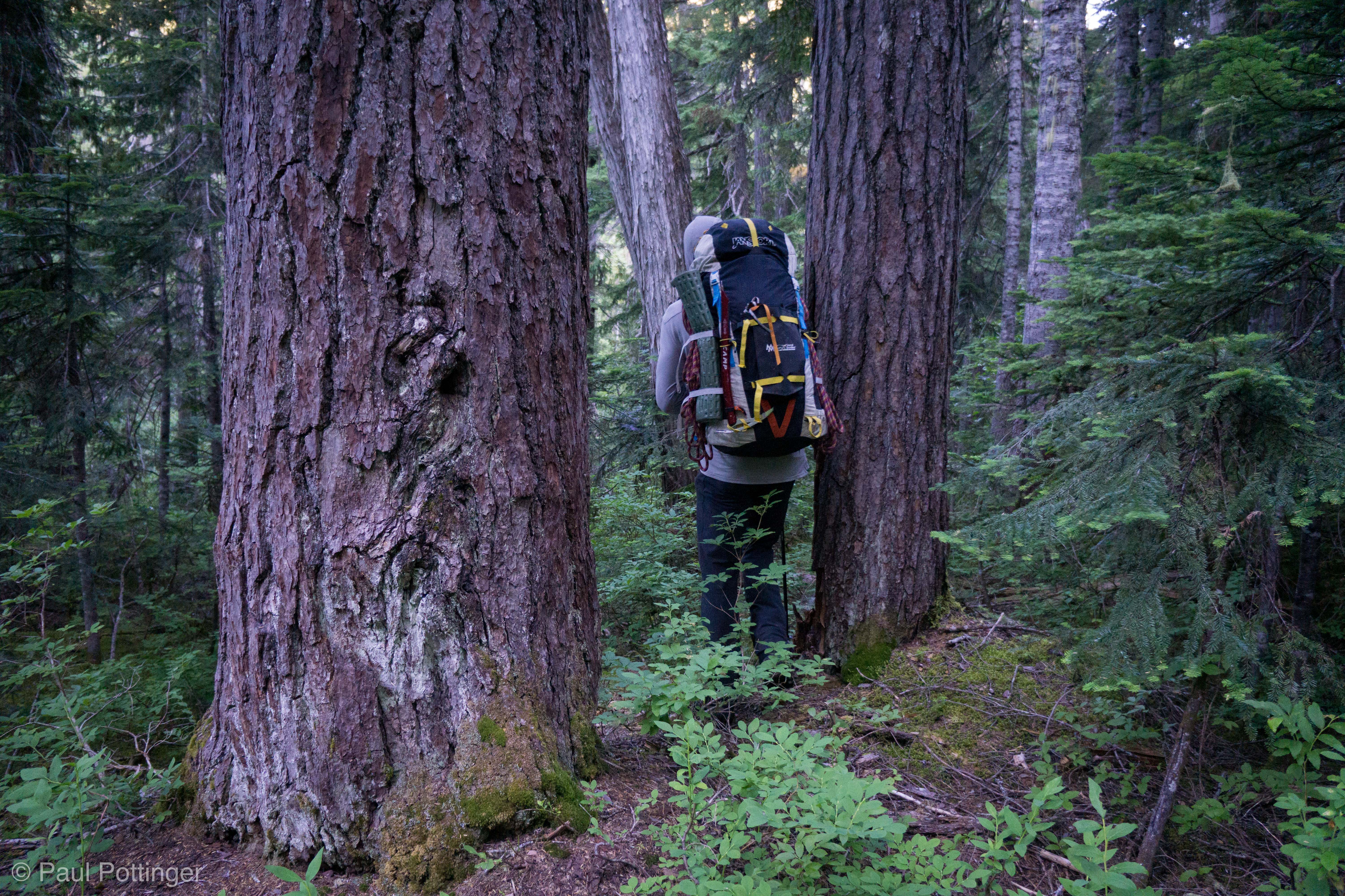
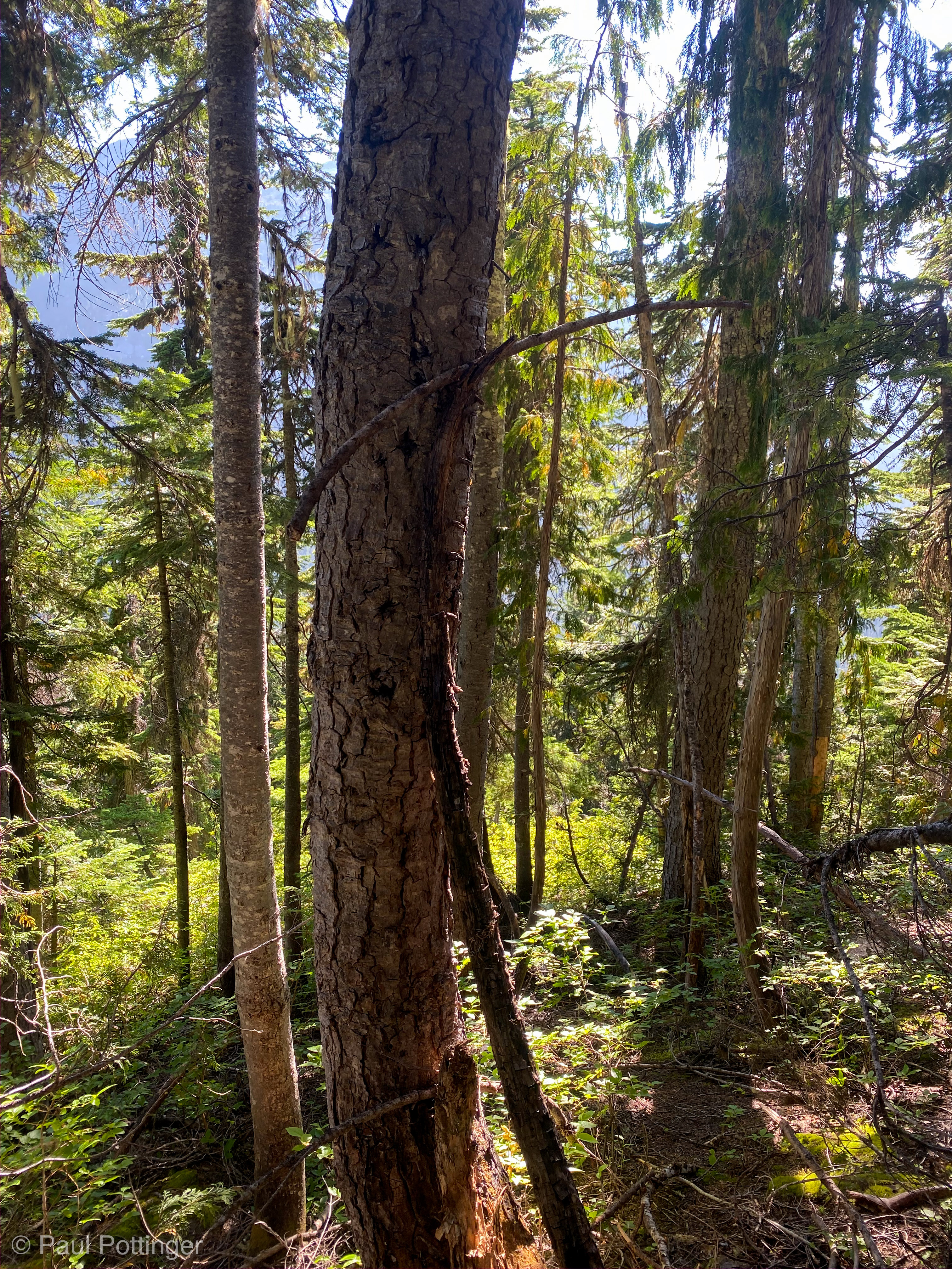
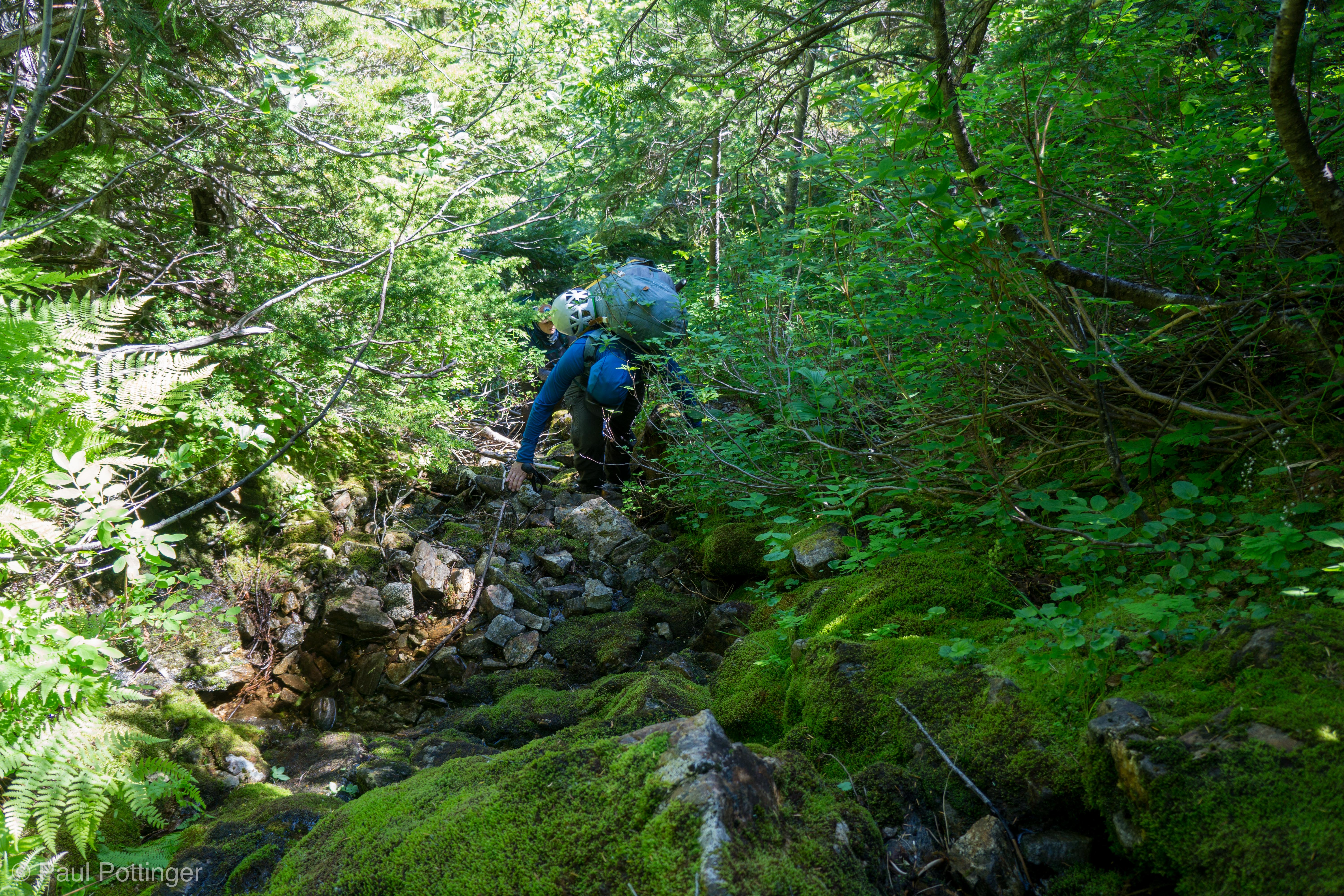
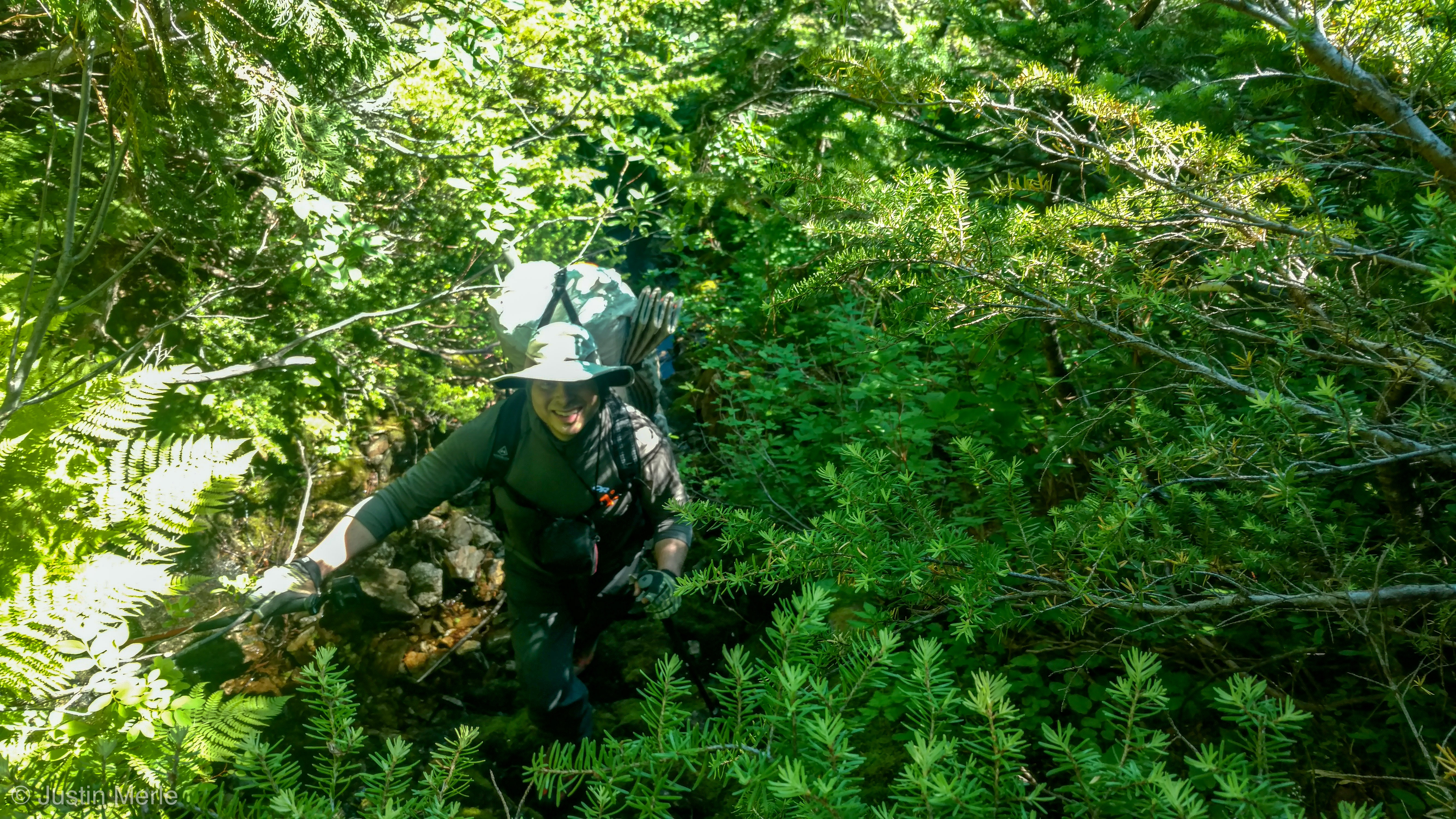
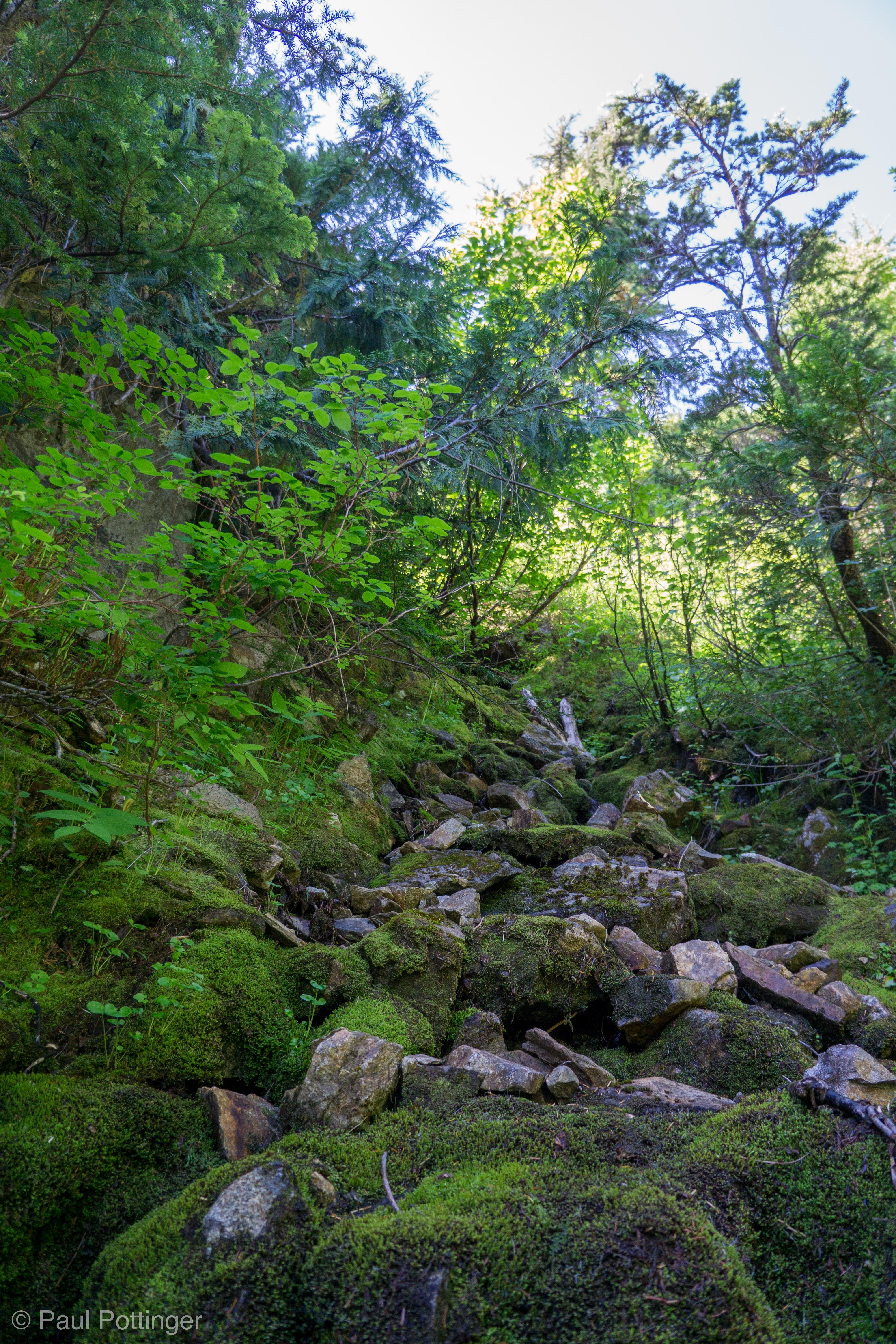
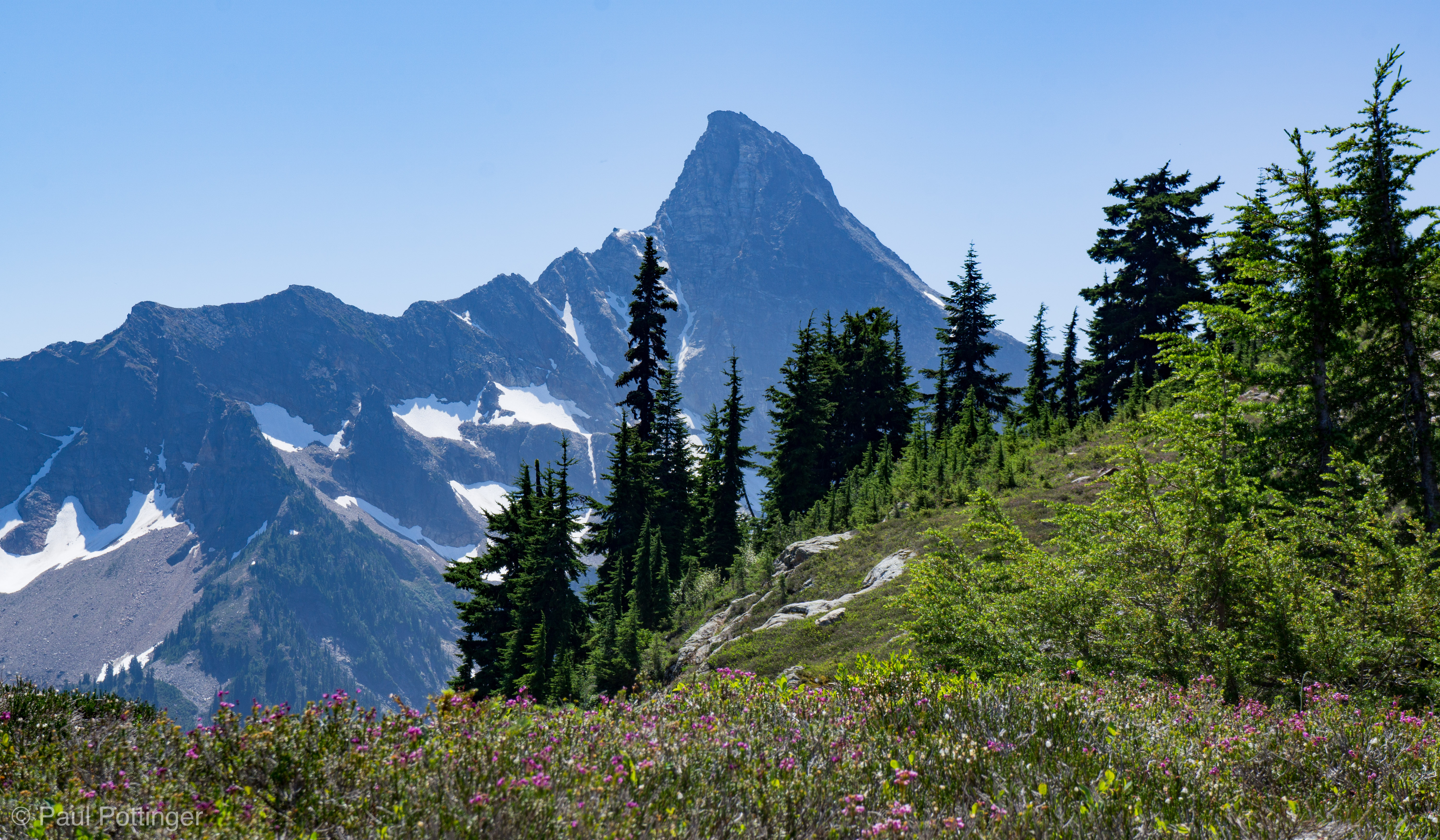
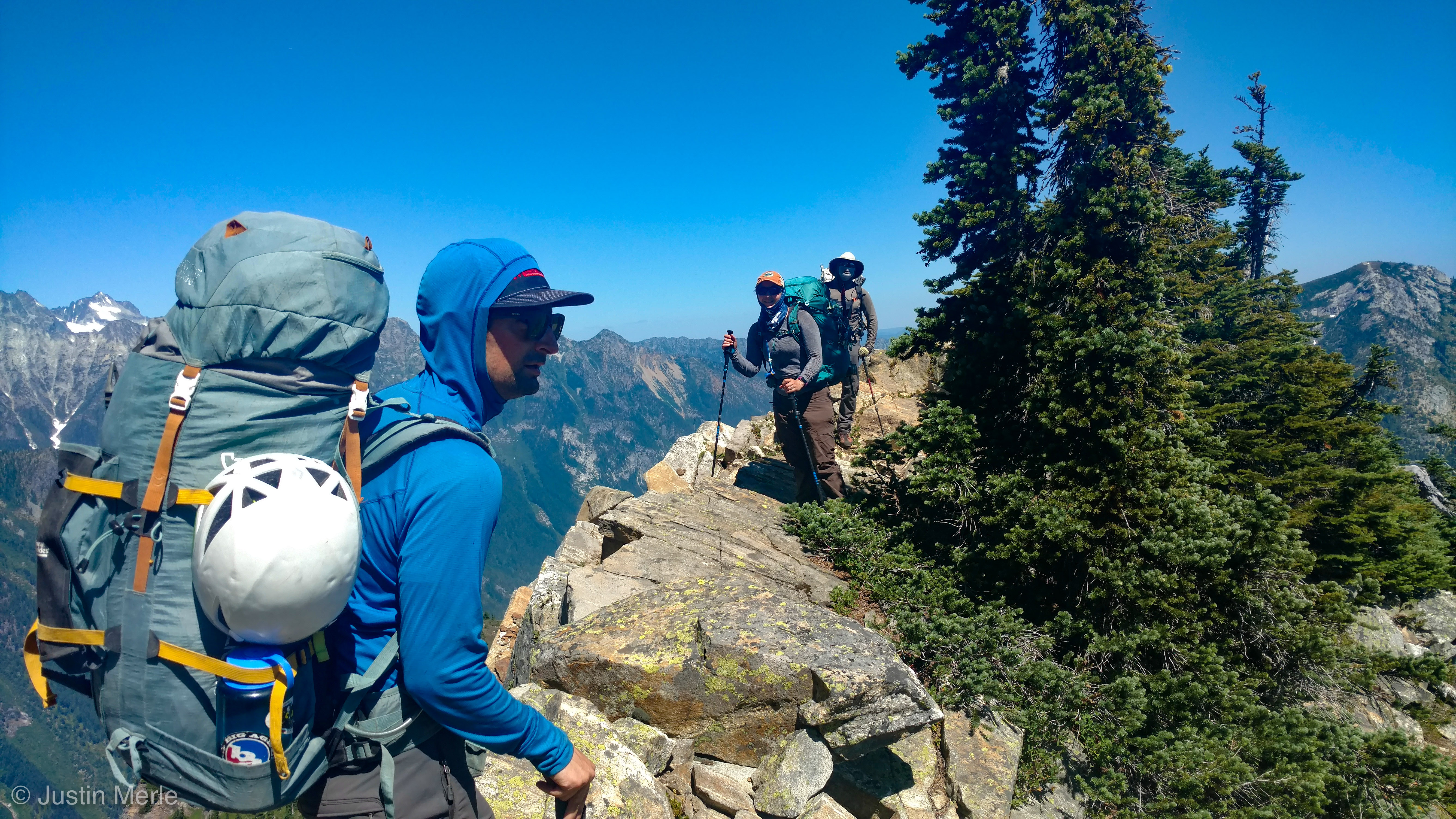
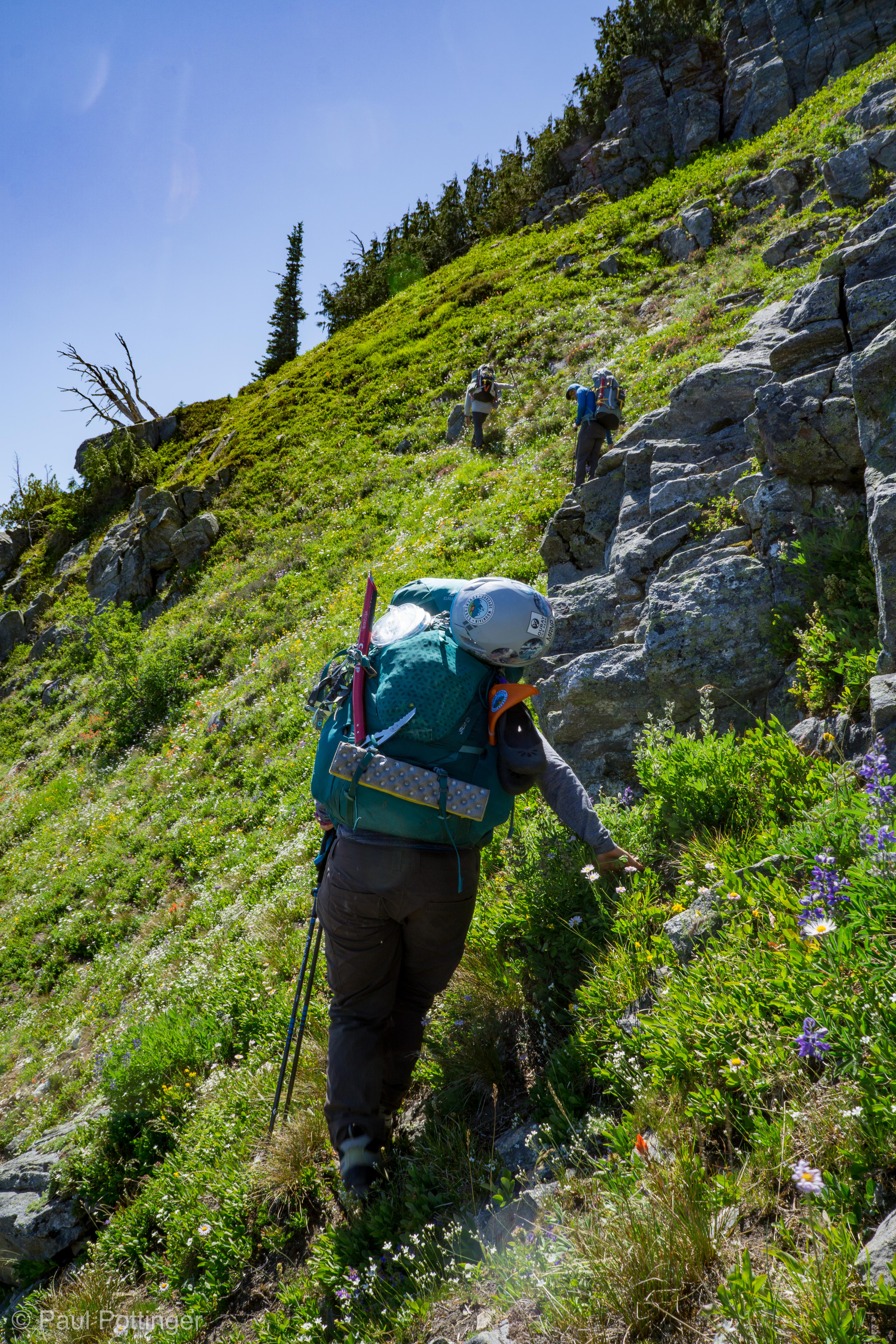
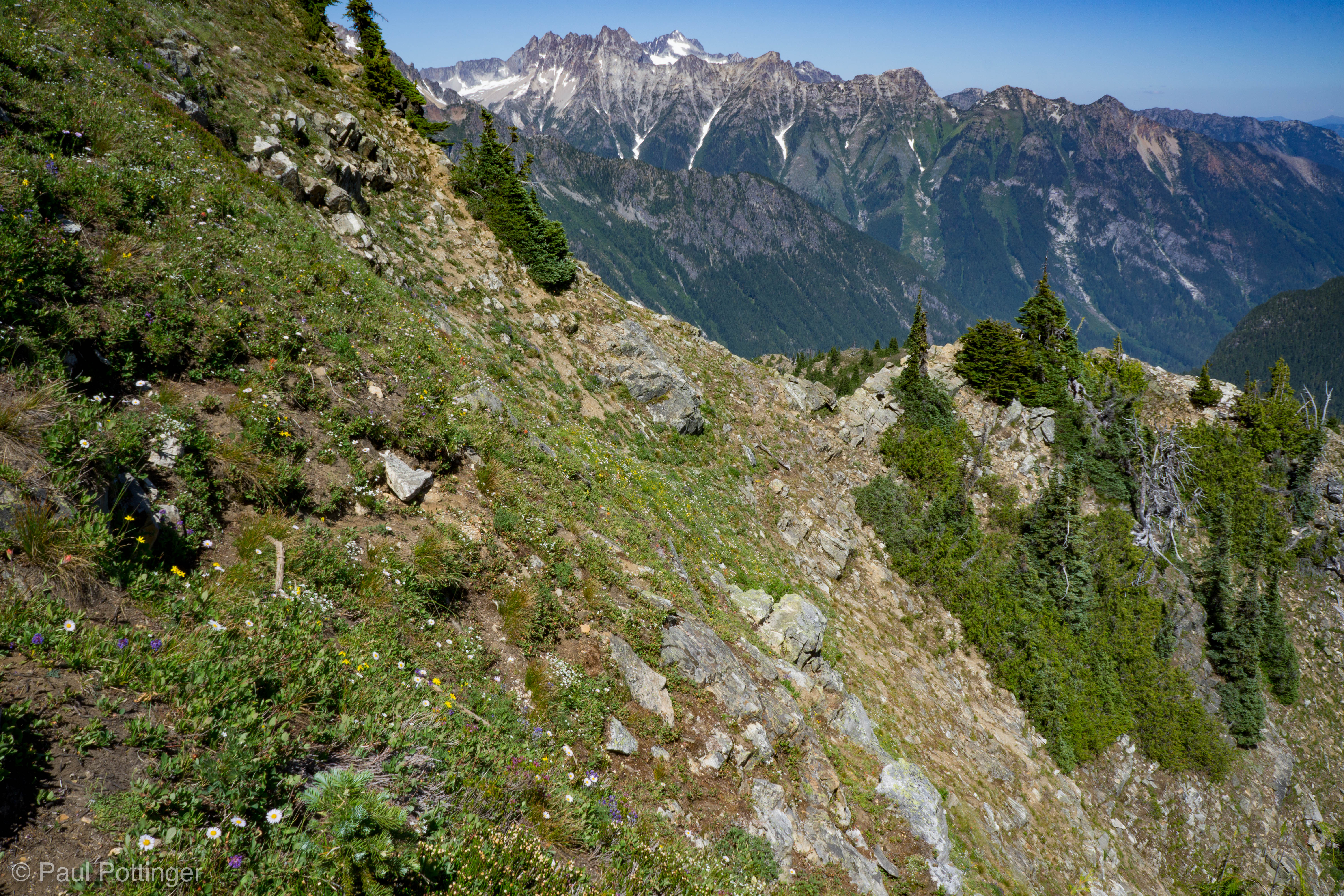
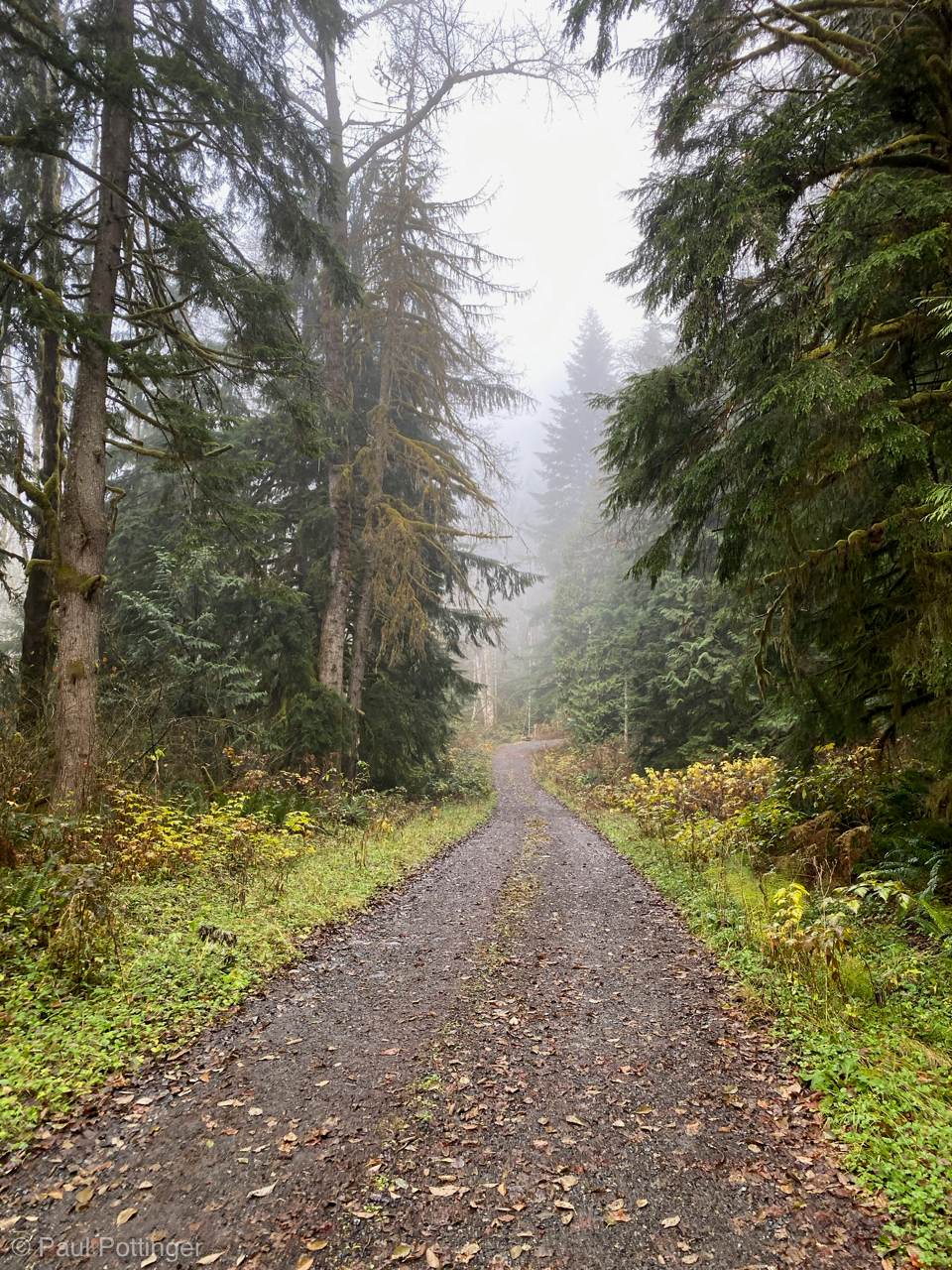
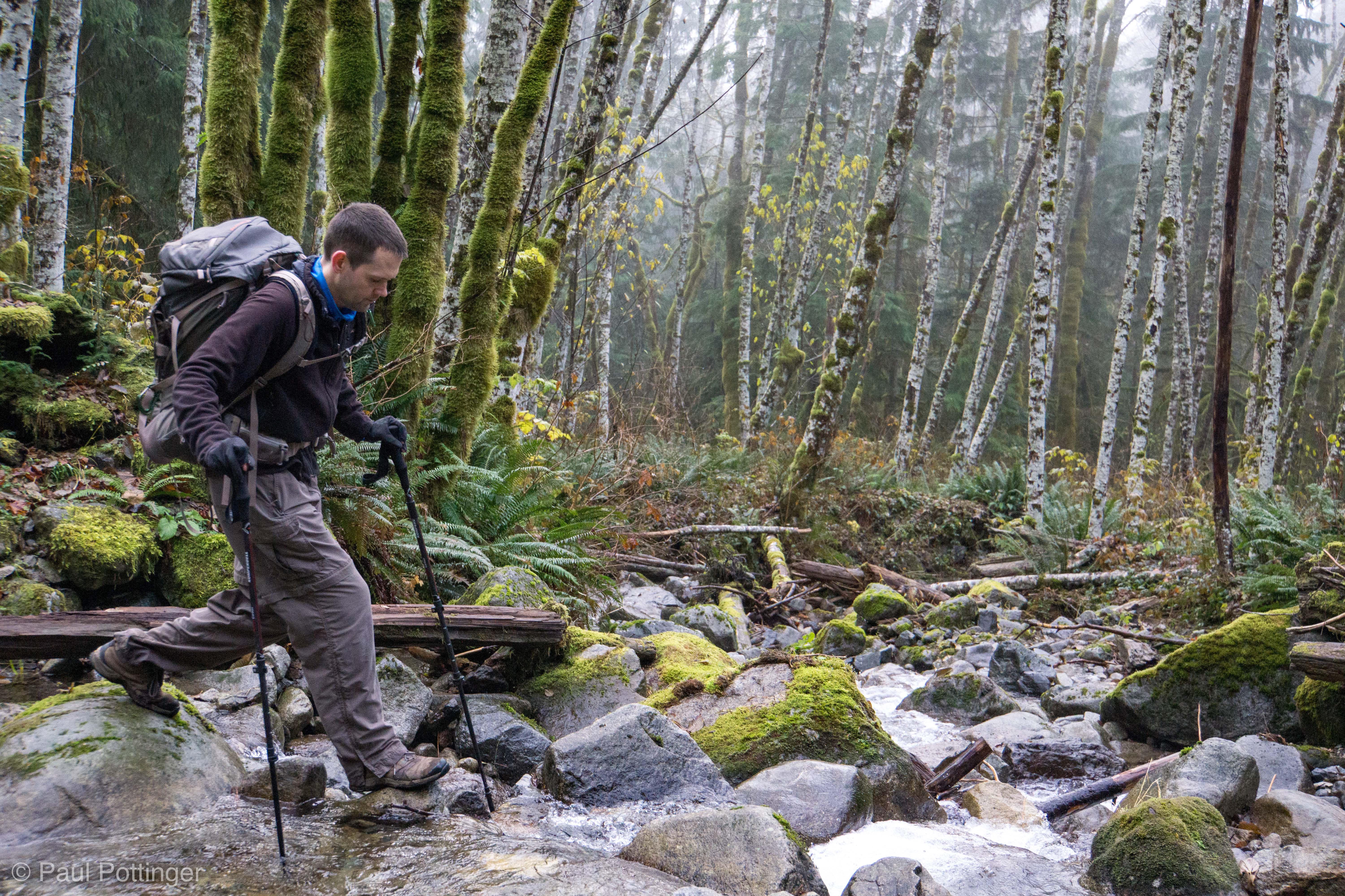
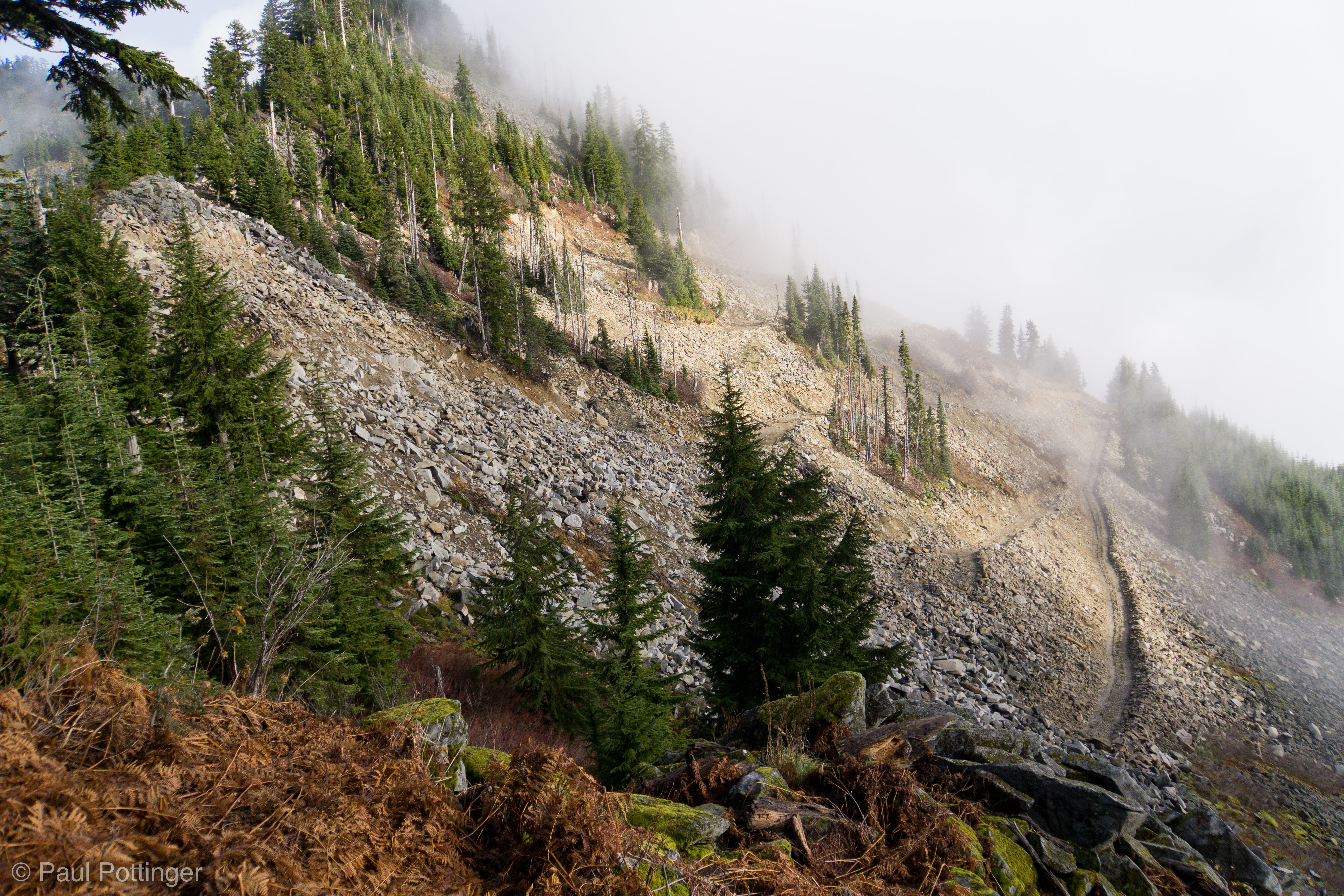
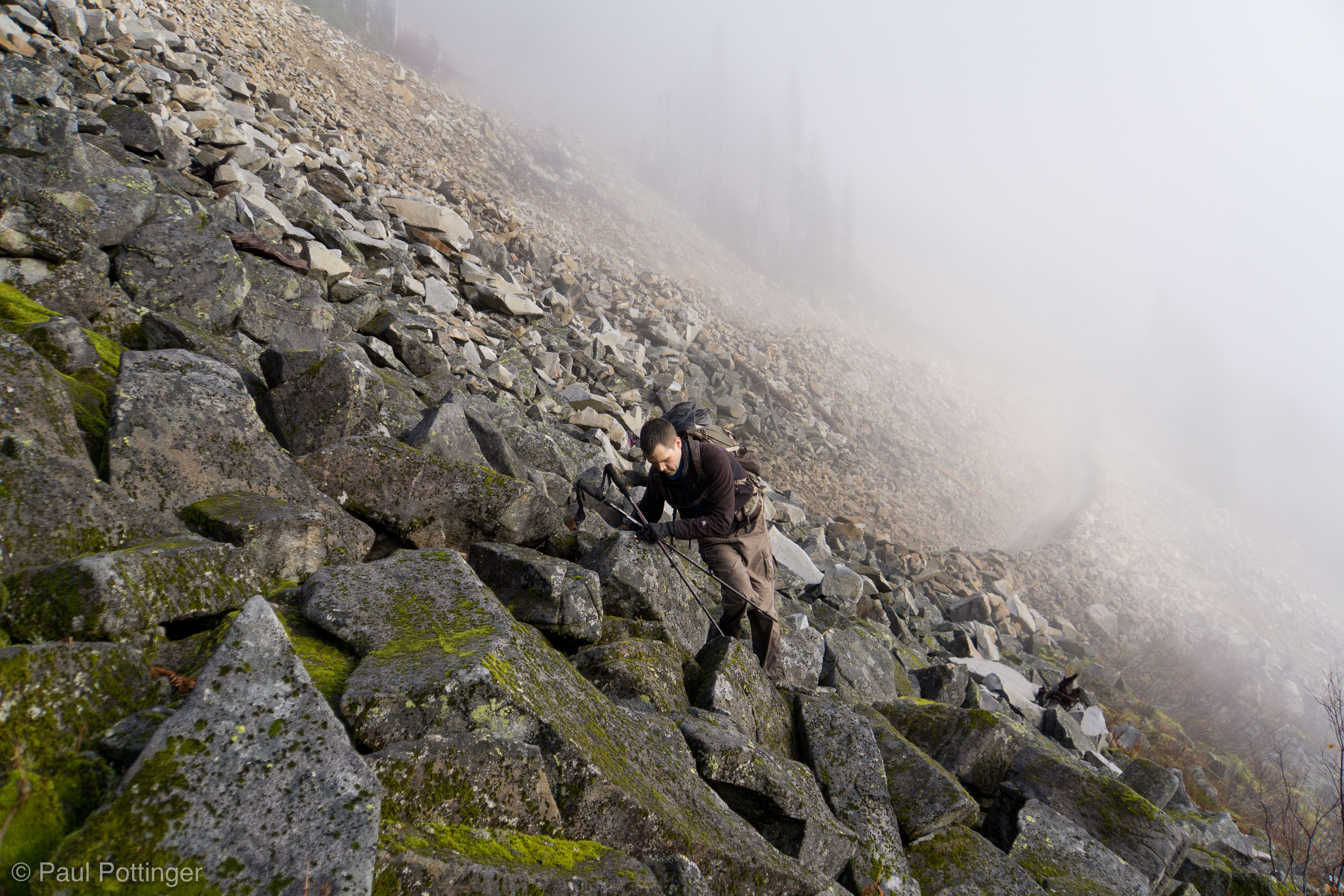
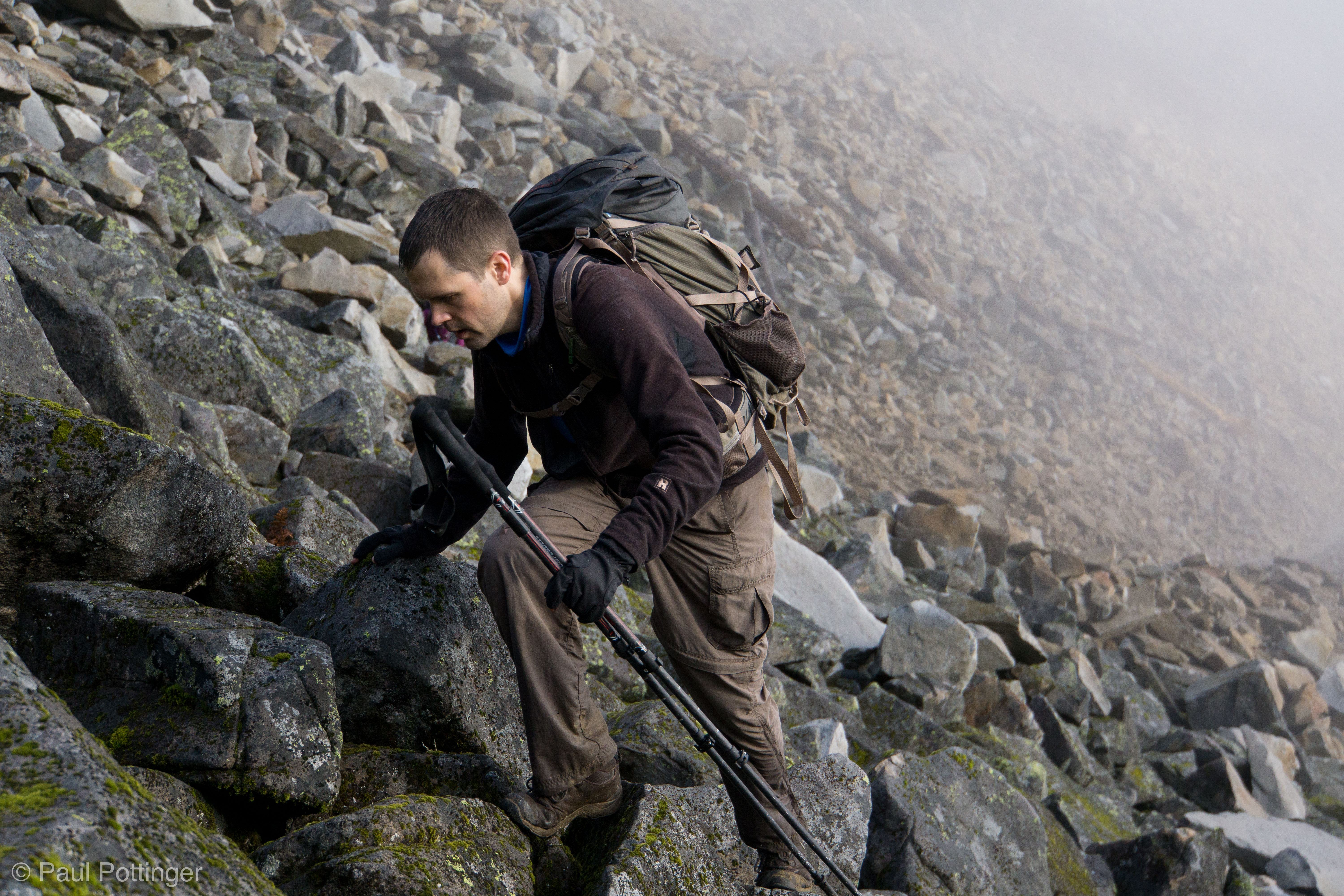
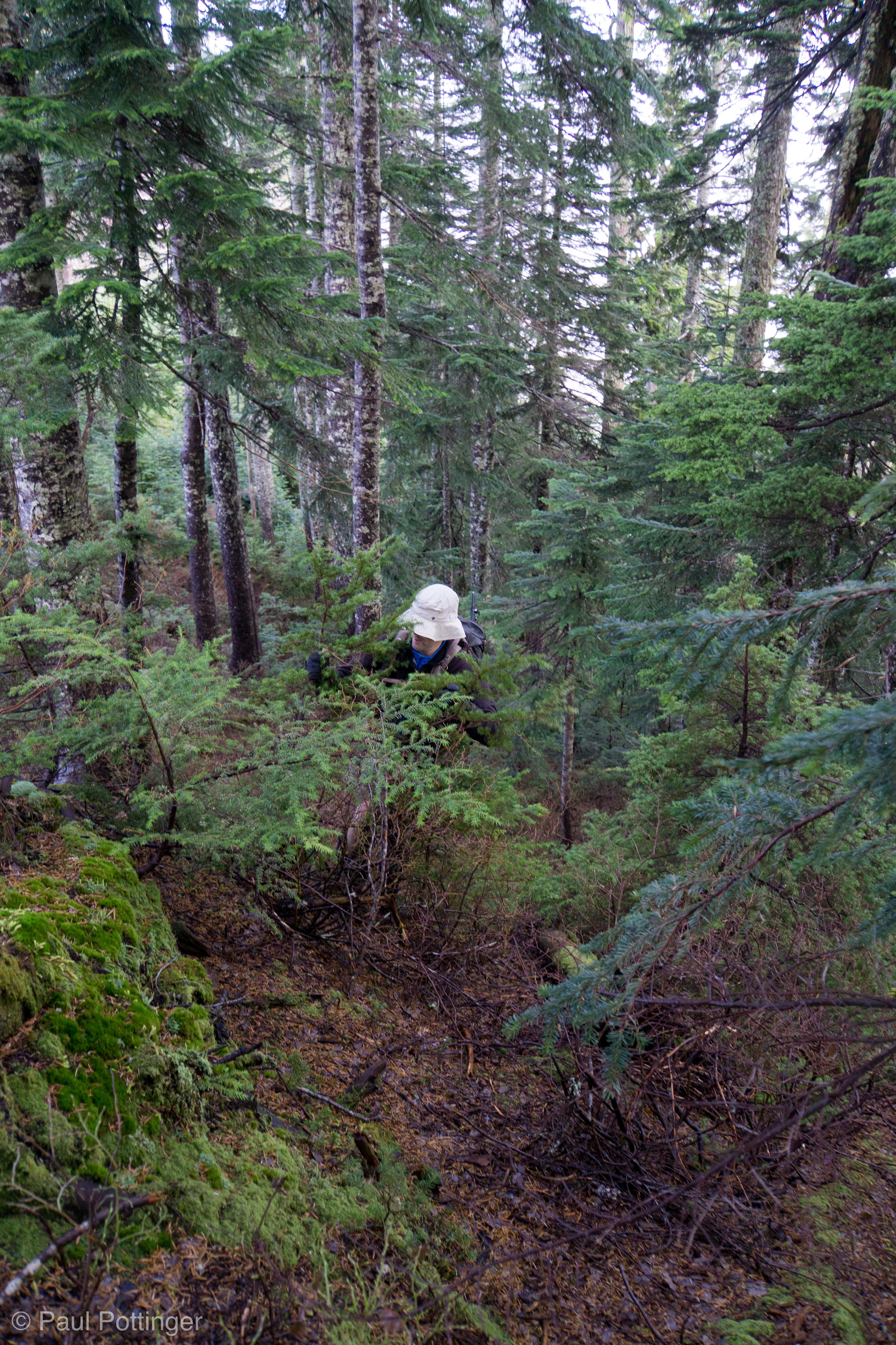
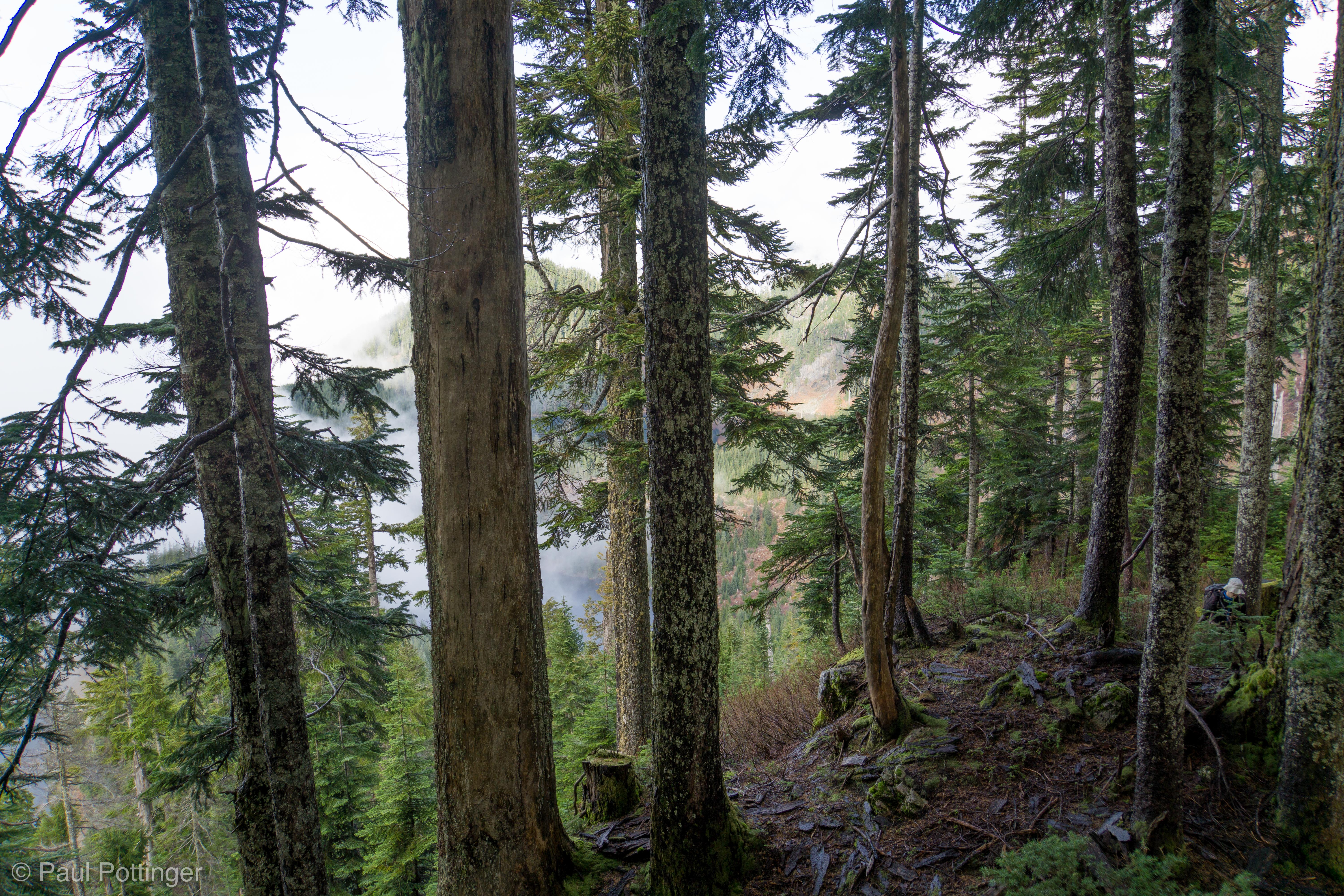
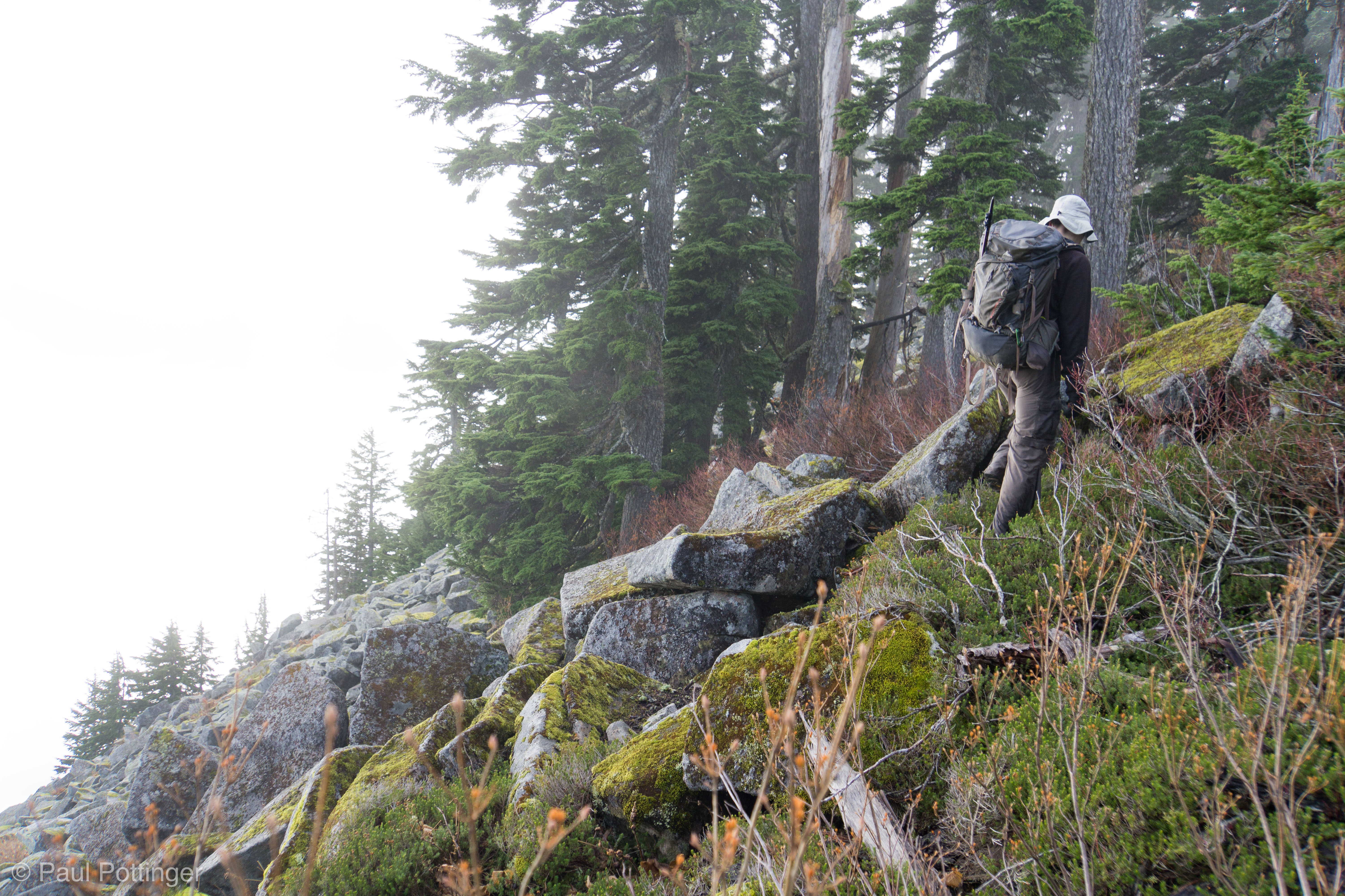
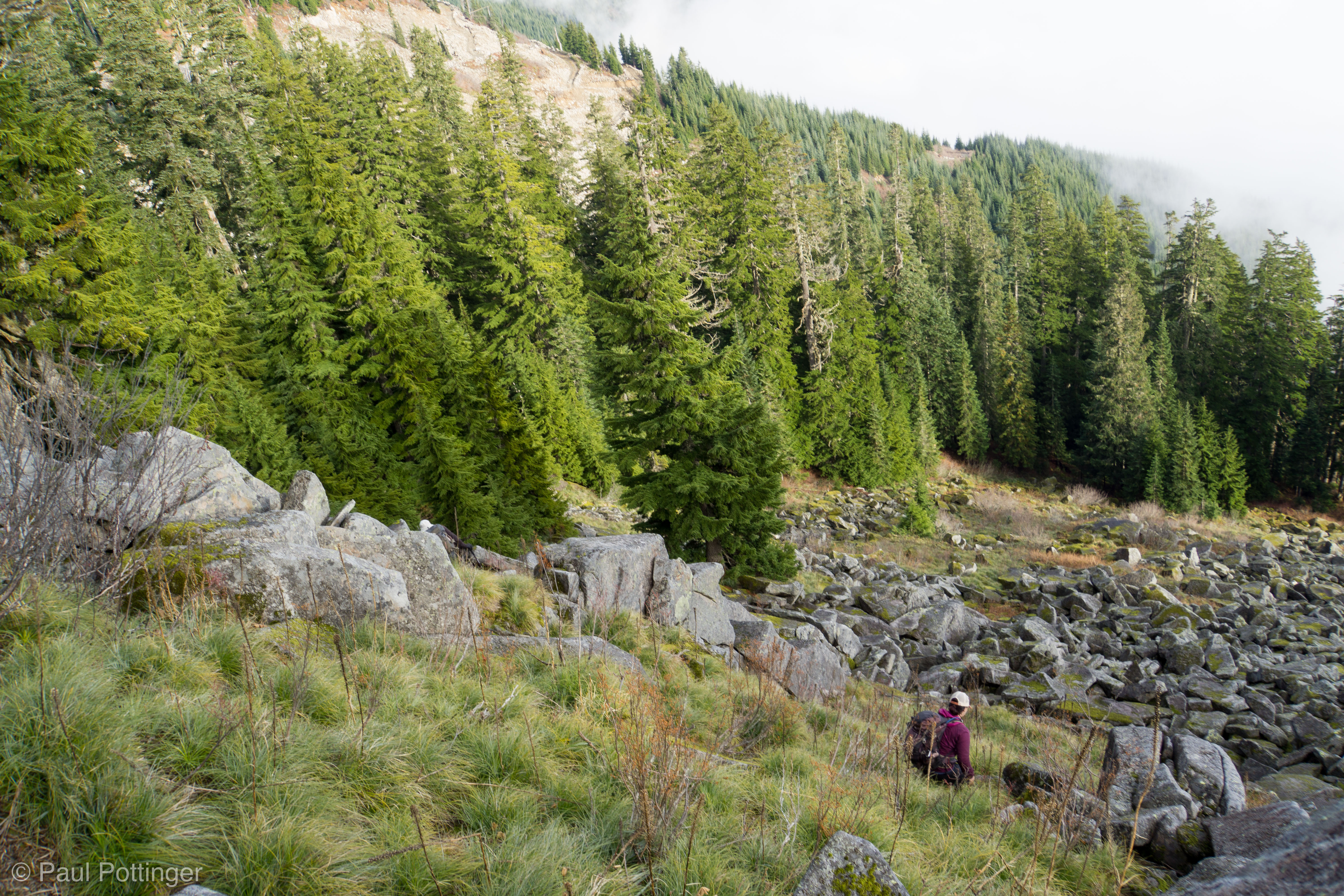
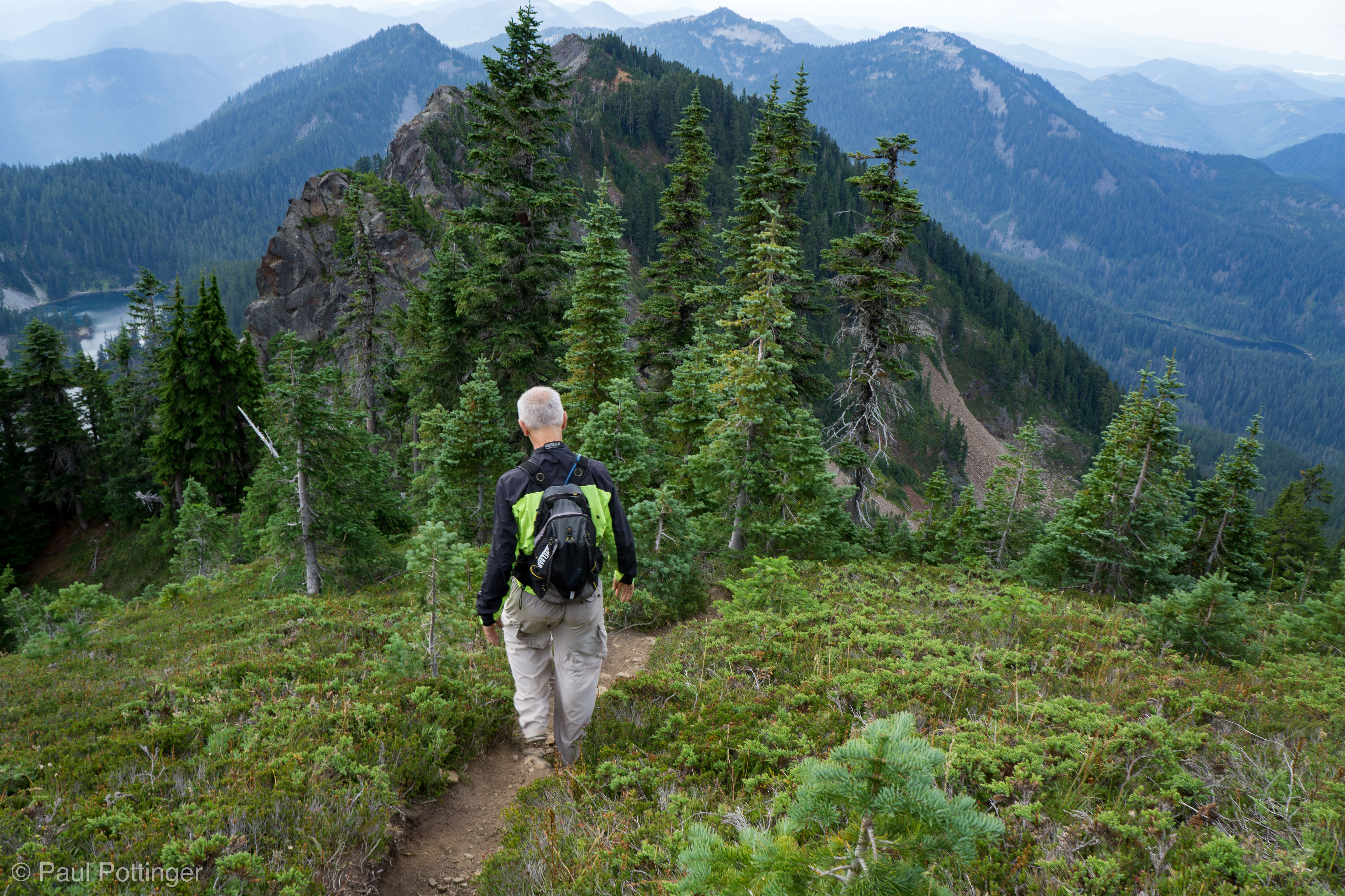
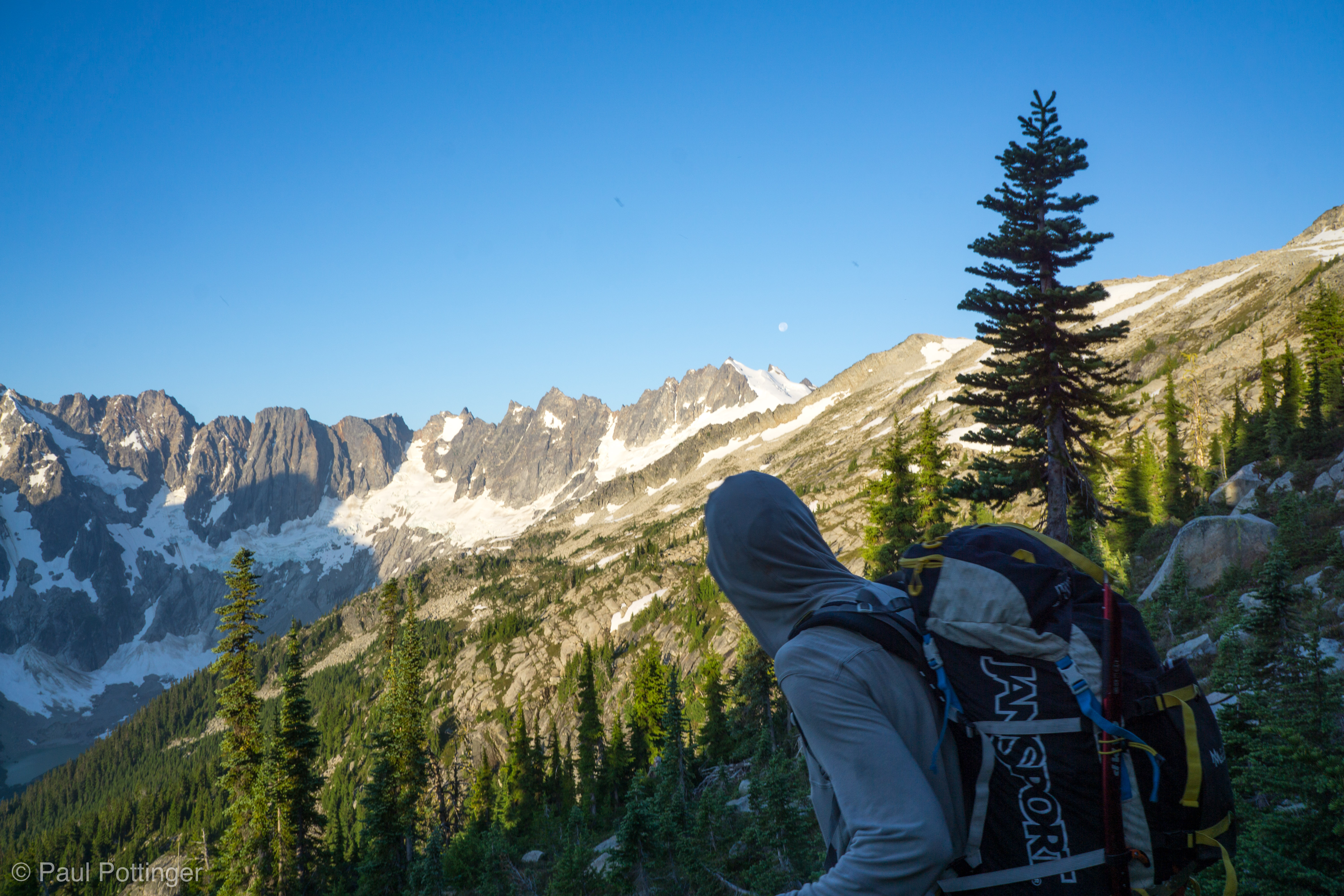
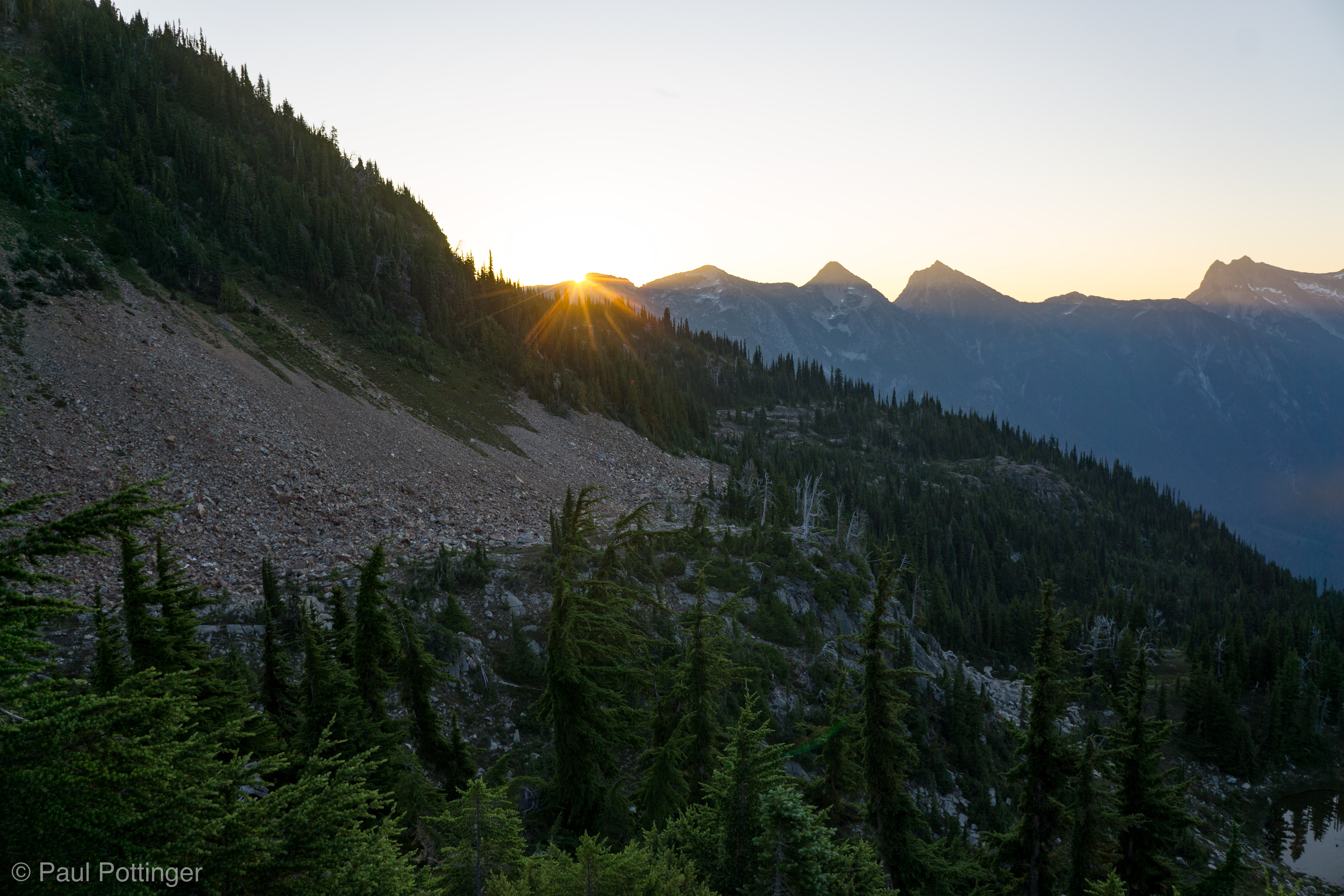
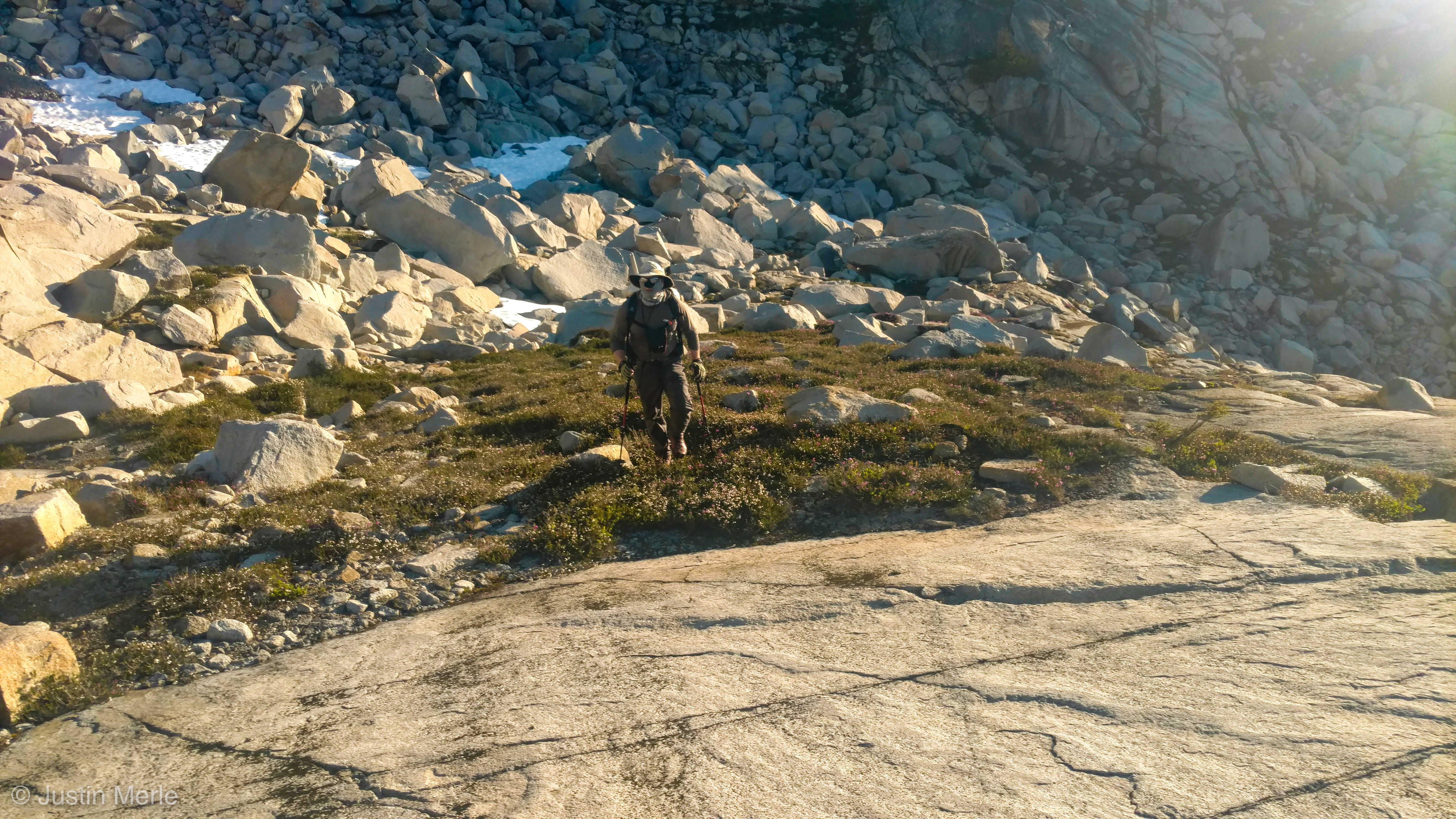
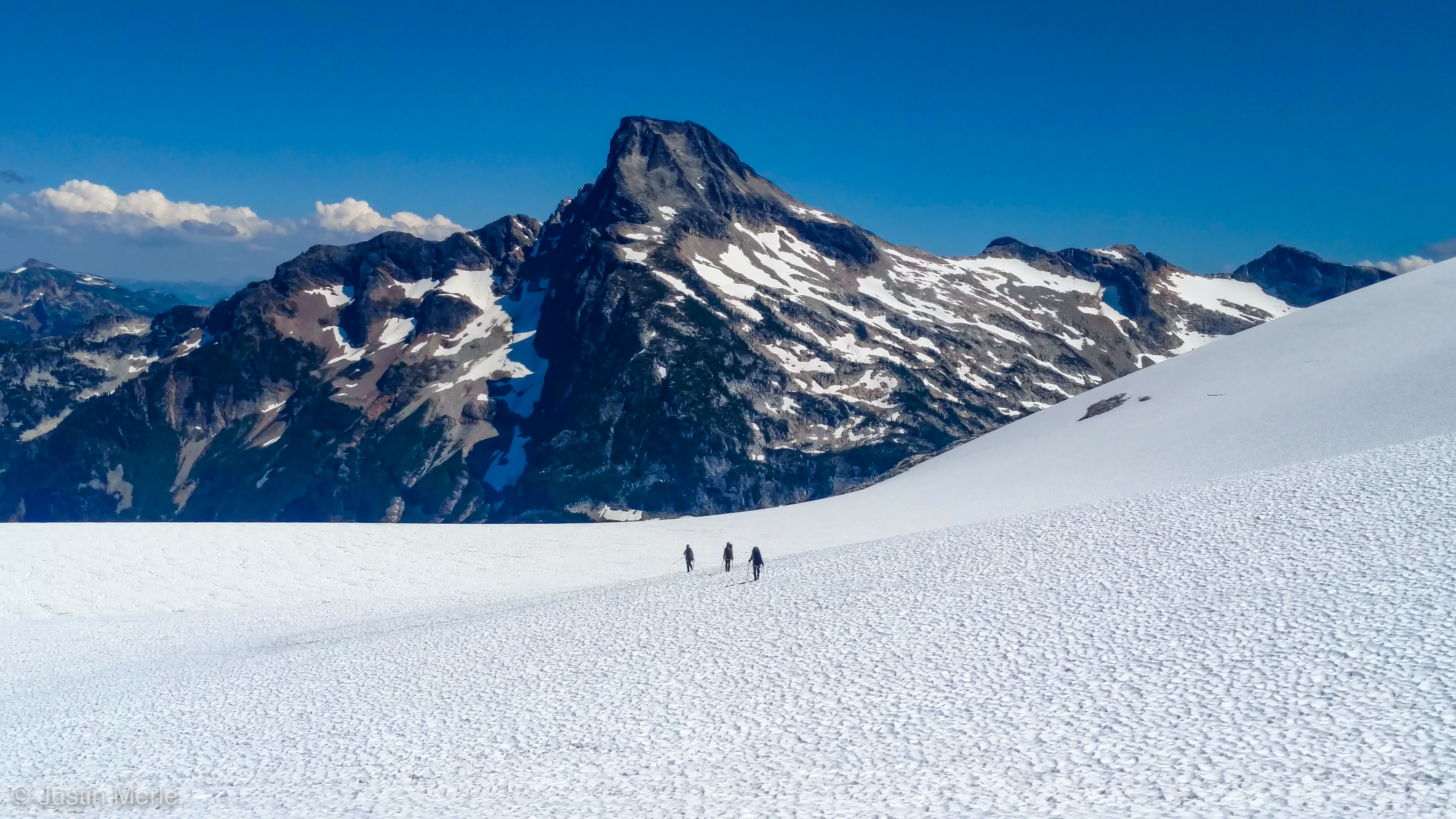
Dawn became day, revealing our route: The first section would be a long traverse, gradually climbing towards Wiley Lake. No path, no trail… just trudging across talus, bushwhacking through stands of spiky spruce, scrambling up slabs, tromping across snowfields. Our packs were light, and we made good progress, with Justin always choosing the best, most efficient line.

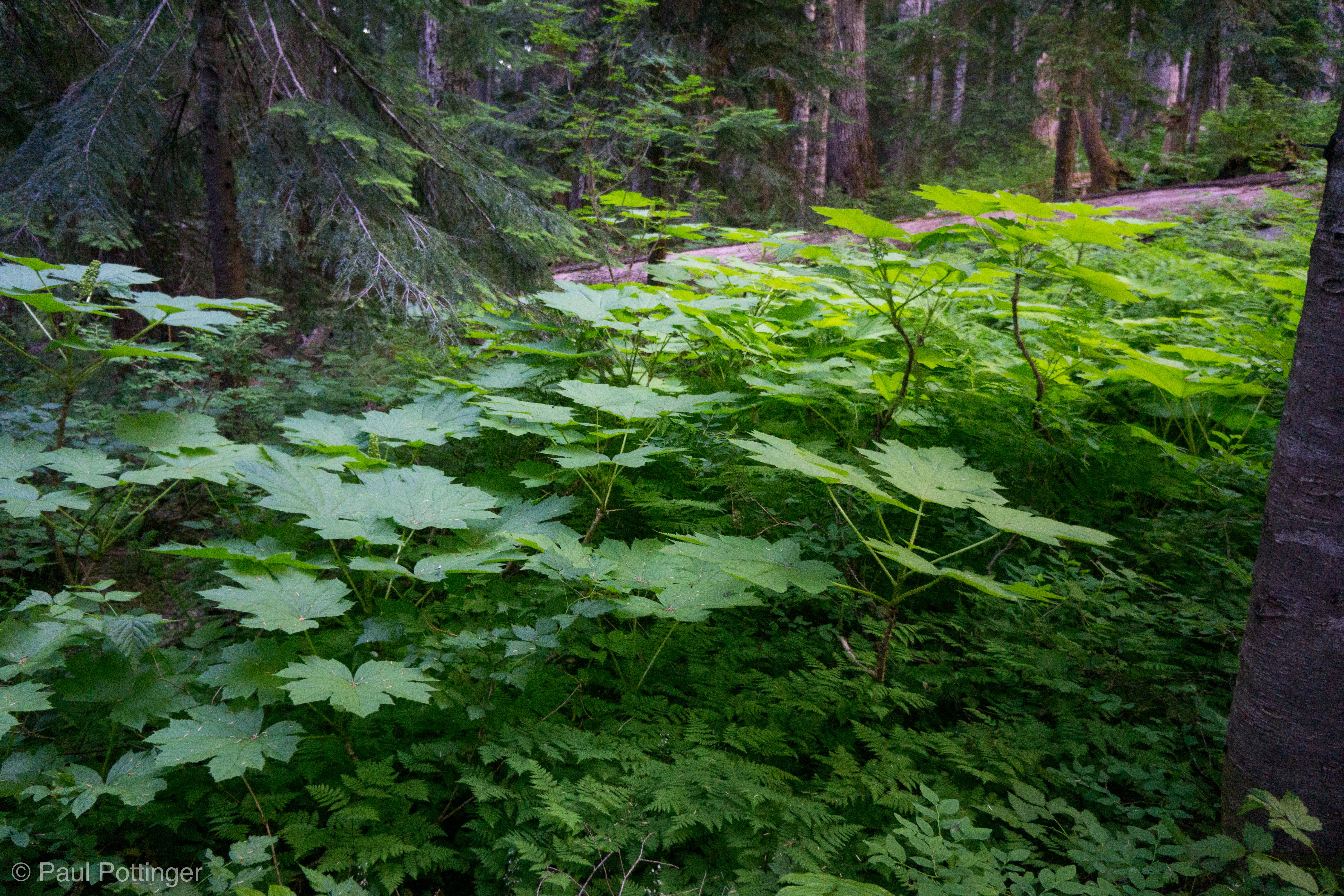
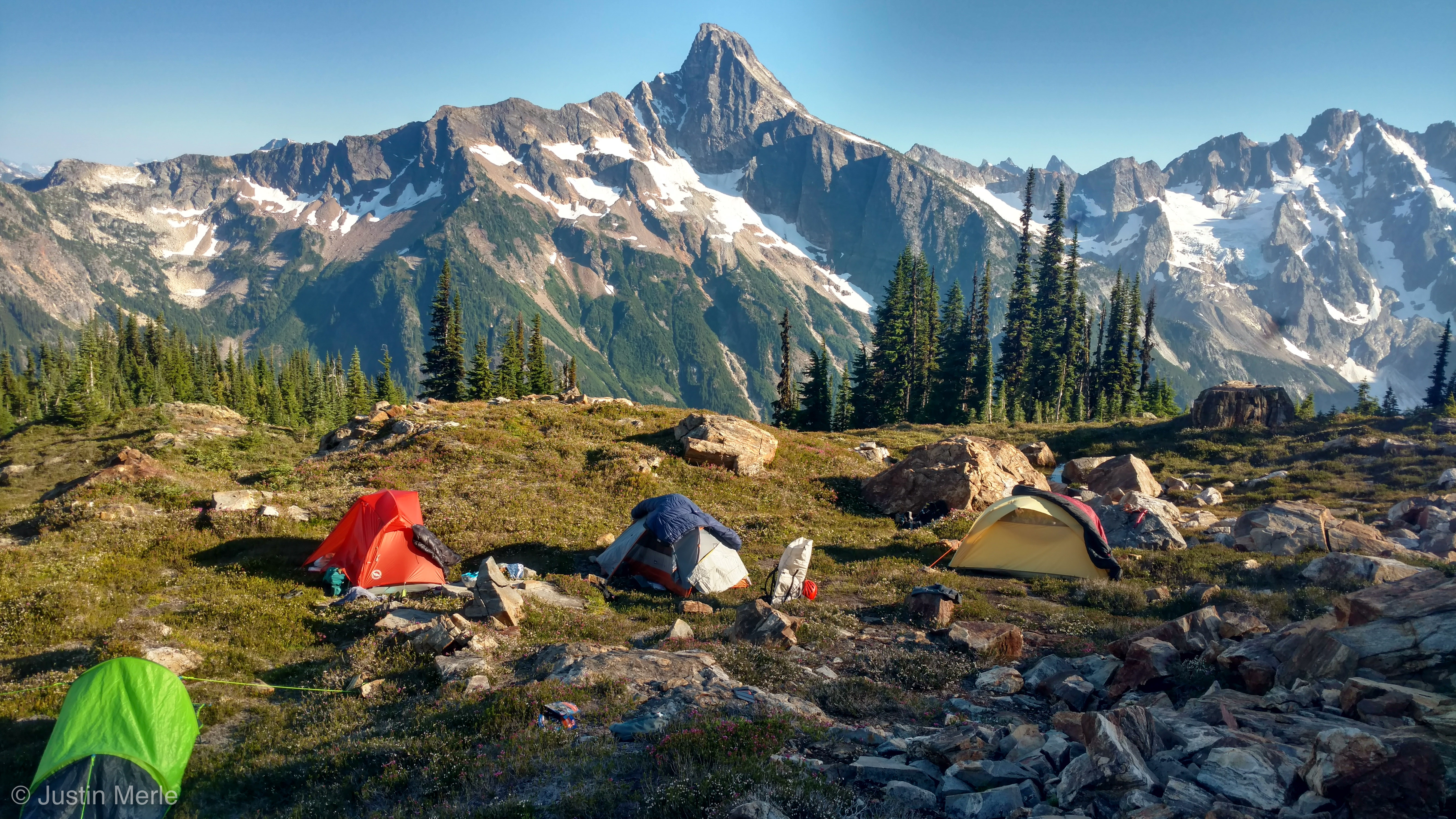
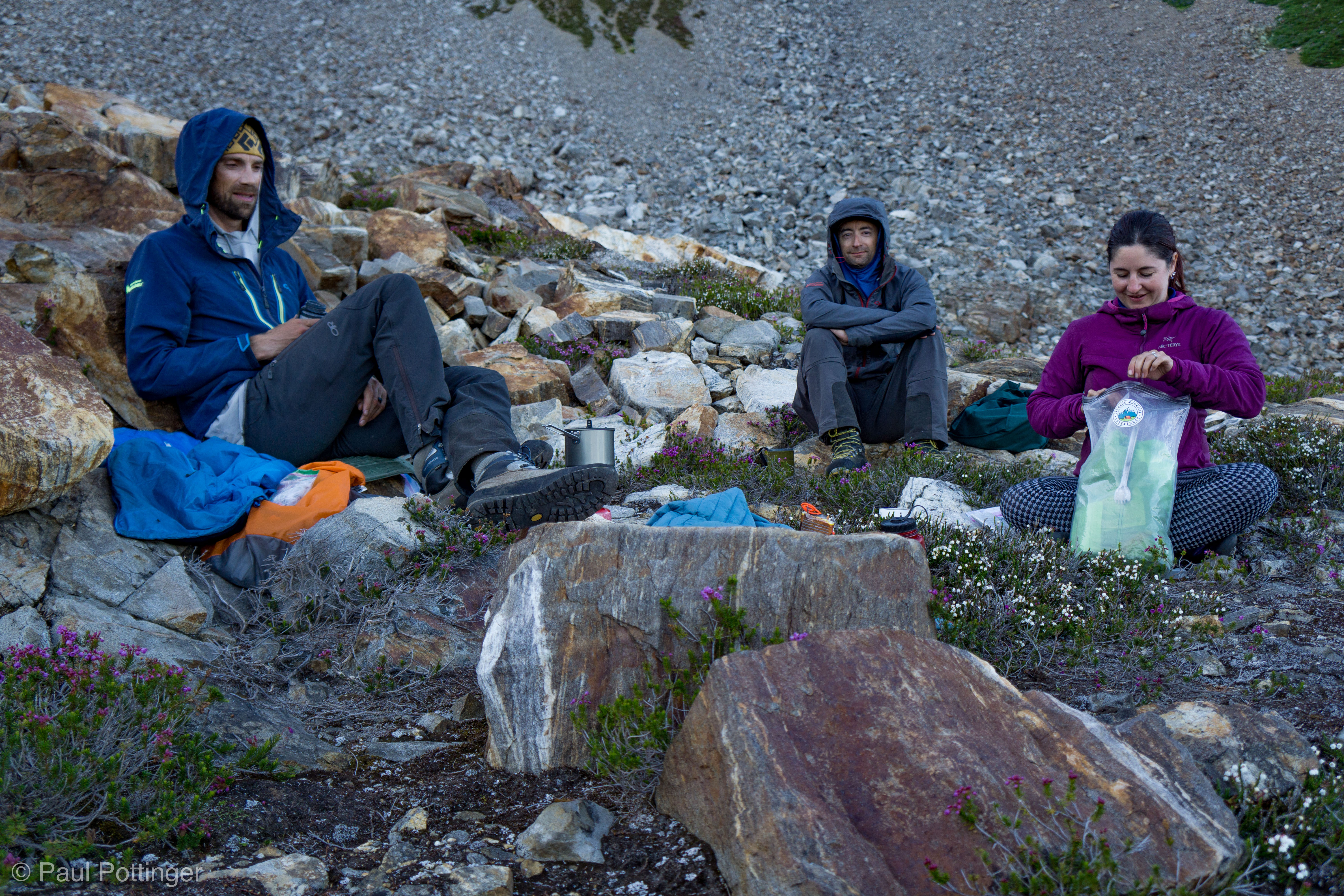
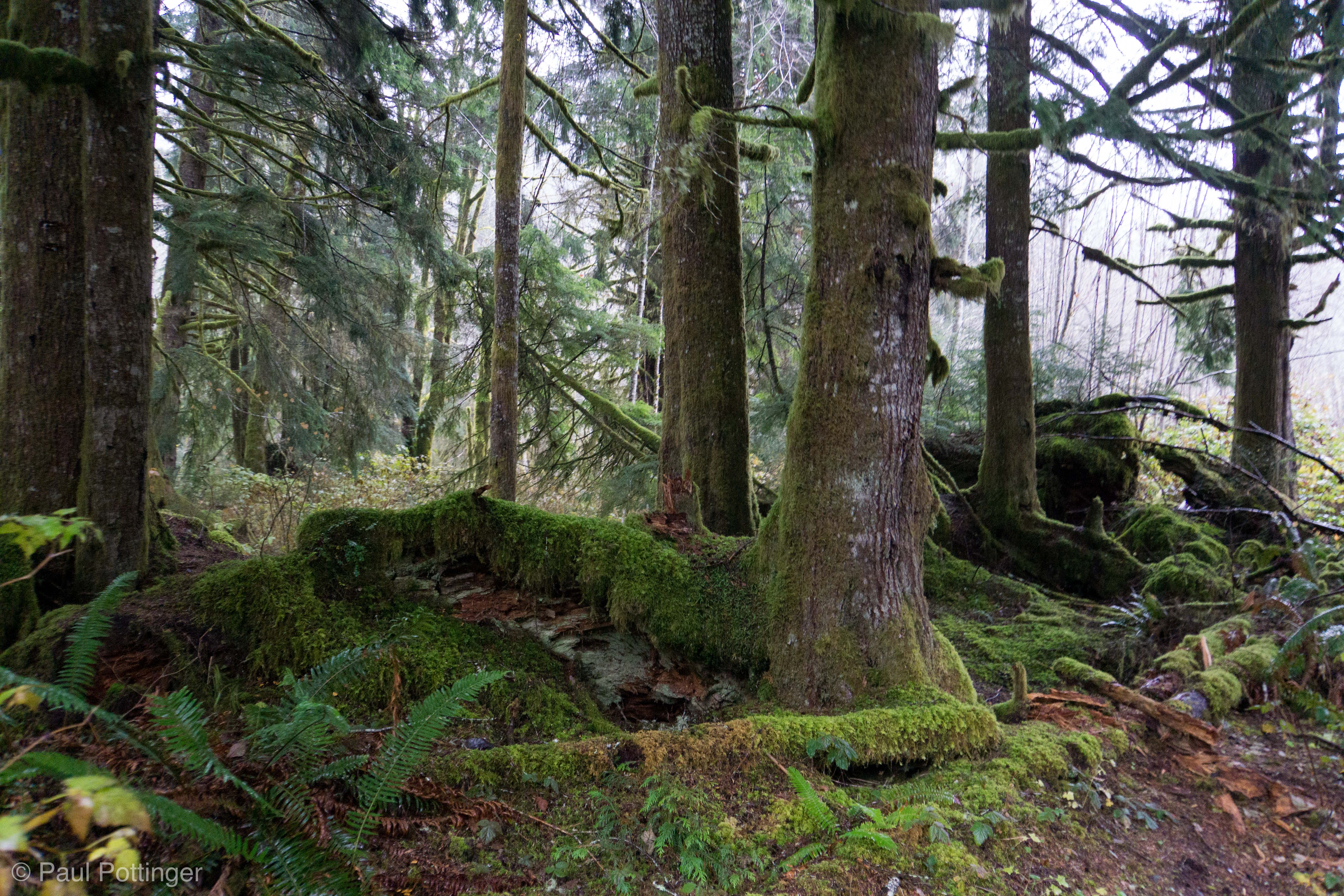
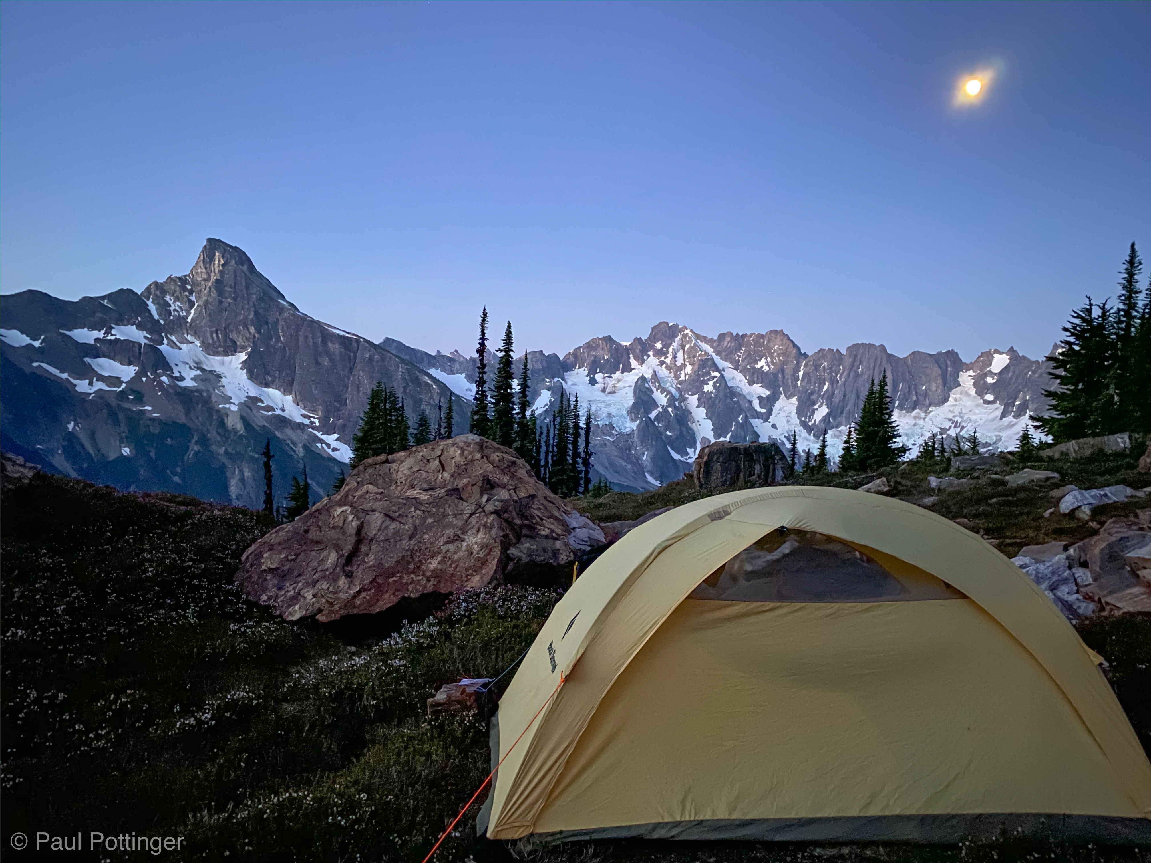
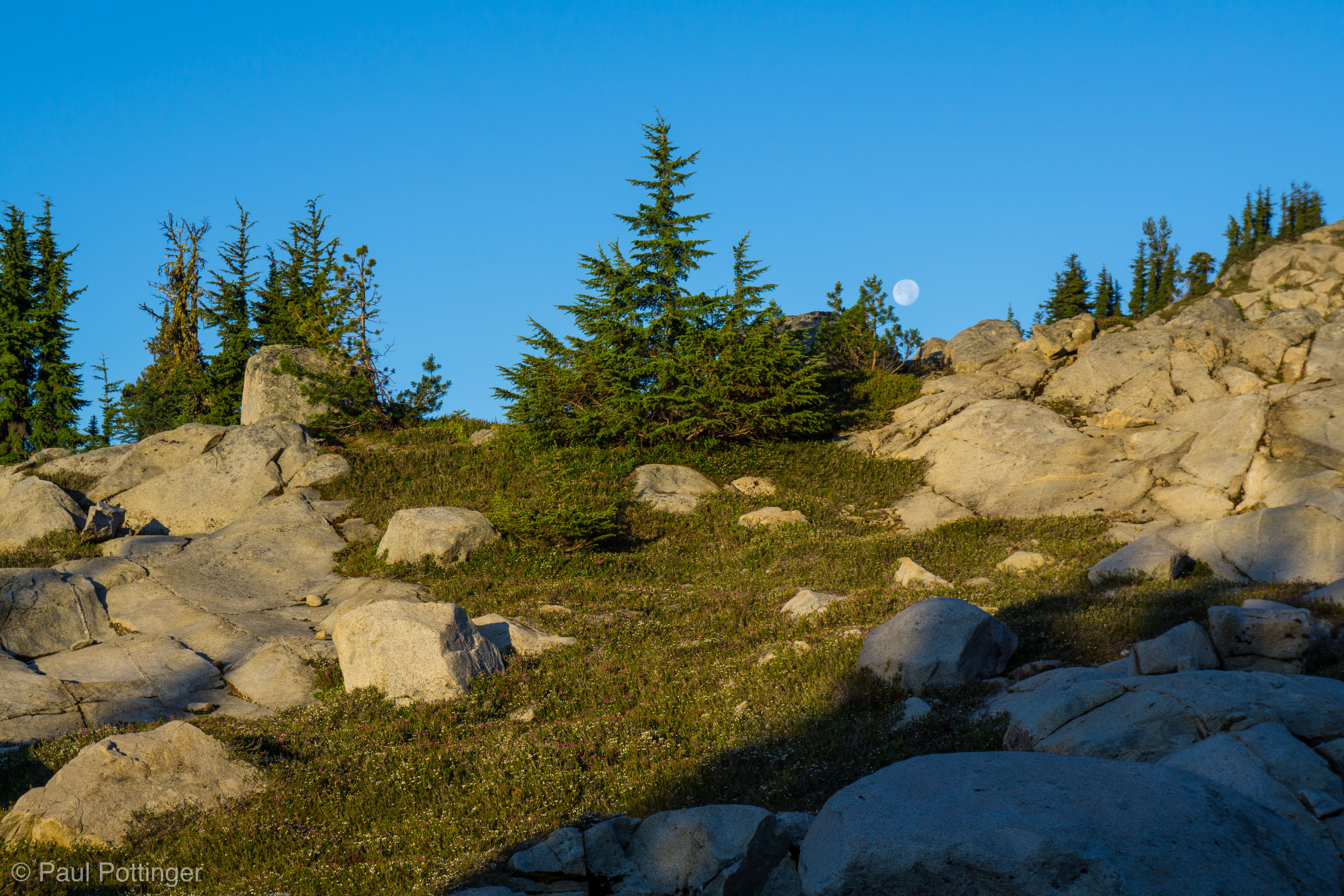
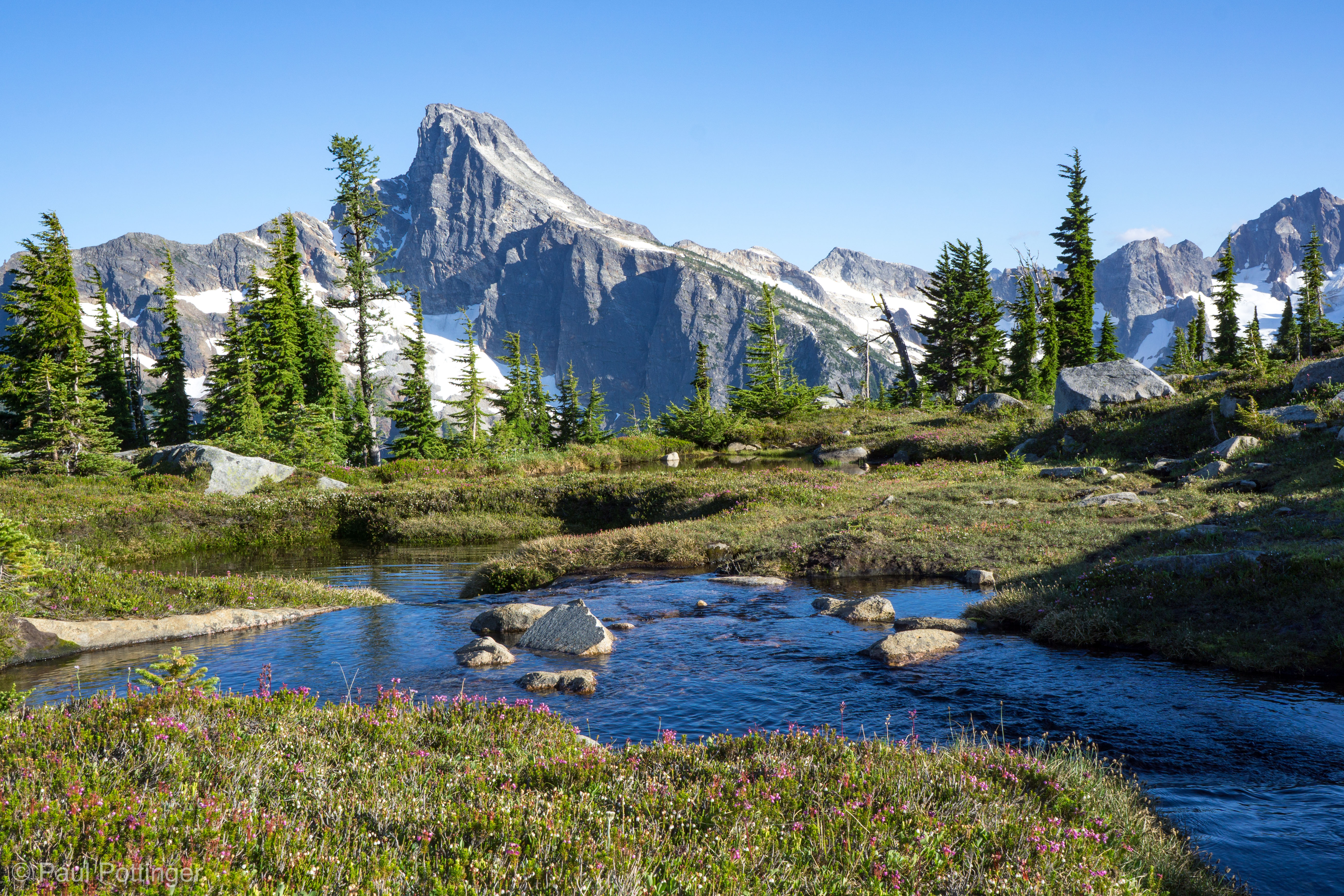
Although the bugs were vicious, we had to admire this location’s beauty. “Every place we cross is better than the last one,” said Forrest. The second big one, in particular, I dubbed Magic Camp, because it was completely perfect: Abundant flowing water, cushy flat spots for tents… even the bugs seemed to stay away out of respect for this sacred location.

Justin shoots a vector from the bottom of “Cathole Gully.”
Justin figures all we have to do is follow the moon to the summit! Indeed the summit sits directly below the moon in this view.
Forrest getting water at our first break.
Almost a full moon, racing away in the dawn.
Luna seen in the distance, reflected in the calm waters of Magic Camp.
Magic Camp, photographed by Justin.
Ah…. yes. The Sun. Thanks for keeping us alive, but… would it be too much to ask for just a few hours more shade?
Forrest takes in the scene. Everything’s bigger in the Pickets.

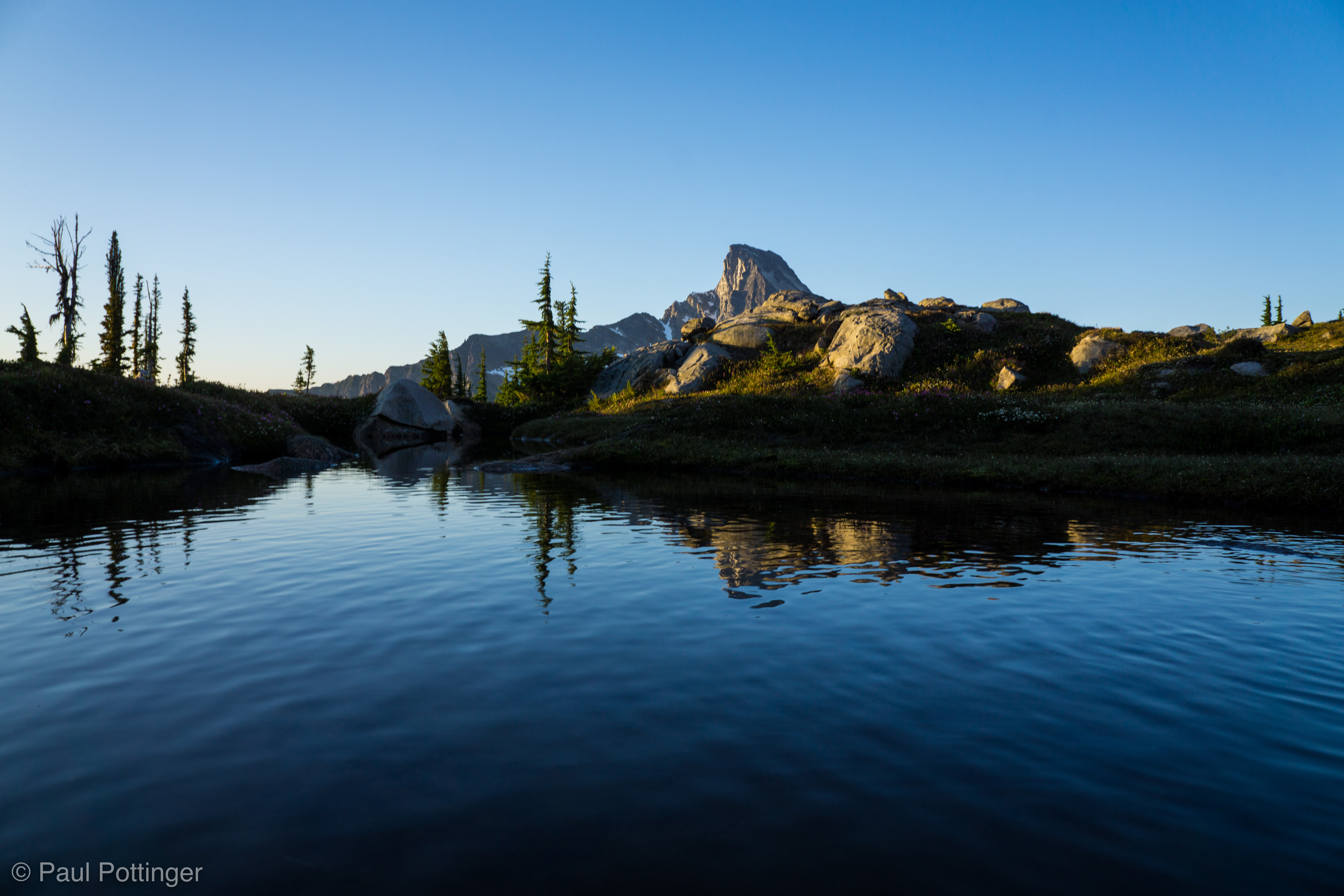
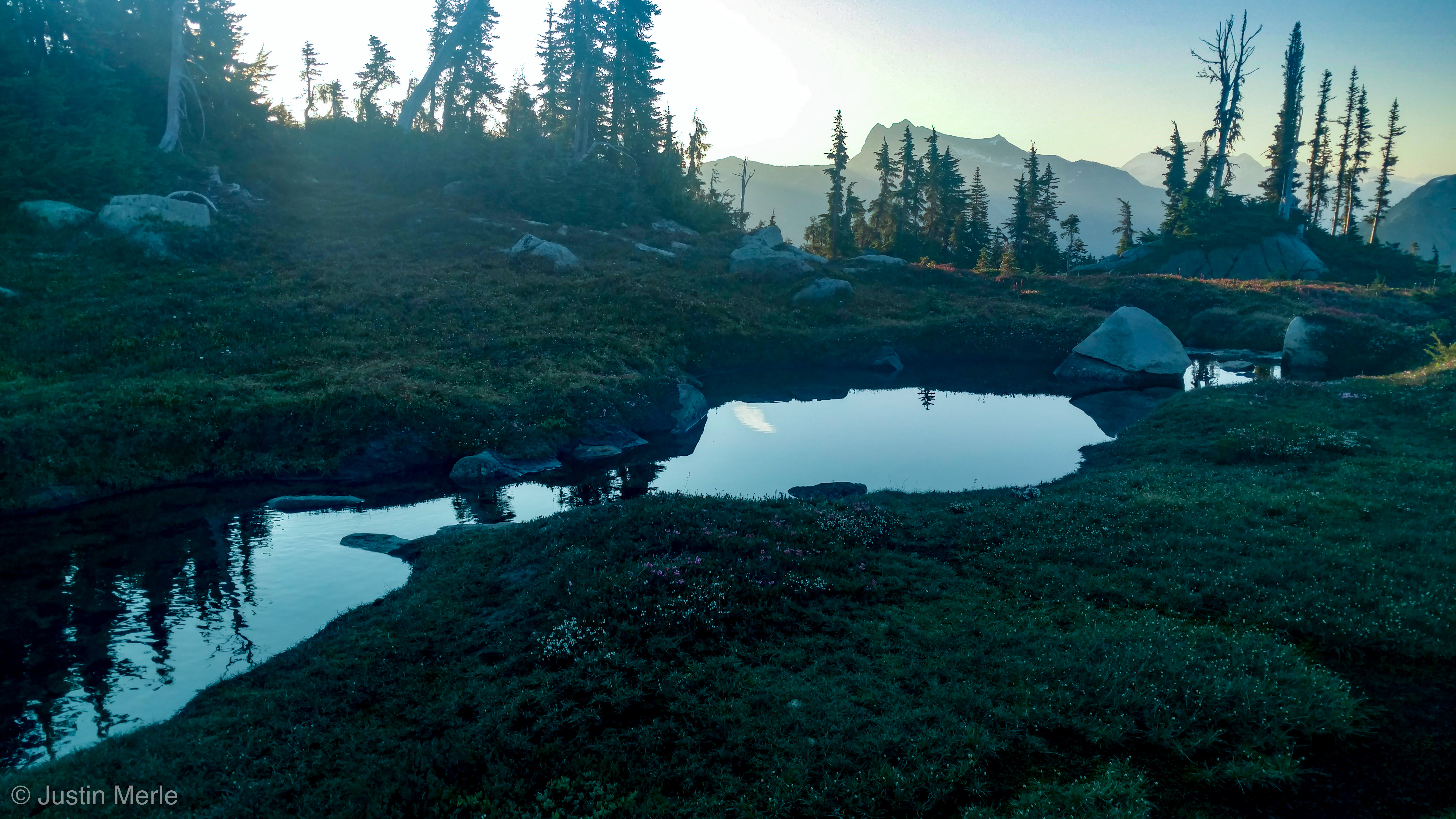
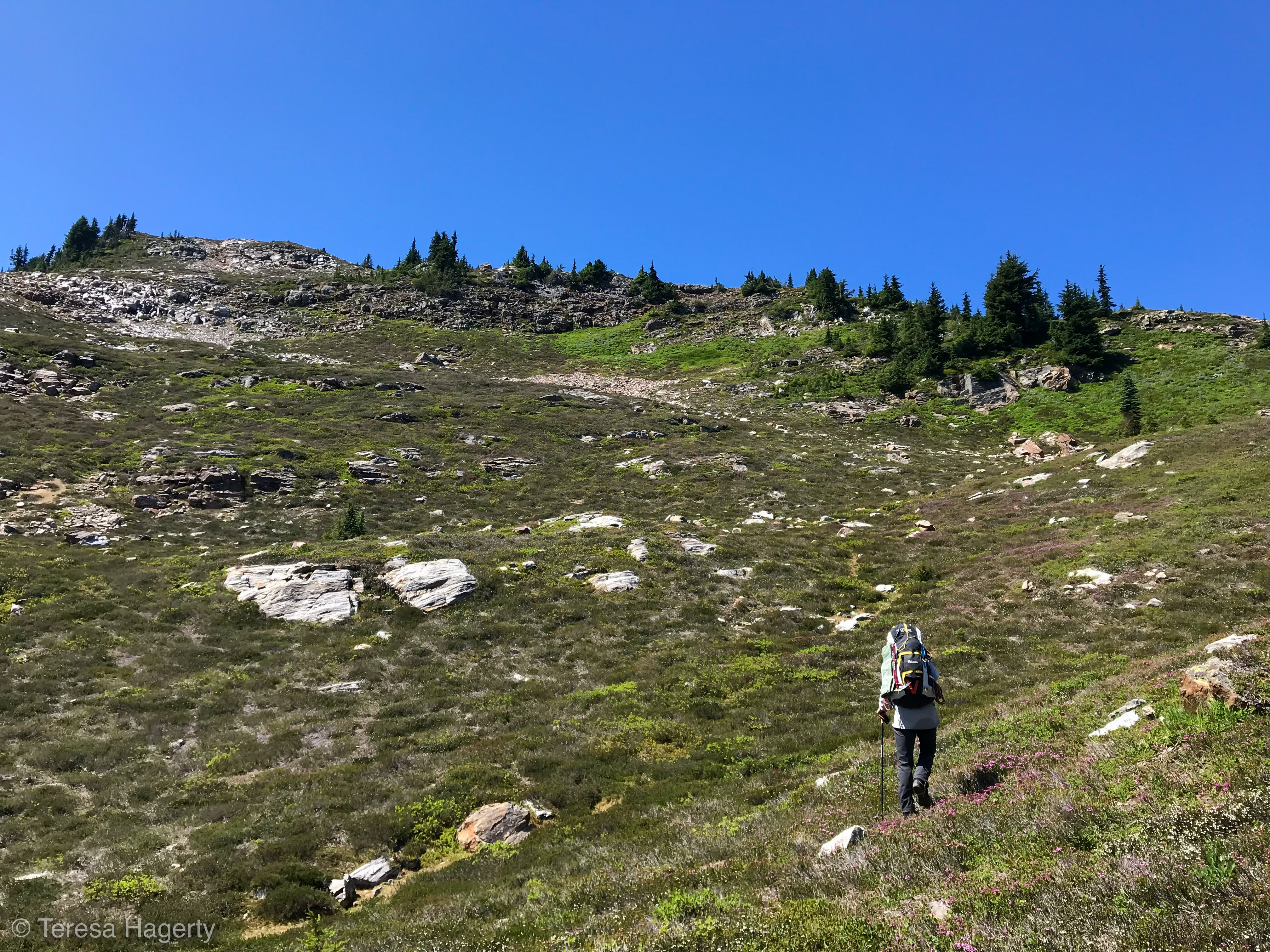
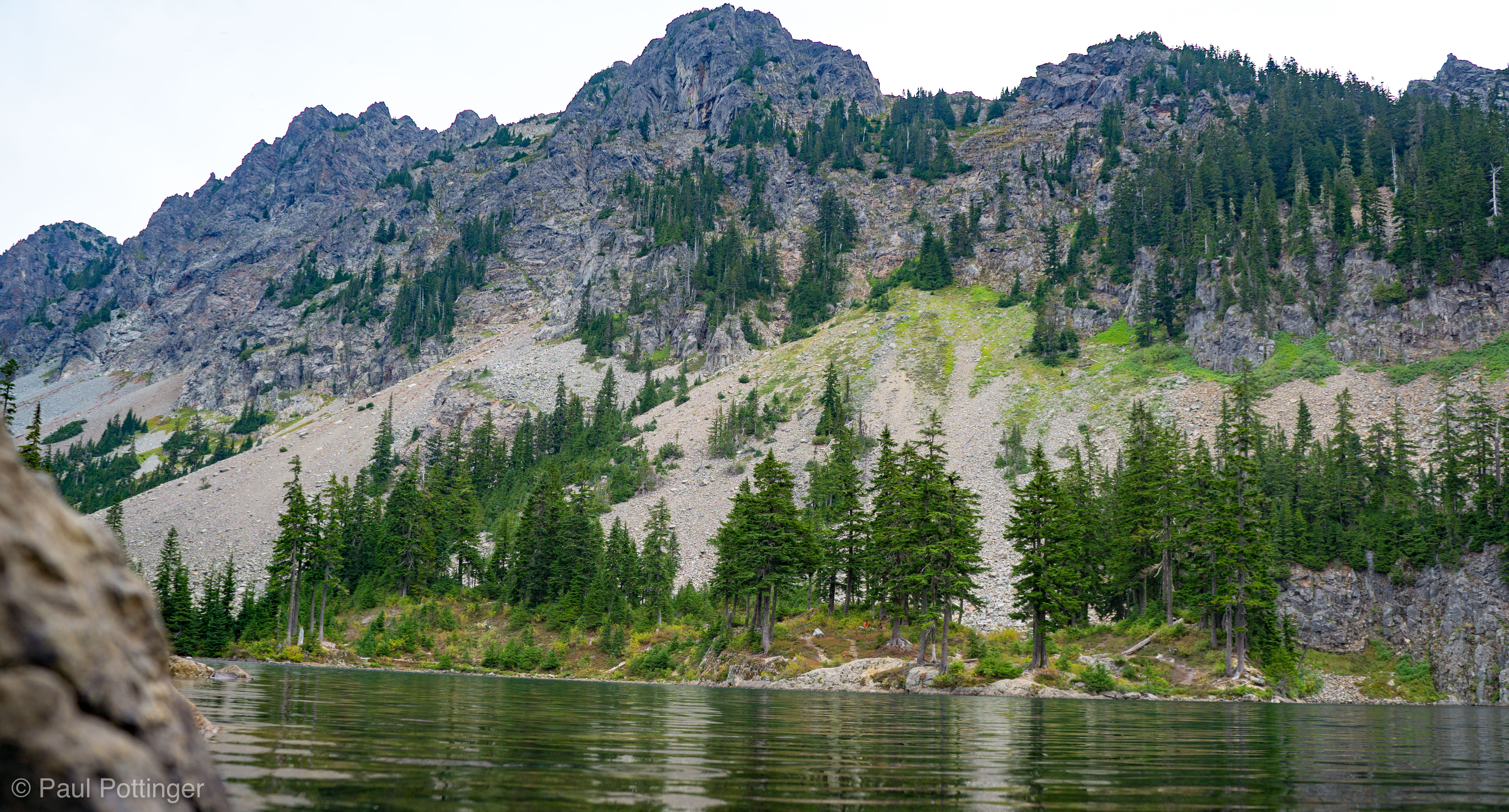
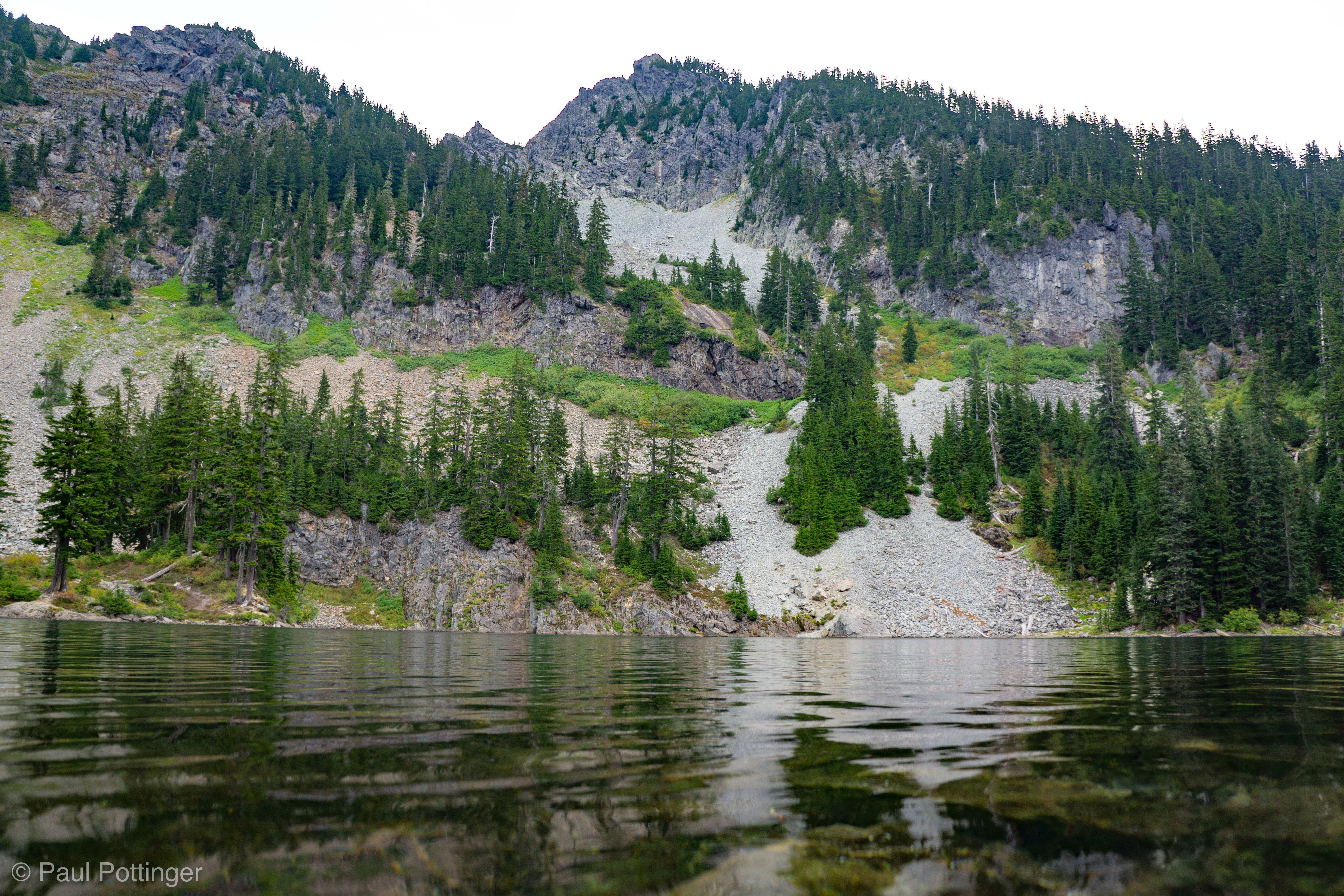
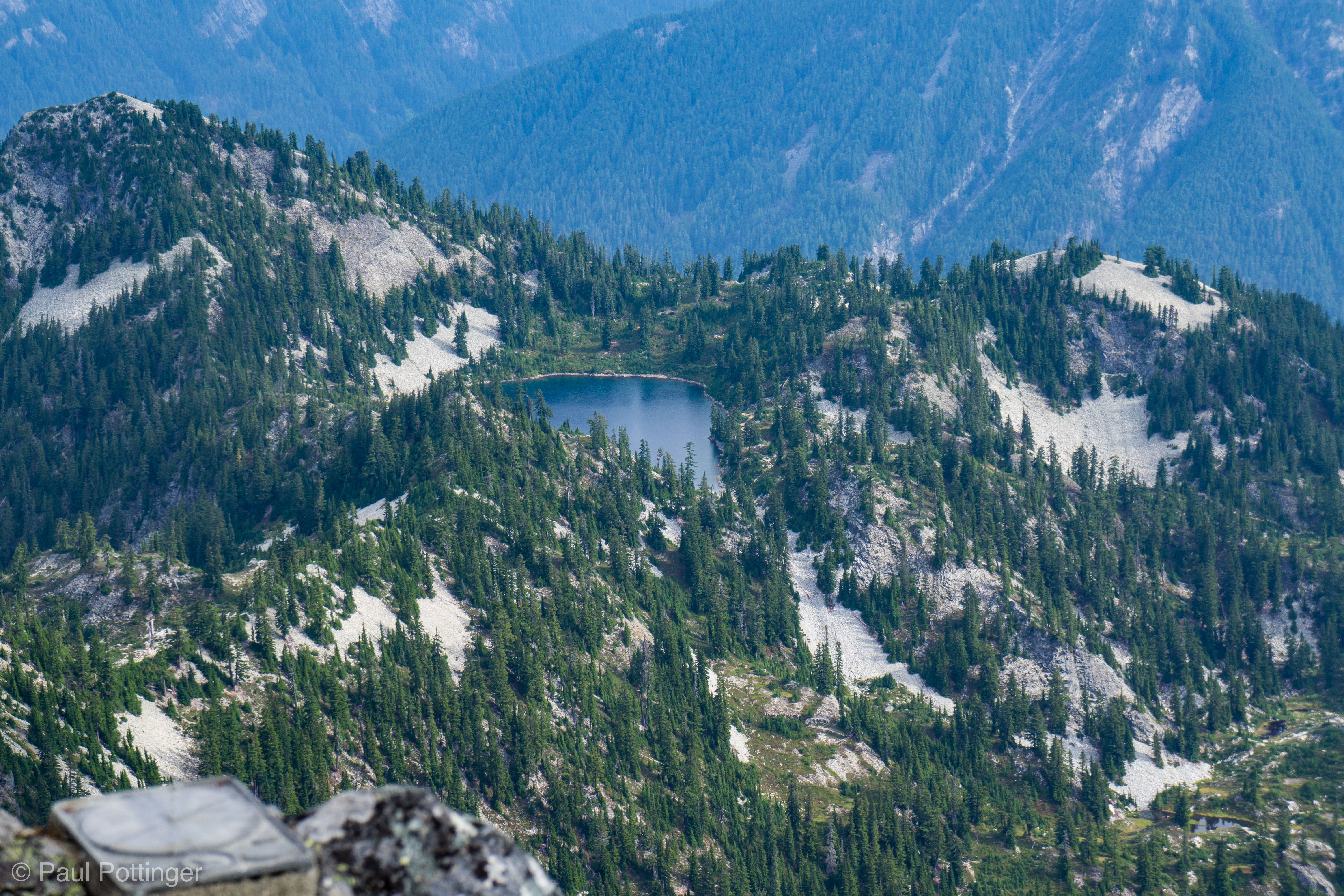
I started out feeling very strong. The summit pack felt so light! And yet… as we made it to Wiley, I began to feel tired. Maybe the prior two days’ effort was catching me, the lack of sleep, etc. Was I eating and drinking enough? Sure… the unavoidable truth became clear: this was my lack of training and declining fitness in the prior 6 months! Well, this was happening, and nothing would stop me now. Still, when we pulled in to Wiley at 7:27 AM, just over two hours since leaving camp, I really did feel pooped. The lake was frozen on the edges, with some beautiful blue liquid water in the center. Yesterday, we had considered coming here to camp, and it was clear now that we’d made the right call. Coming here with a full pack, exhausted after the bushwhack ascent would have been cray-cray.

Photo of me making my way up the slabs below Wiley Lake.
Forrest is looking strong!
Getting moving on the descent to Wiley Lake.
Panorama of Wiley Lake, seen from our water filling spot.
Wiley Lake: Clear… inviting… very very cold!

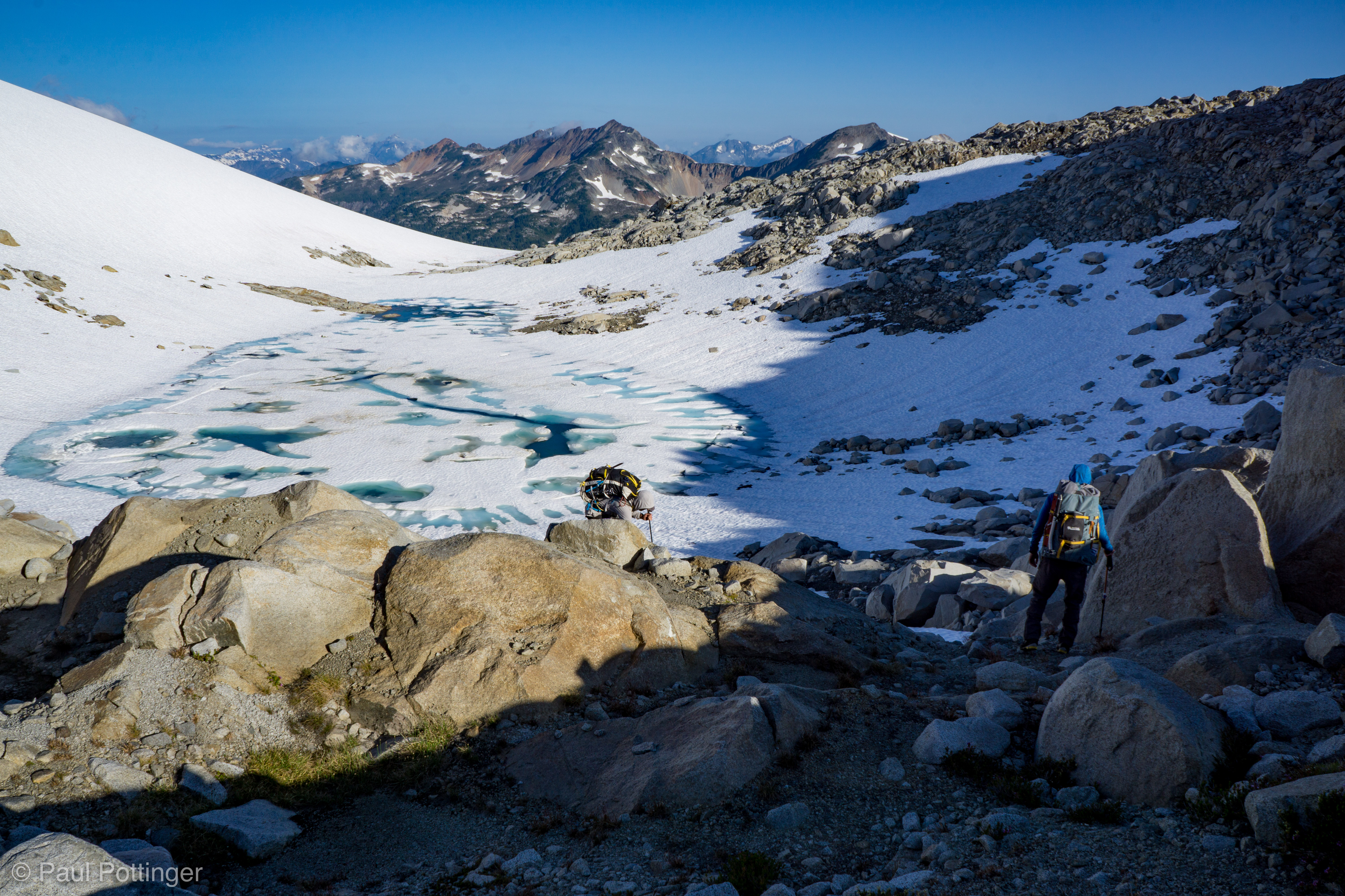
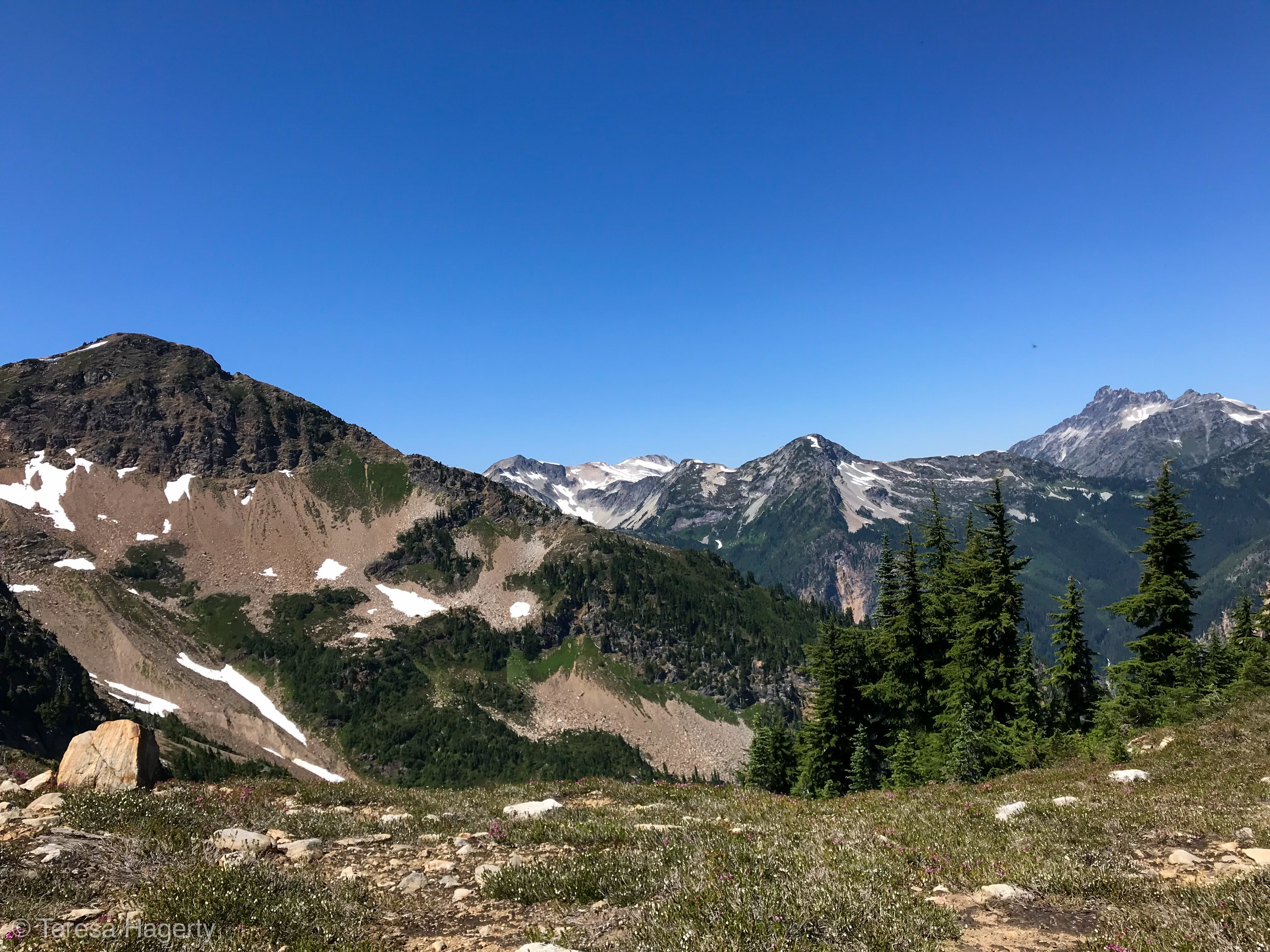
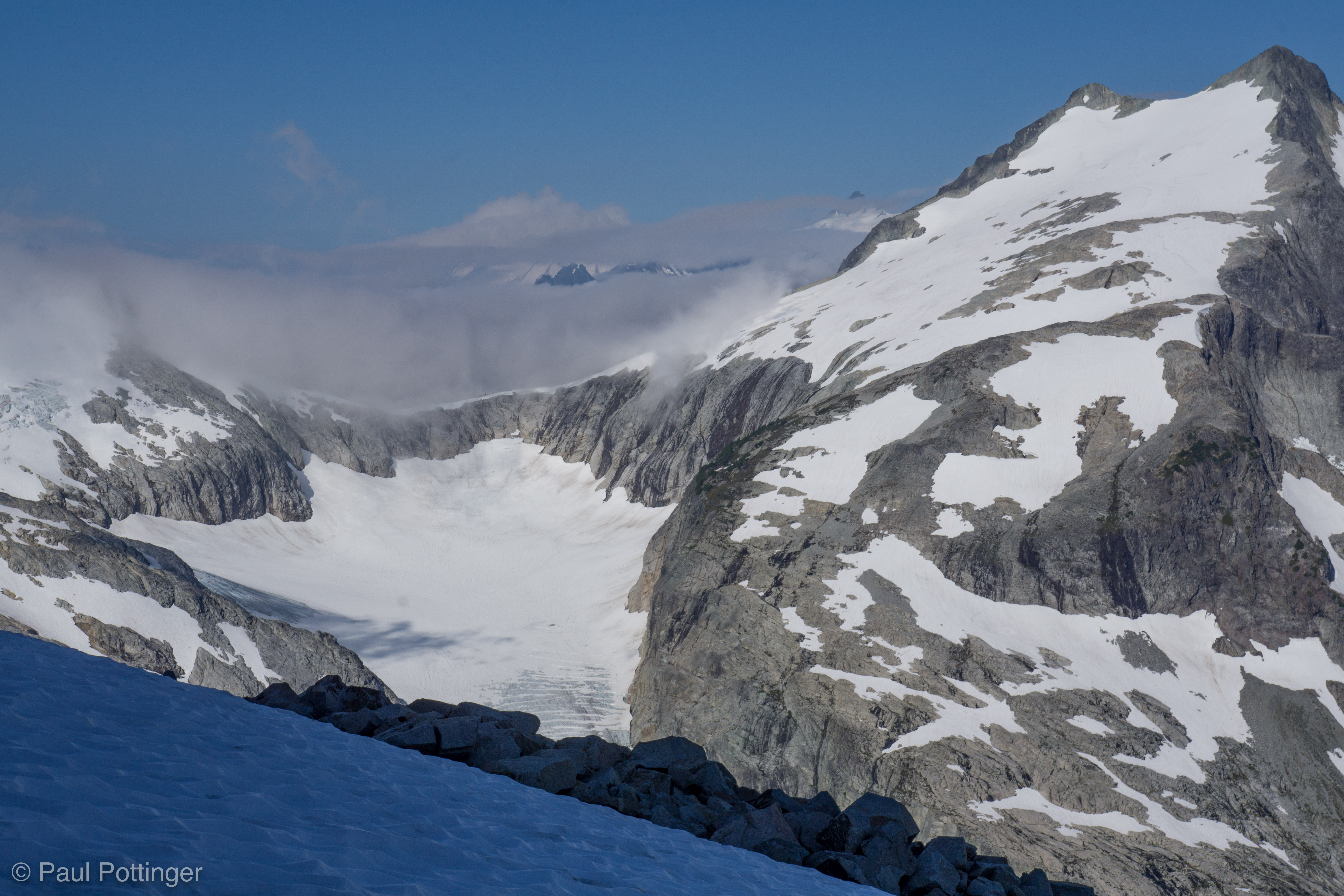
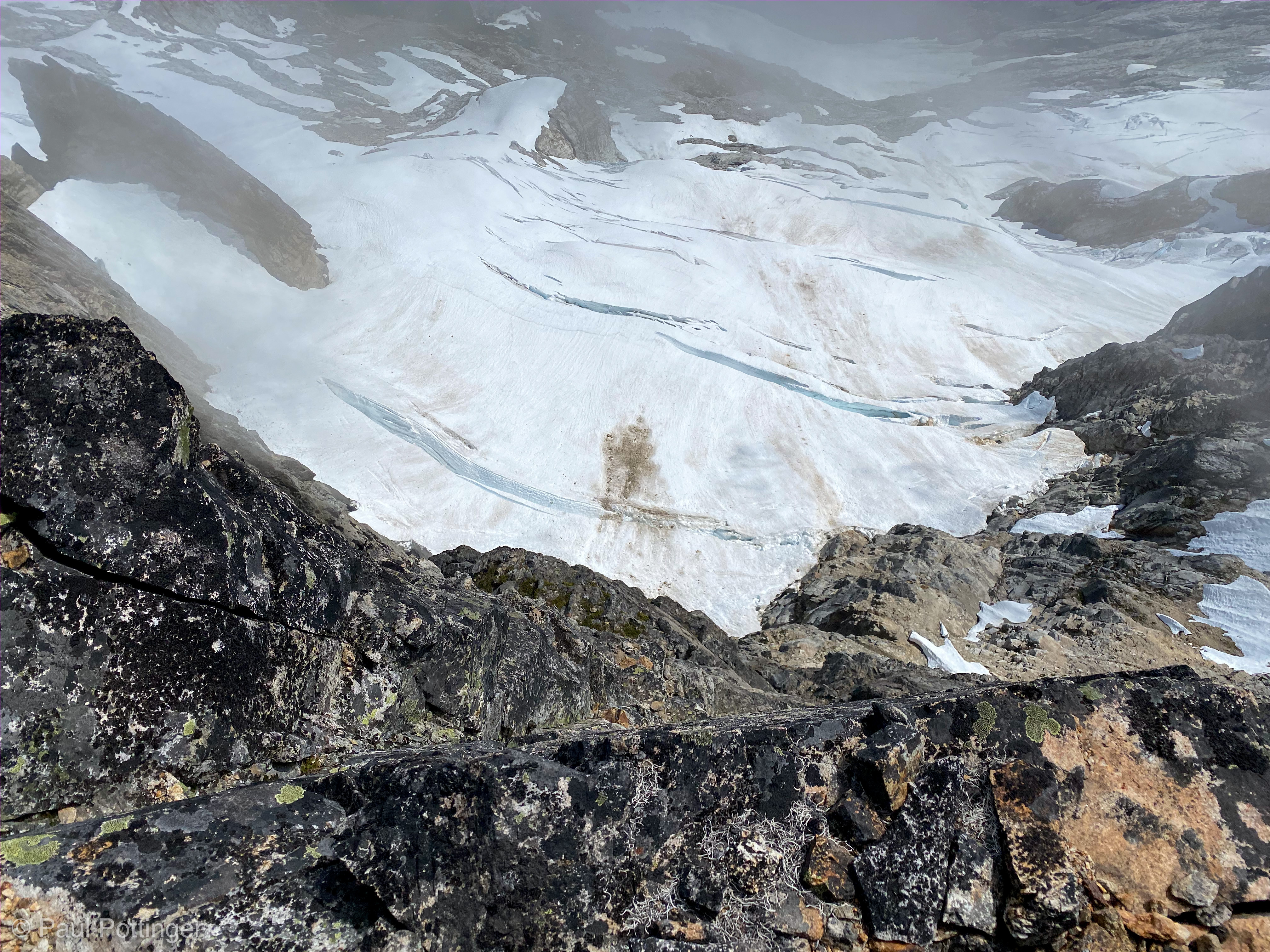
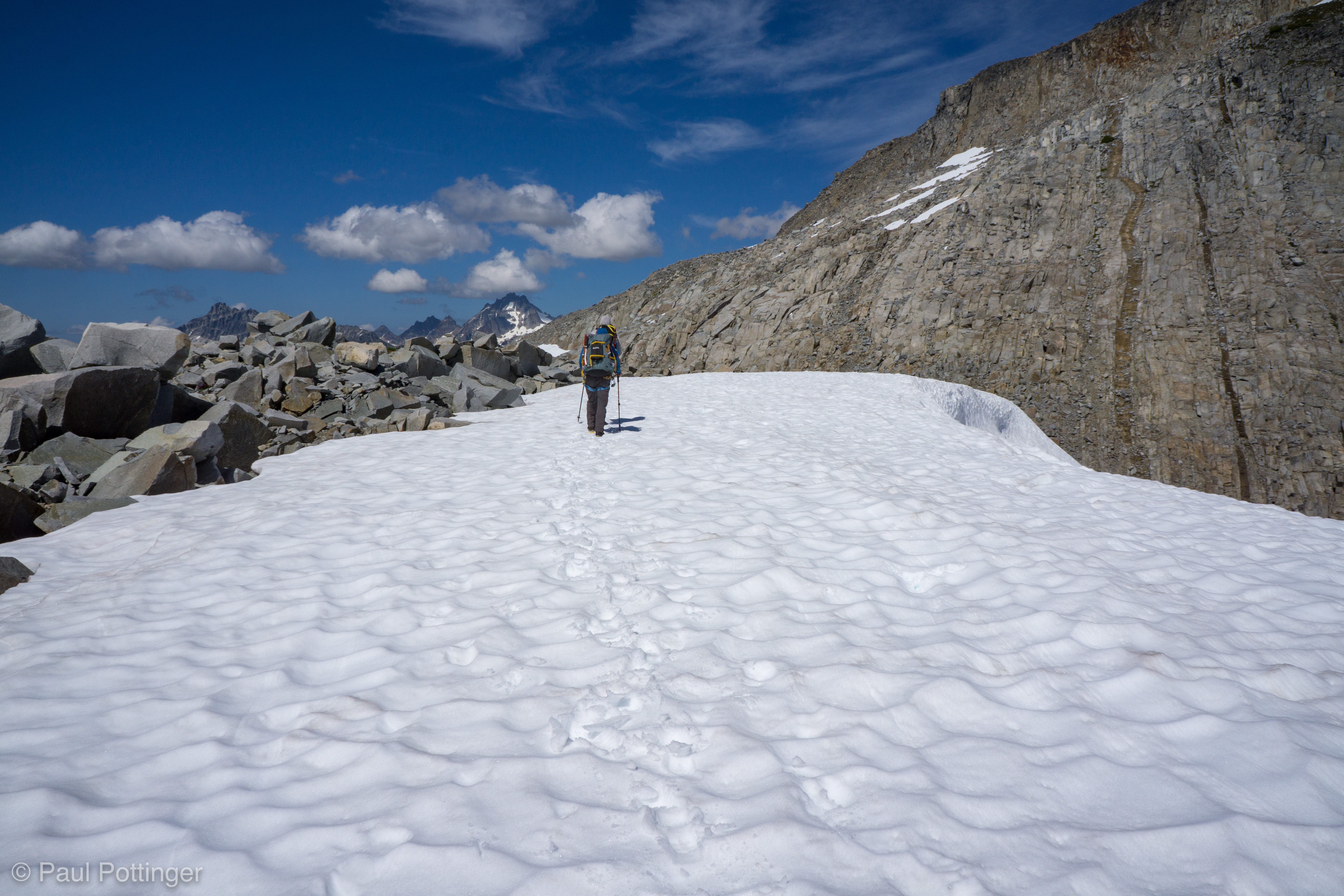
We filled our water bottles at the lake and took a proper break. And, we made the transition to the next segment of the climb: Snowfields and glaciers. Wiley sits in a bowl immediately East of a small mountain, which rises a few hundred feet above the water. Cresting it would be easy… but, what lay on the other side? Justin’s read of the topo suggested that the far side would be a chossy, exposed, steep drop. We all agreed on the alternative route: Skirting around the north side of this rise, which involved no substantial elevation change but required an additional mile (or so) traverse on snow and ice. It seemed the better approach to all of us. And, indeed, I think it is the better way to go.

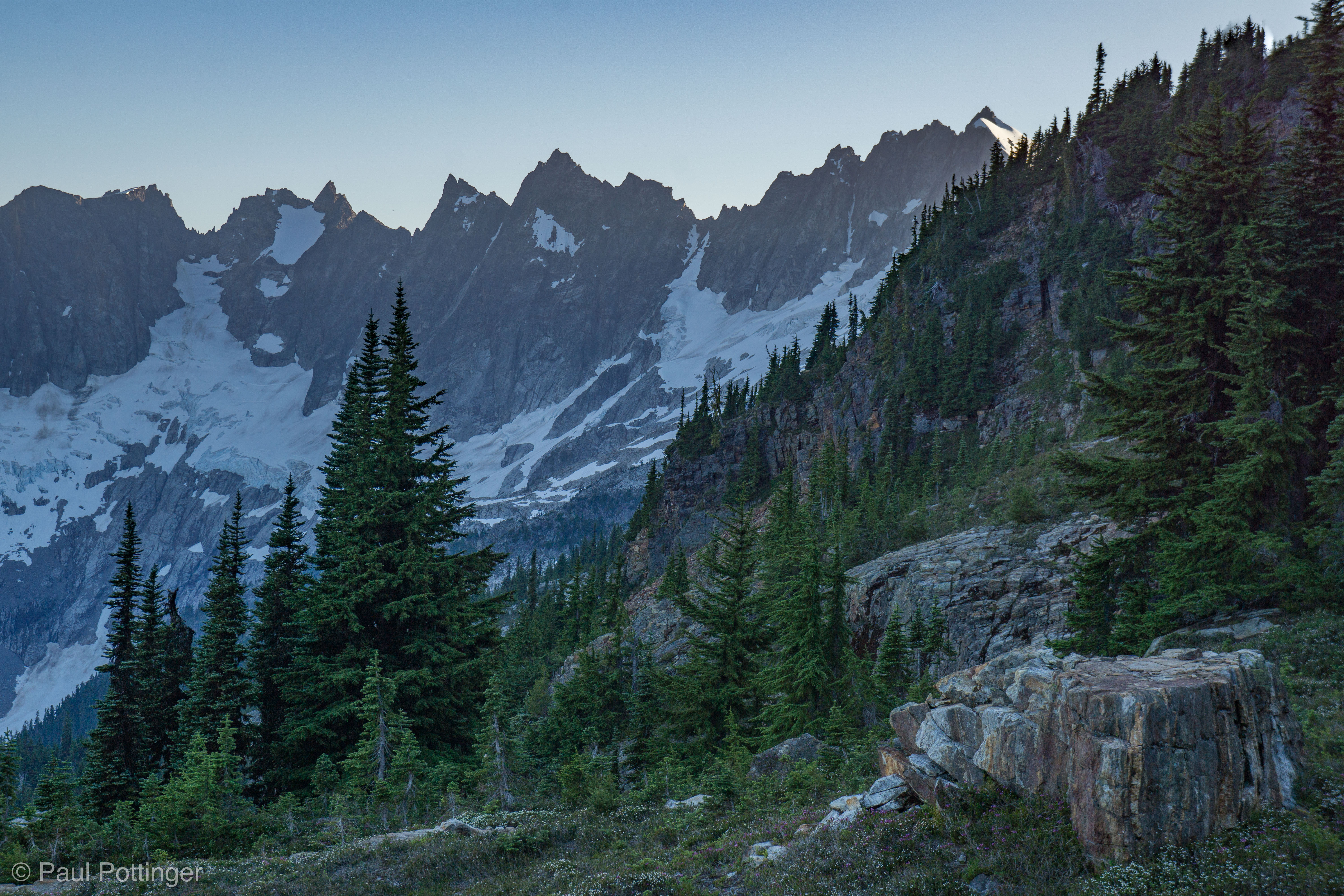
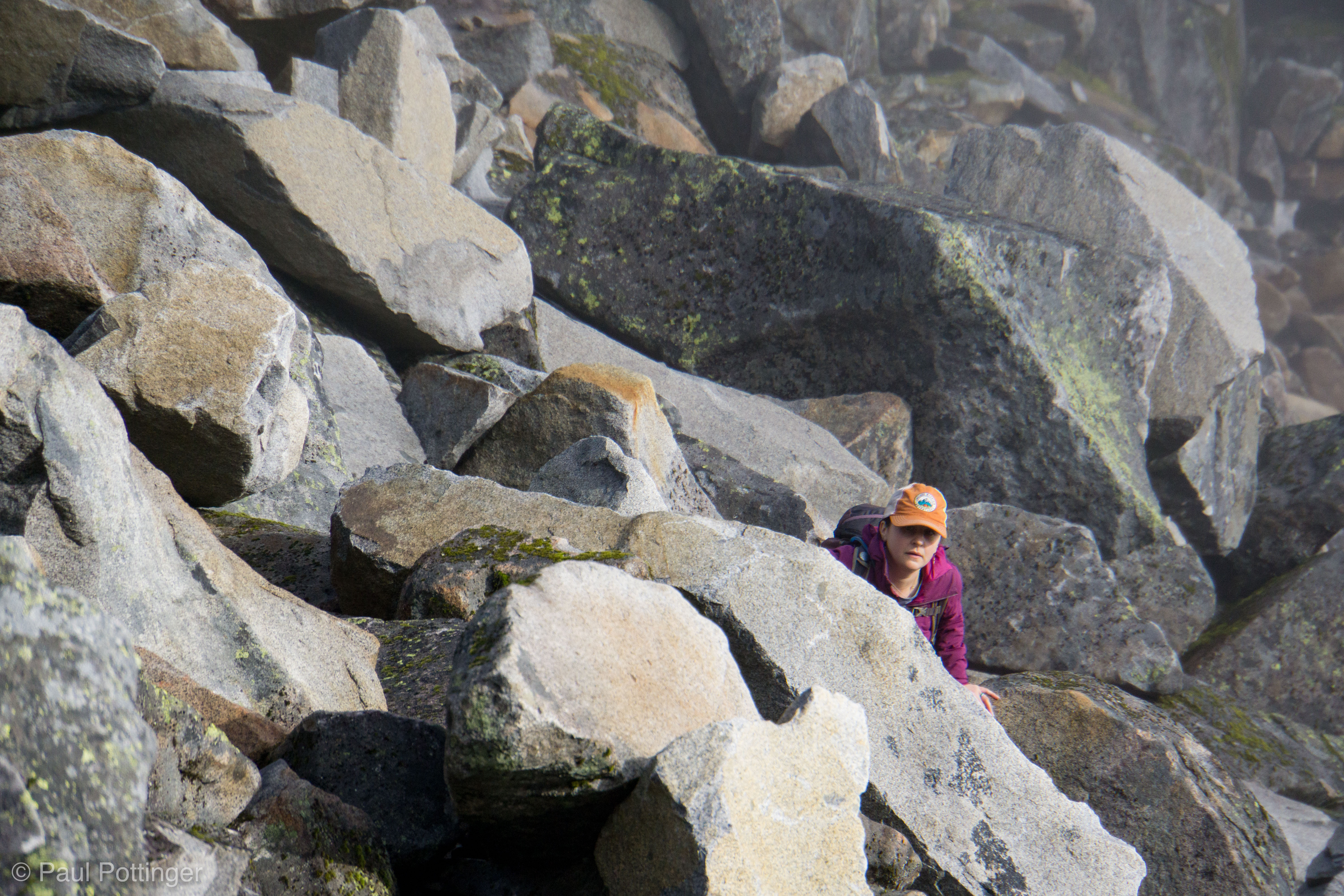
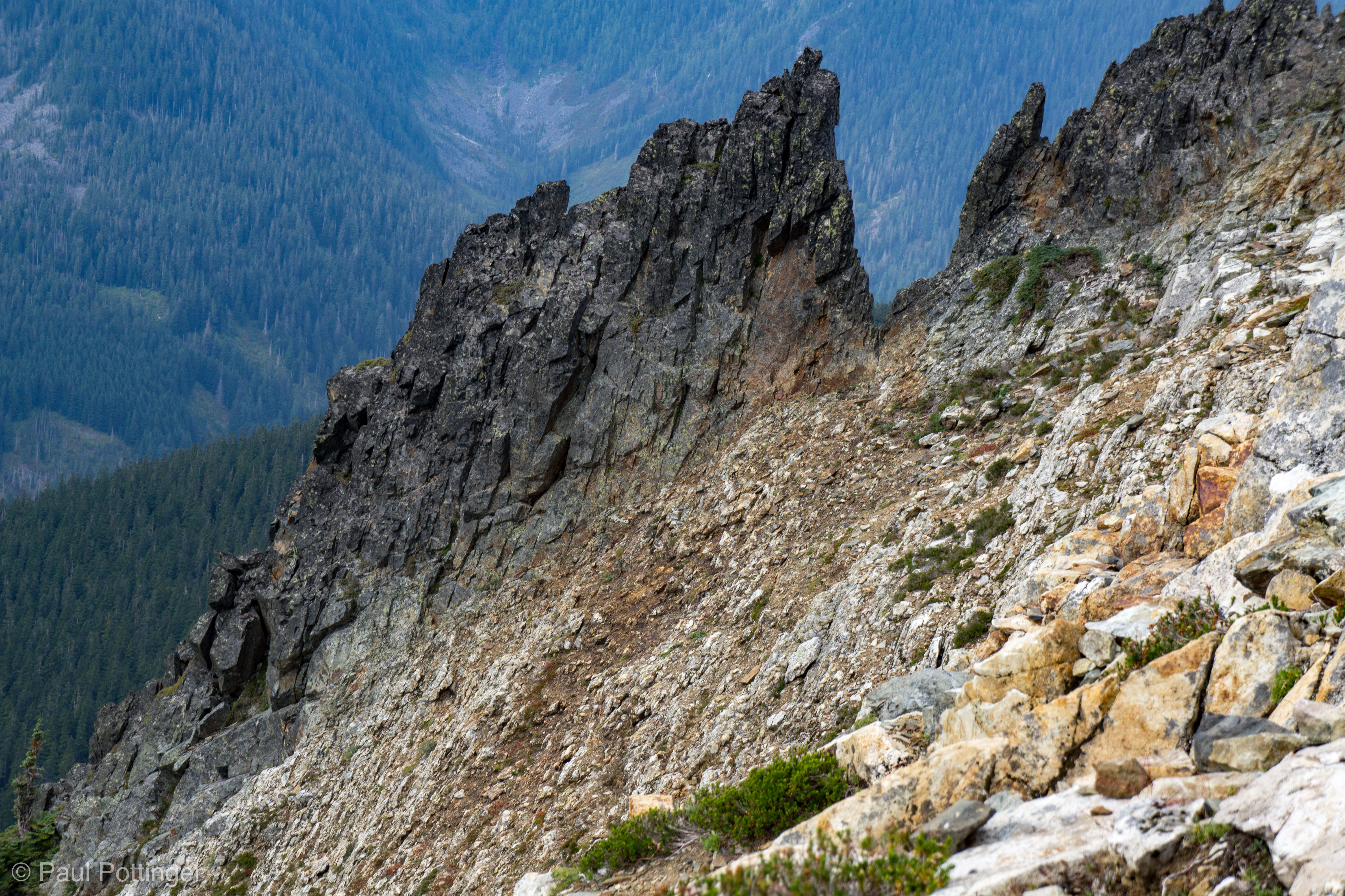
The traverse mostly involved corn snow. The runout on our left was no big deal: A gradually-steepening drop towards Little Beaver Creek about 3,500 feet below. We were  very safe. Only one section of steep water ice slowed us down, necessitating a quick rope up, although it was perhaps 10 meters wide. Immediately beyond that, a transition again to rock scrambling… then more snow… then more rock.

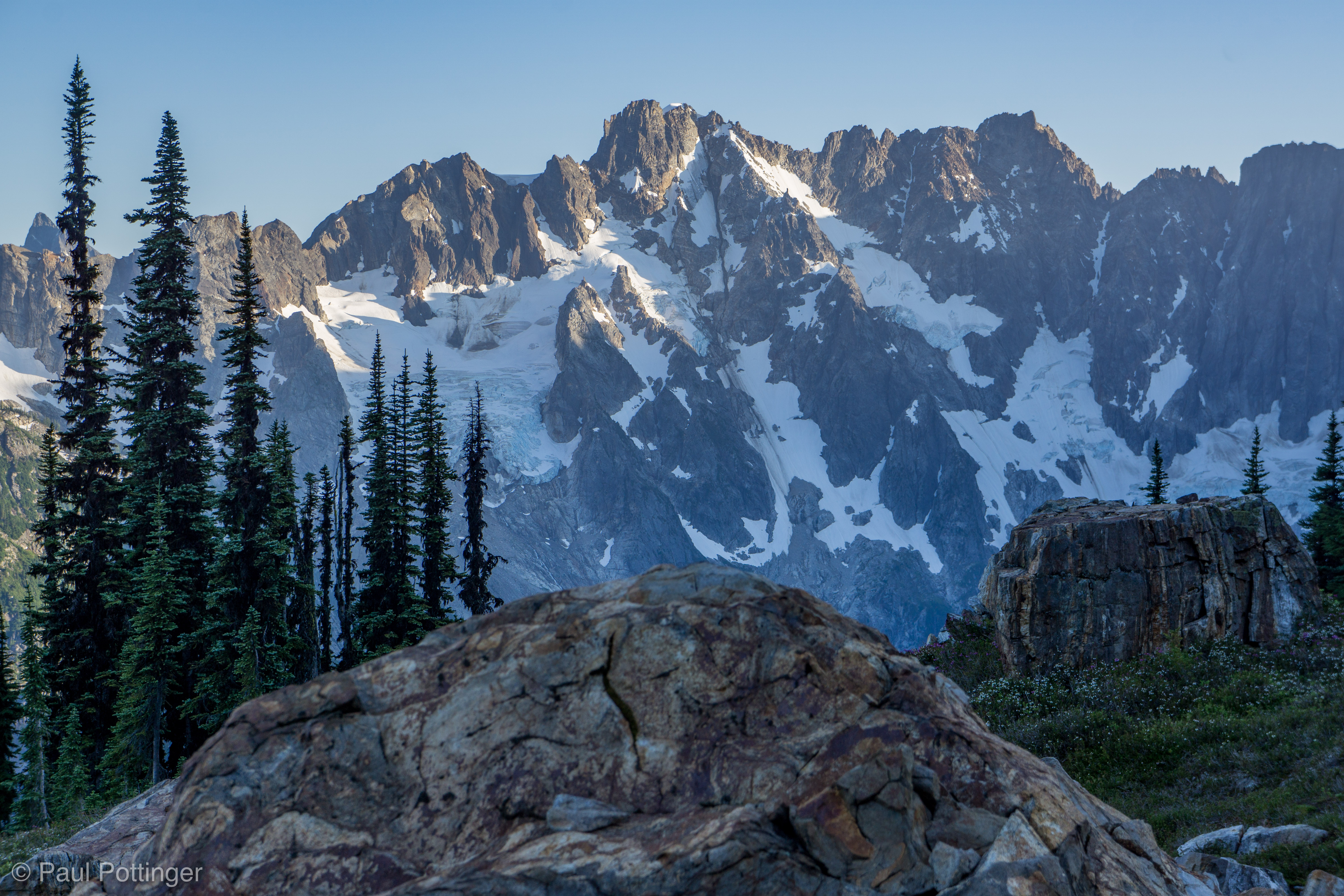
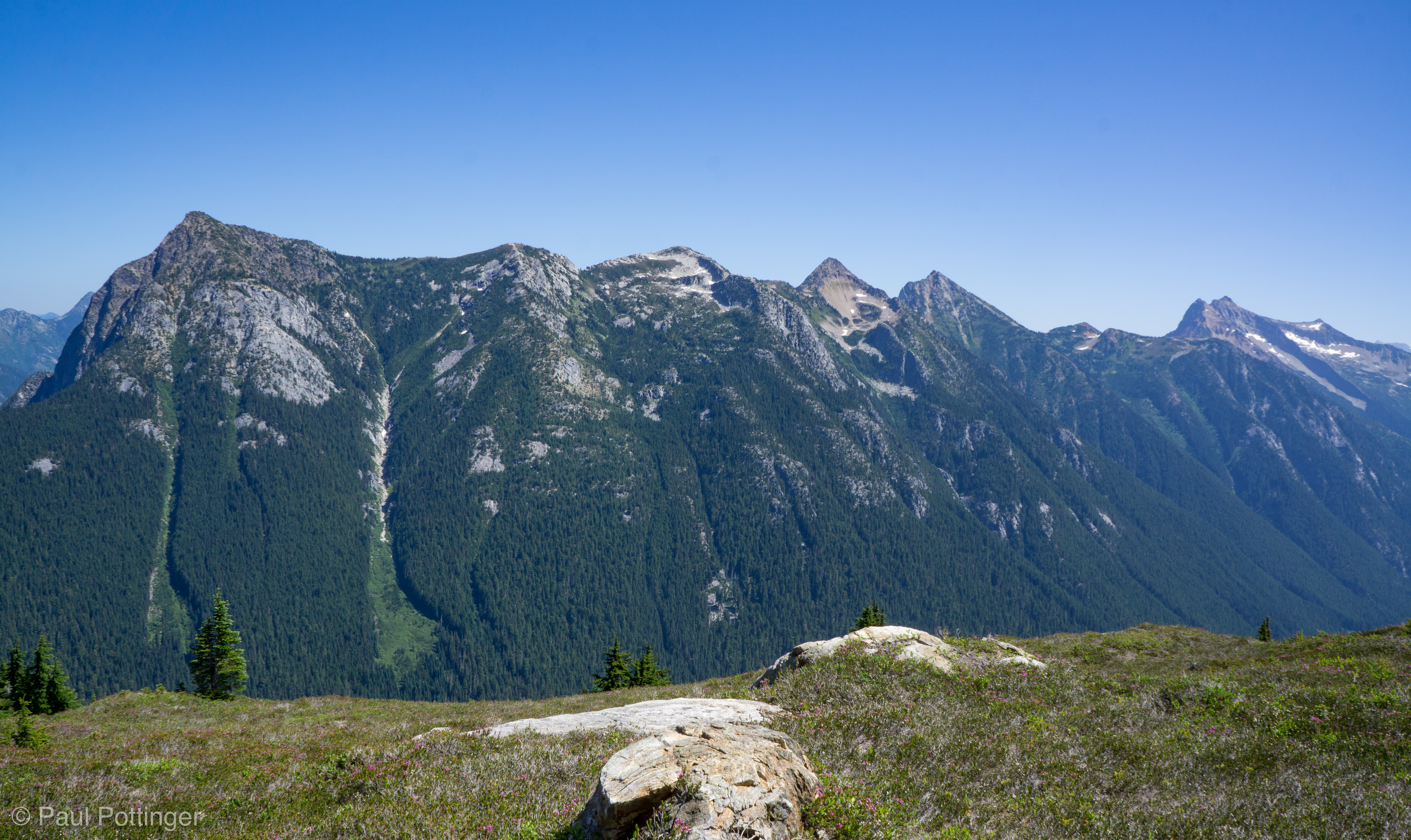
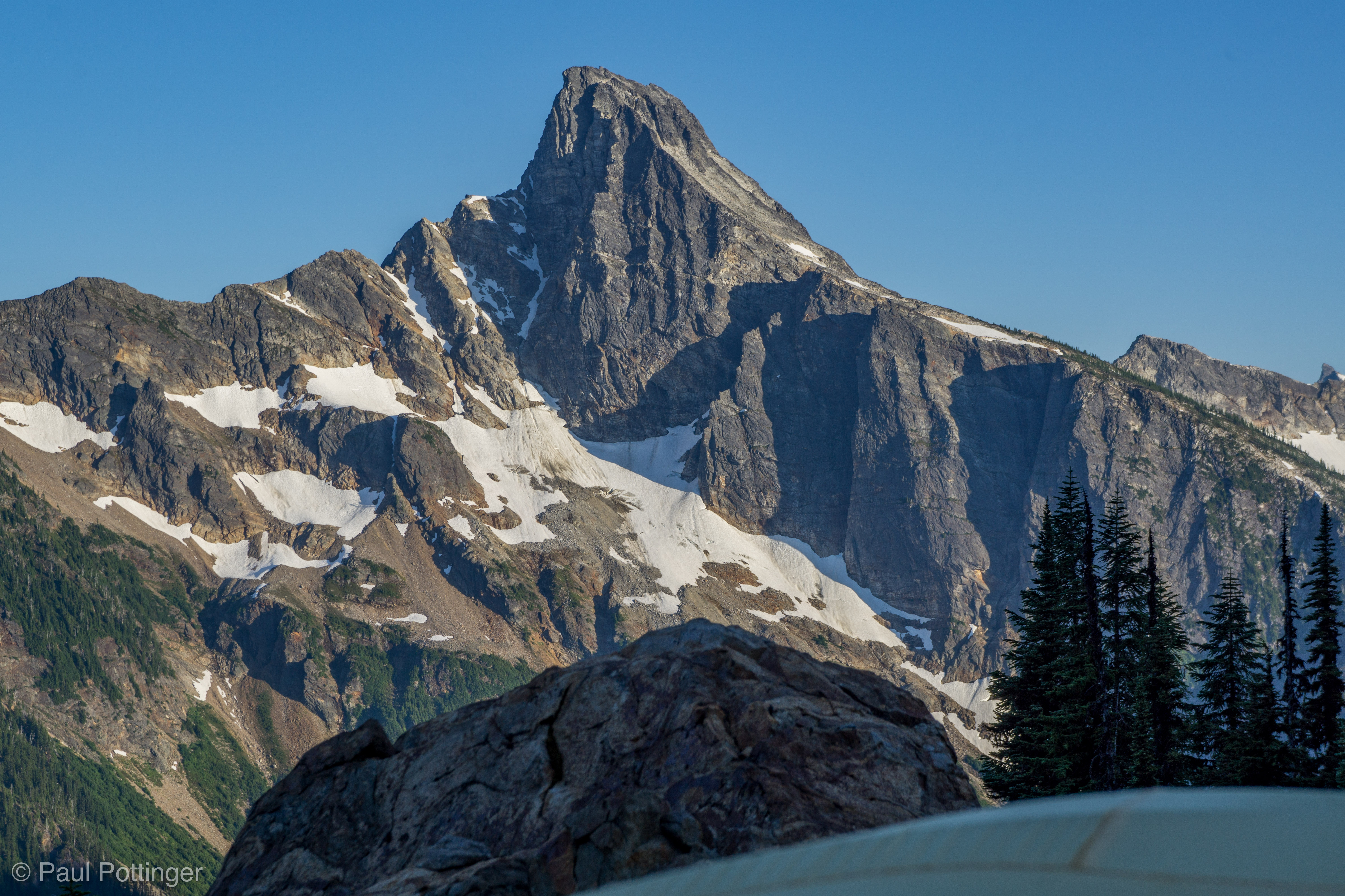
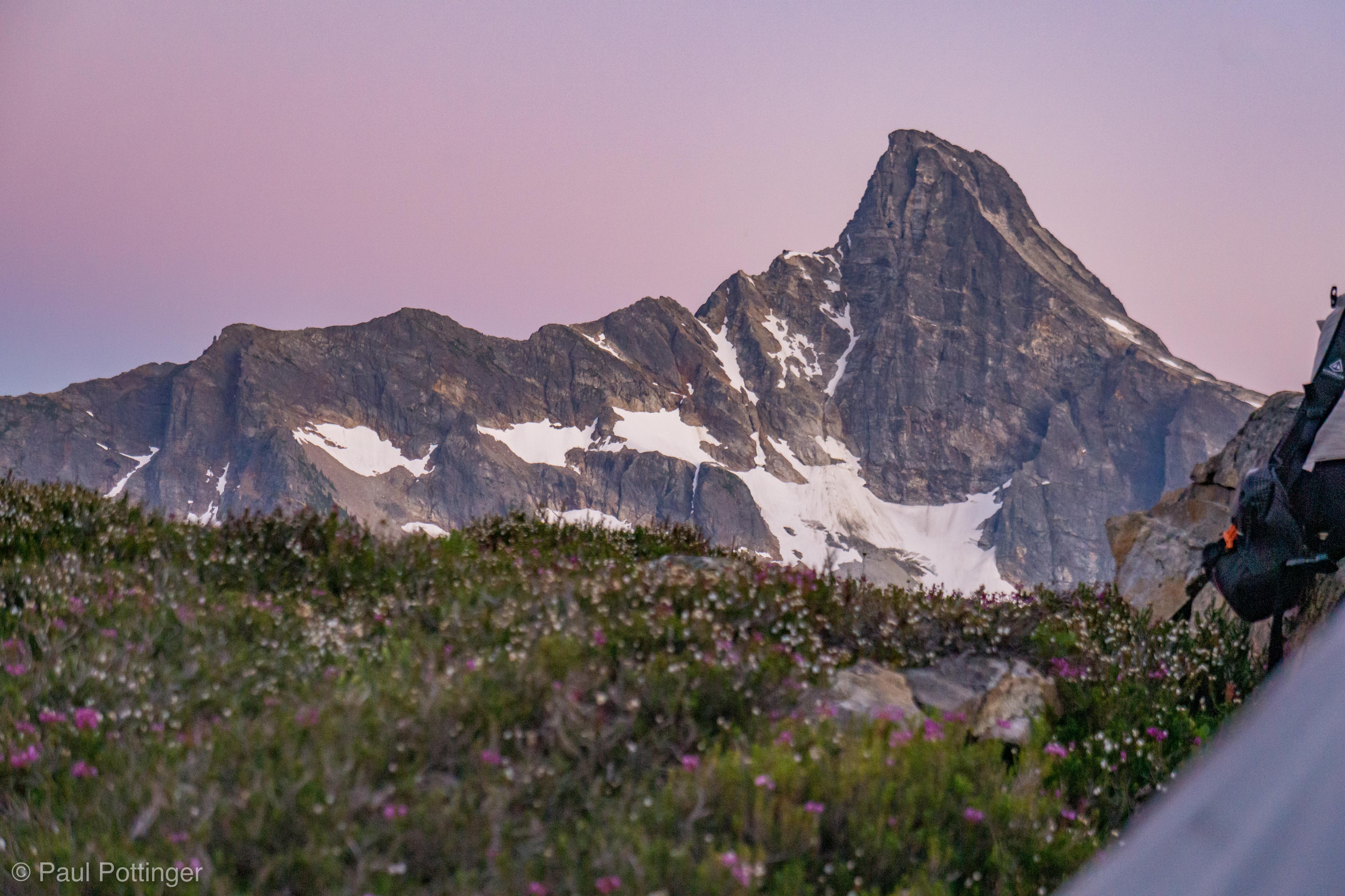
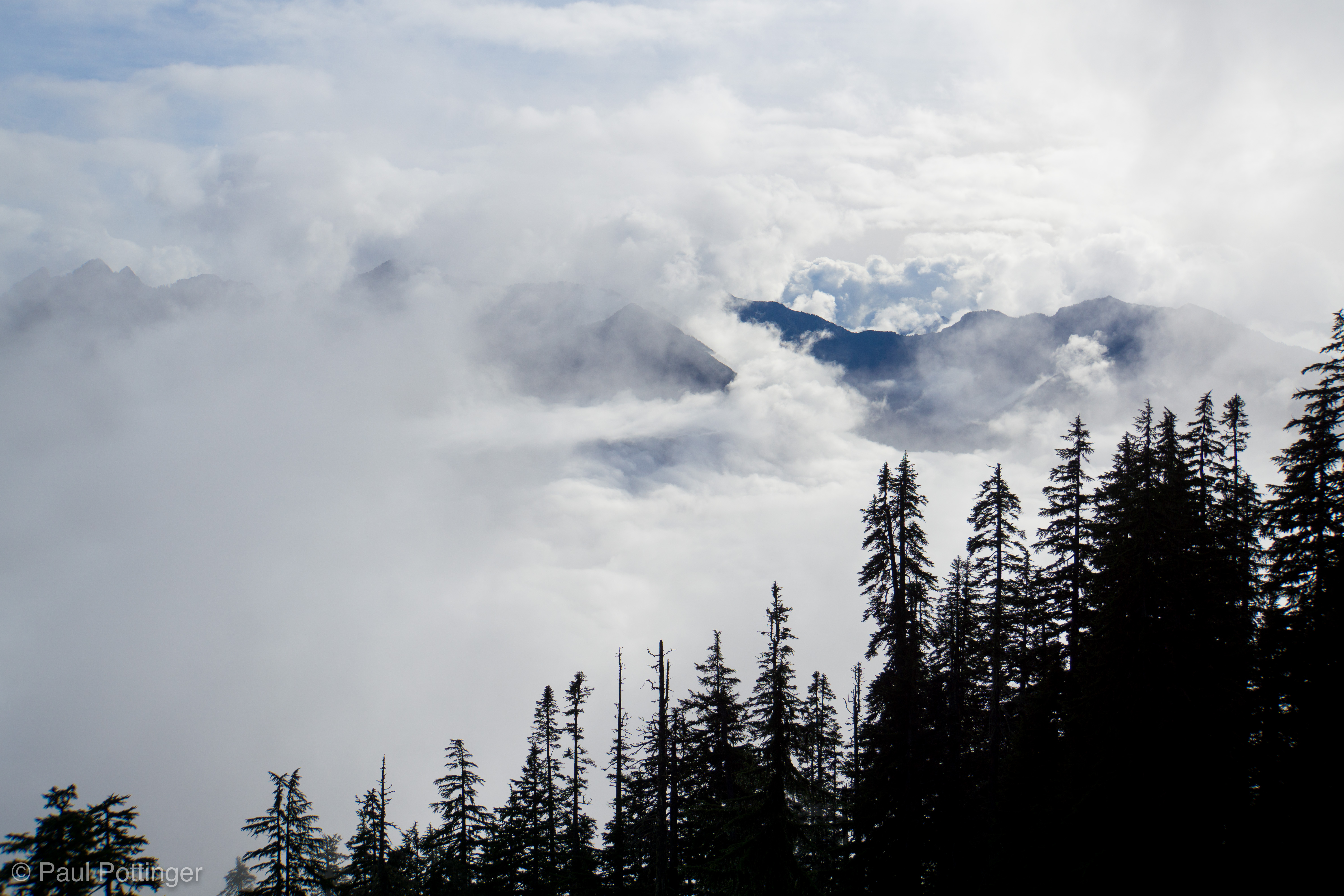
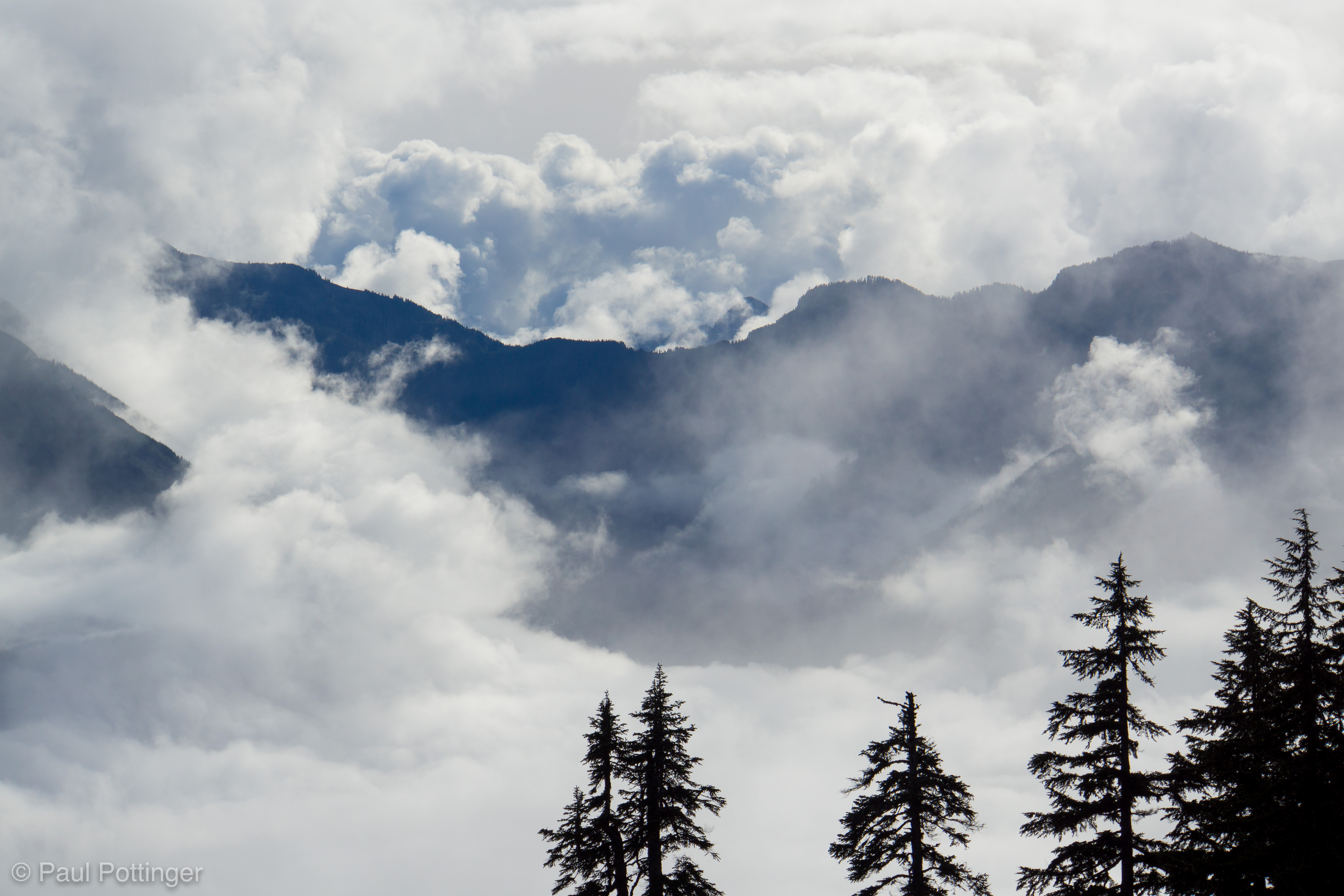
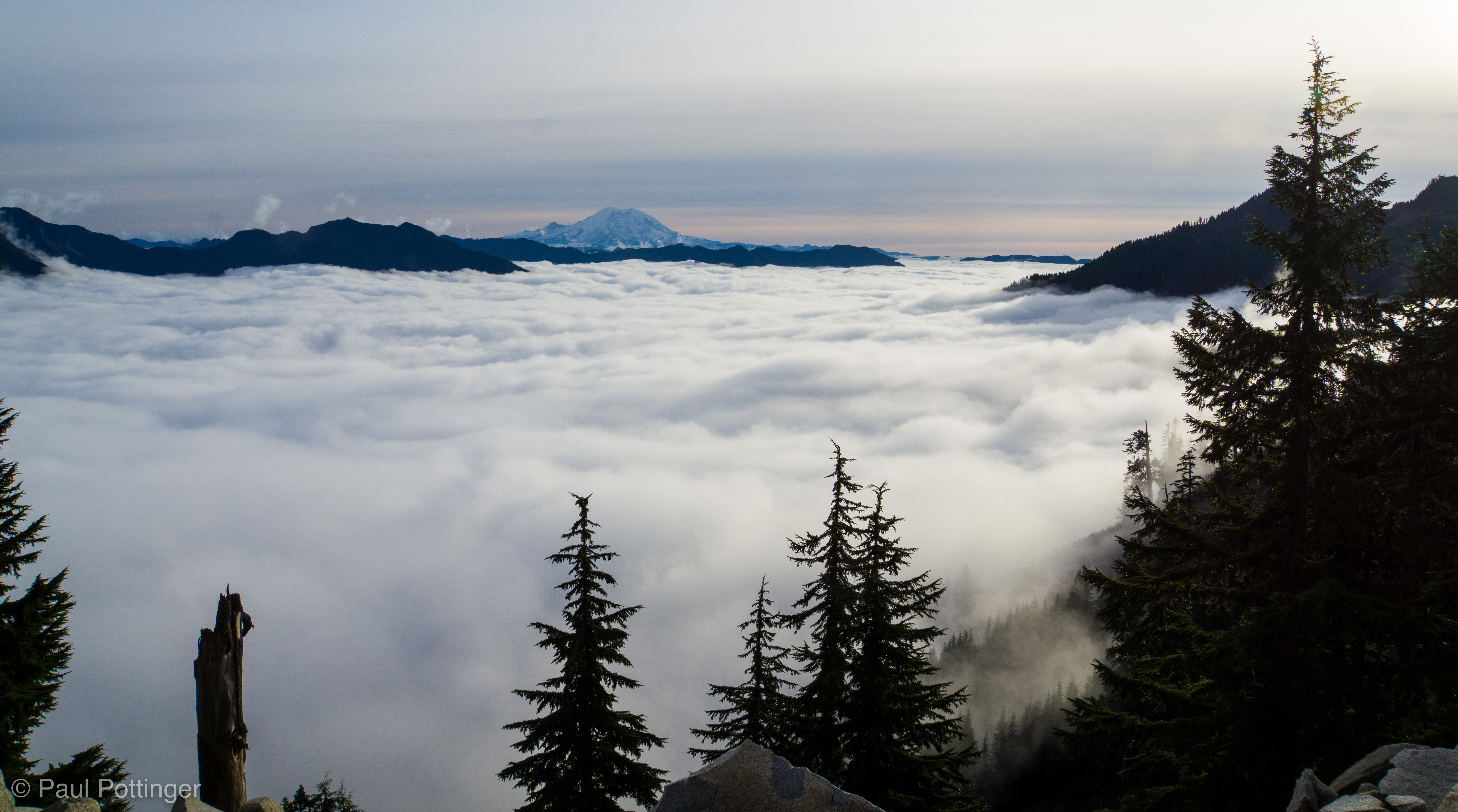
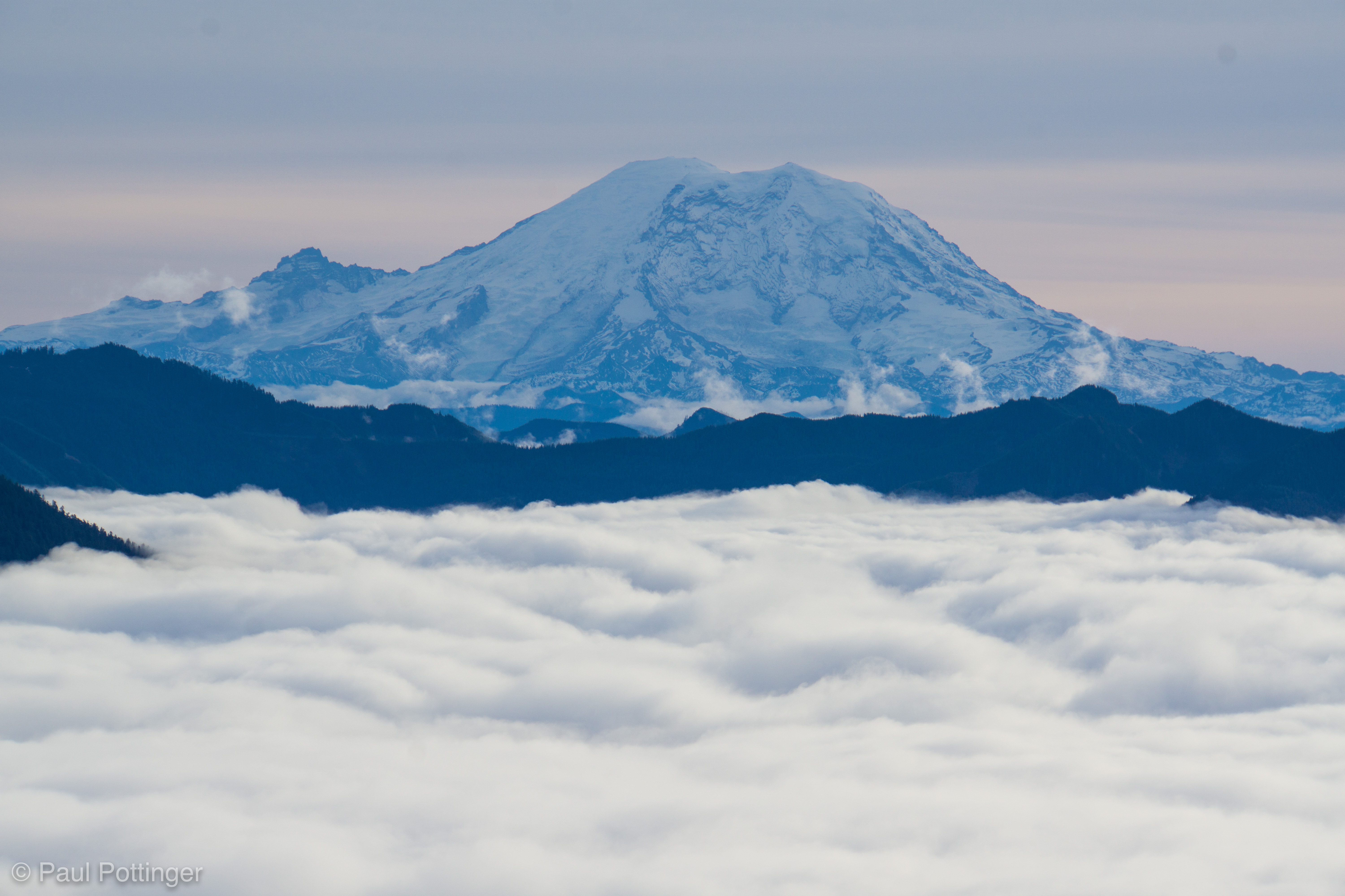
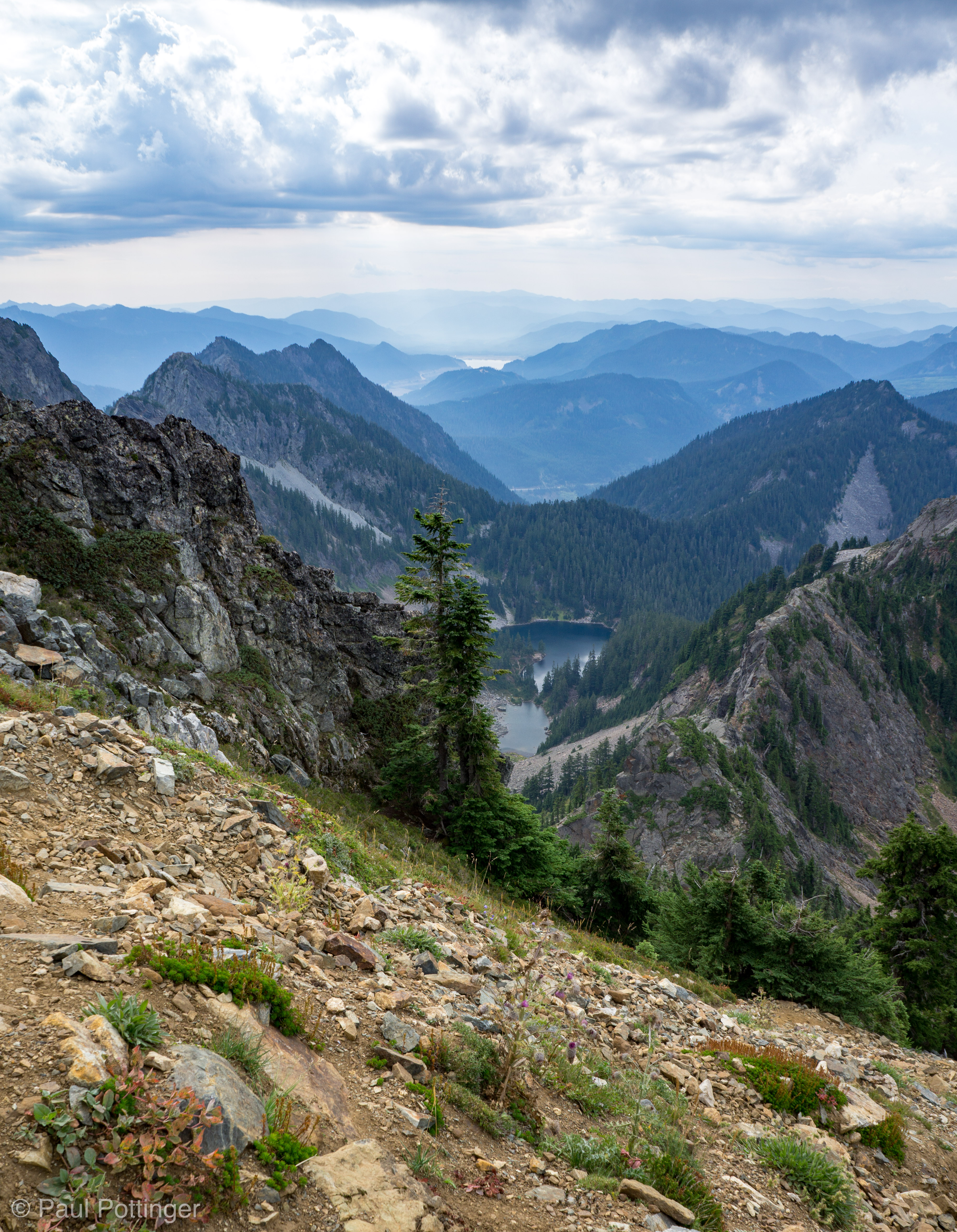
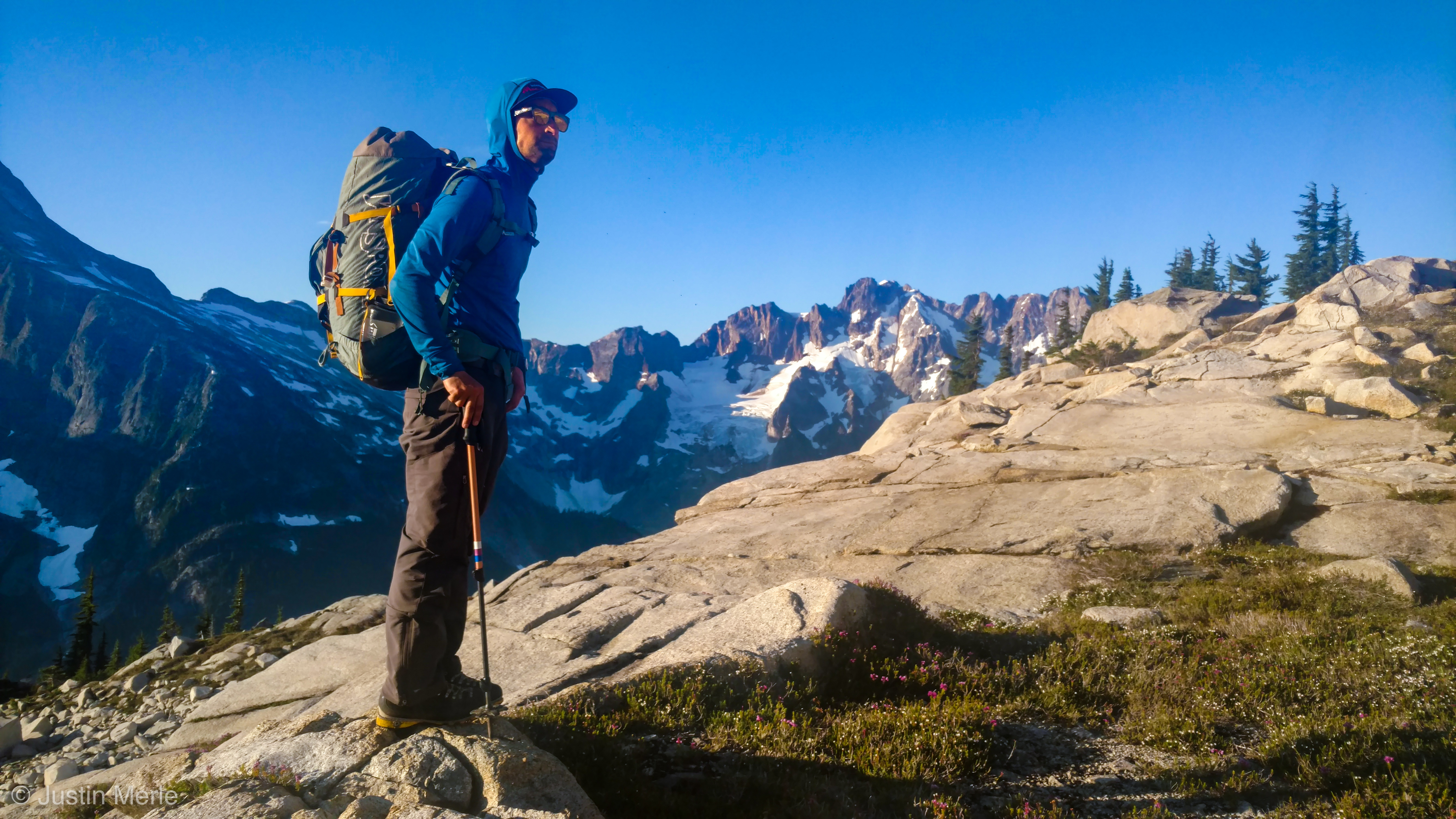
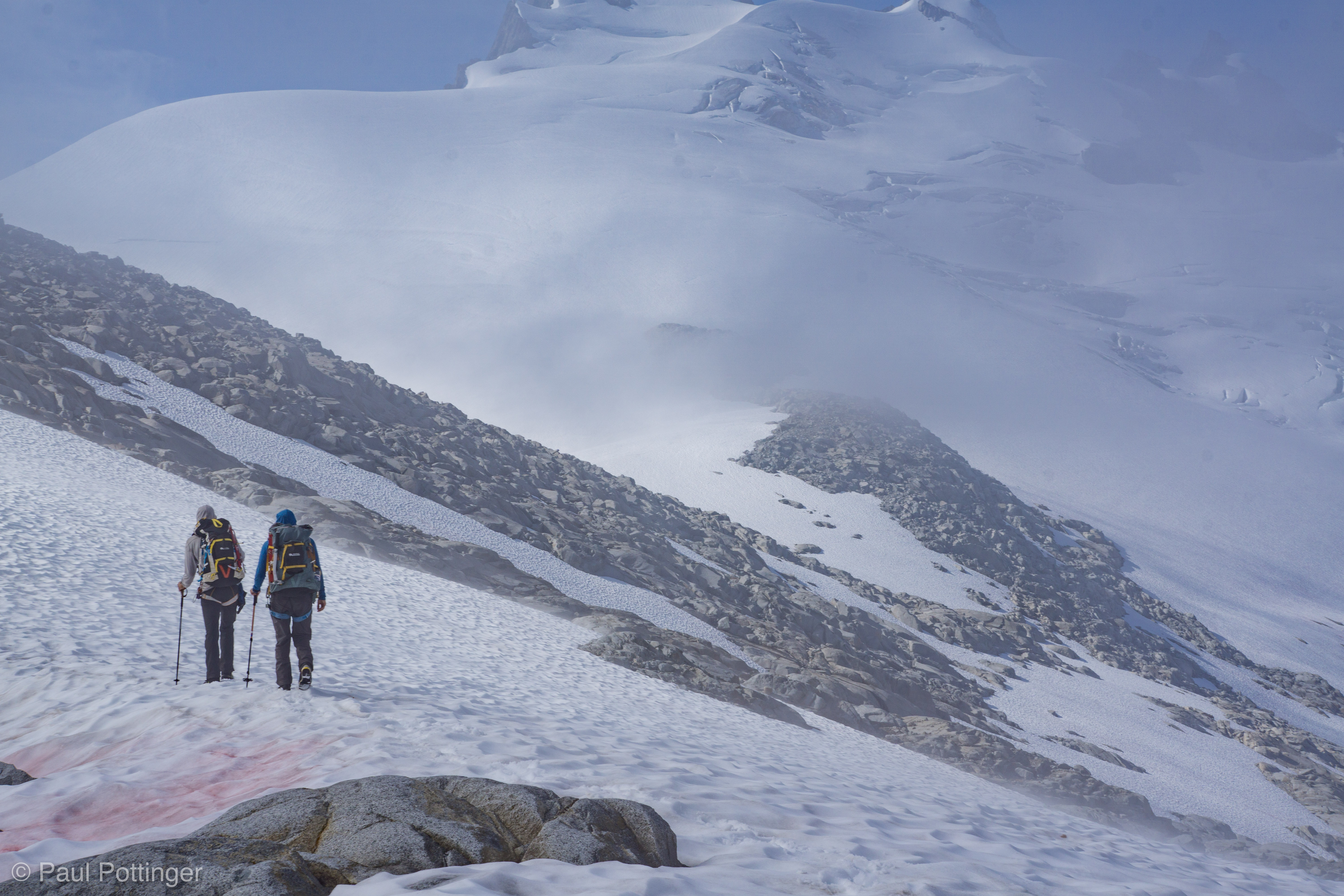
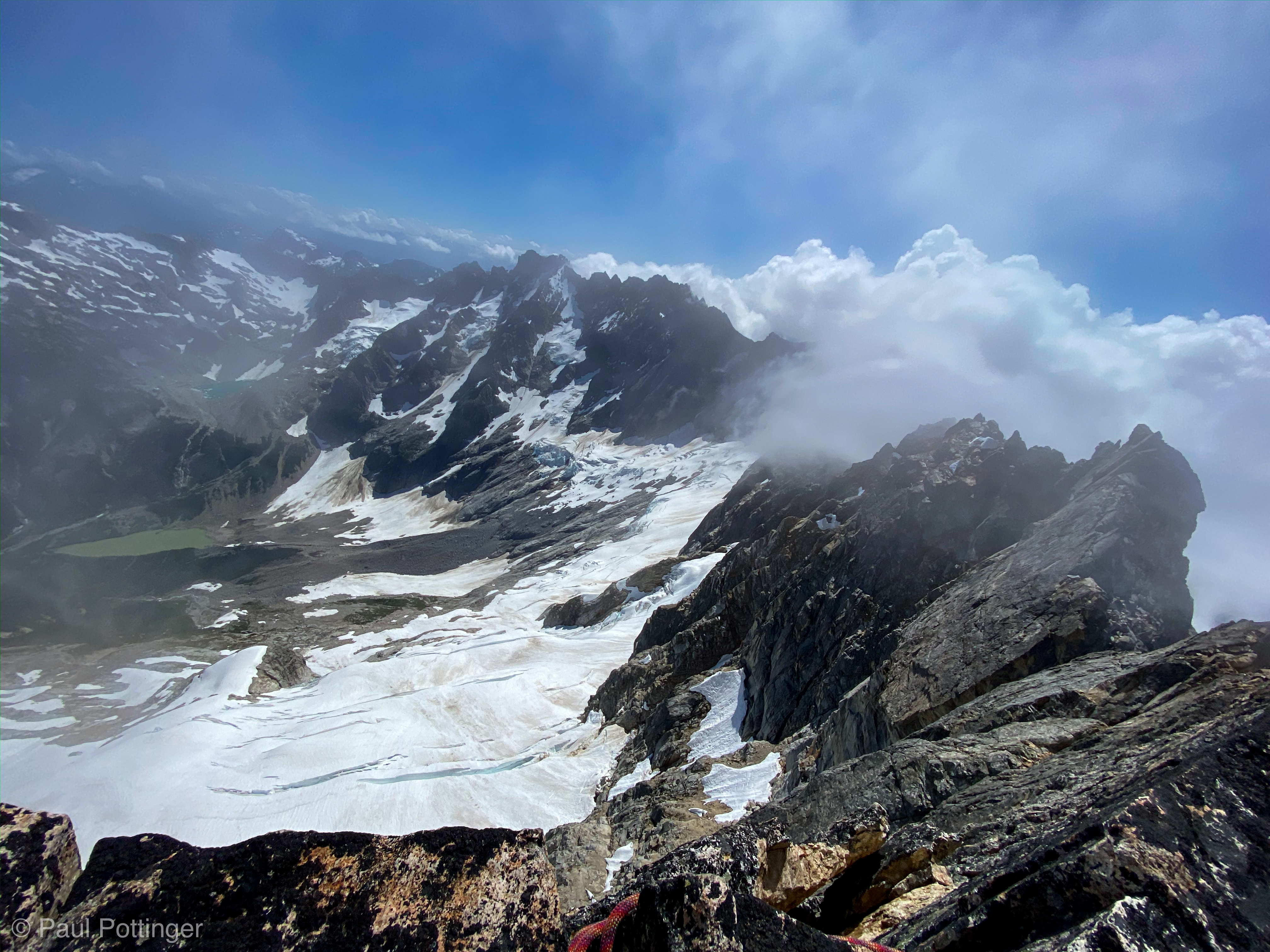
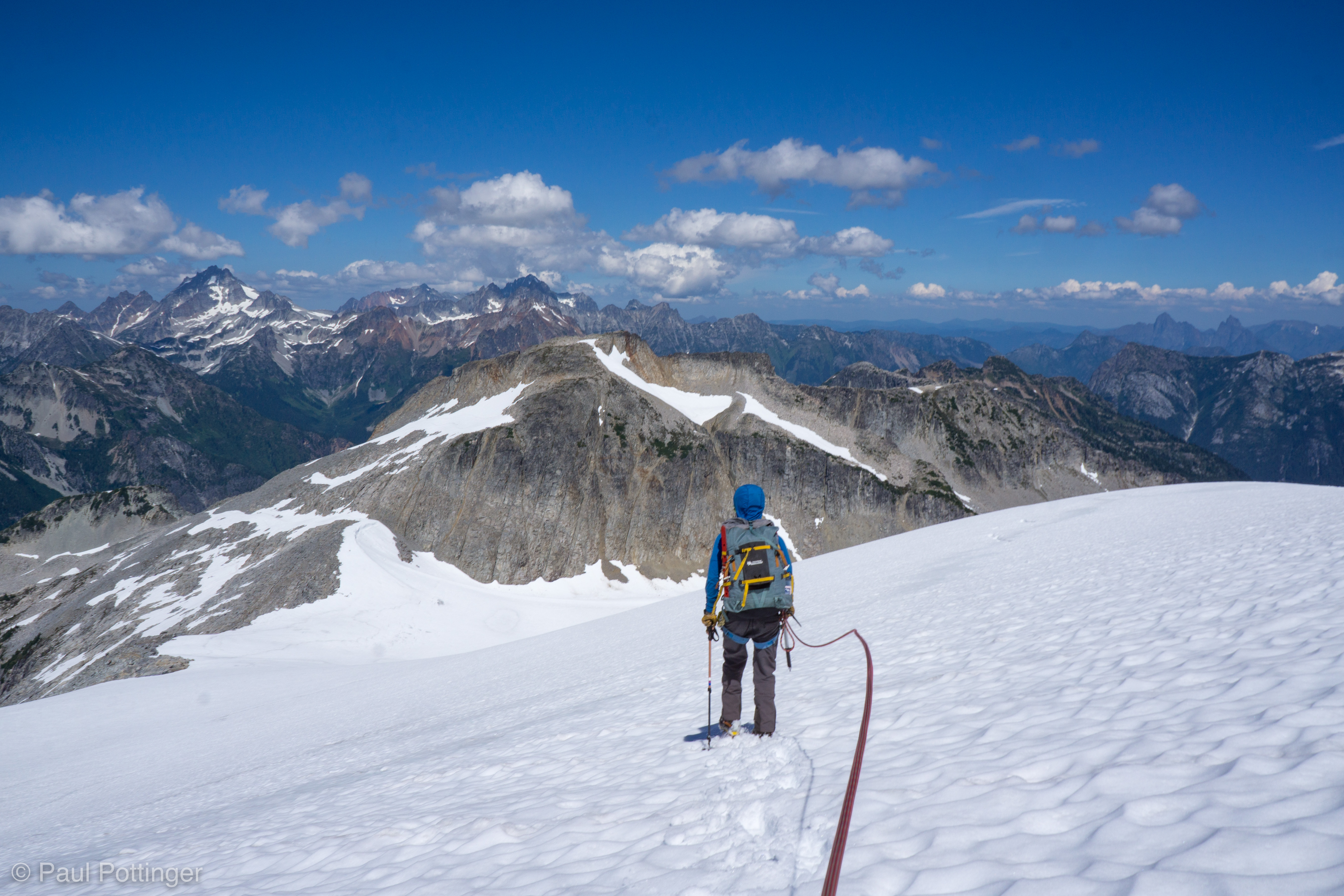
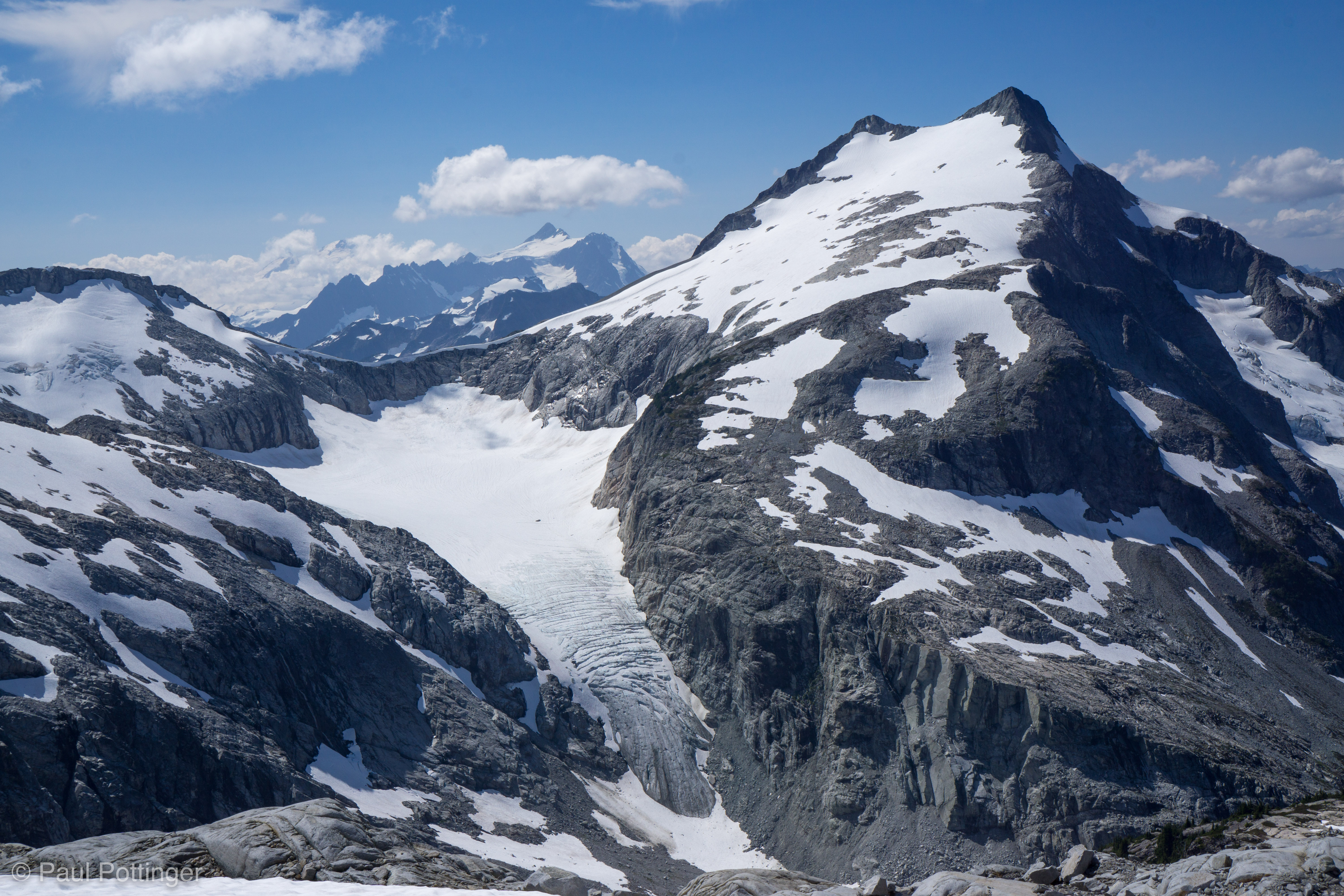
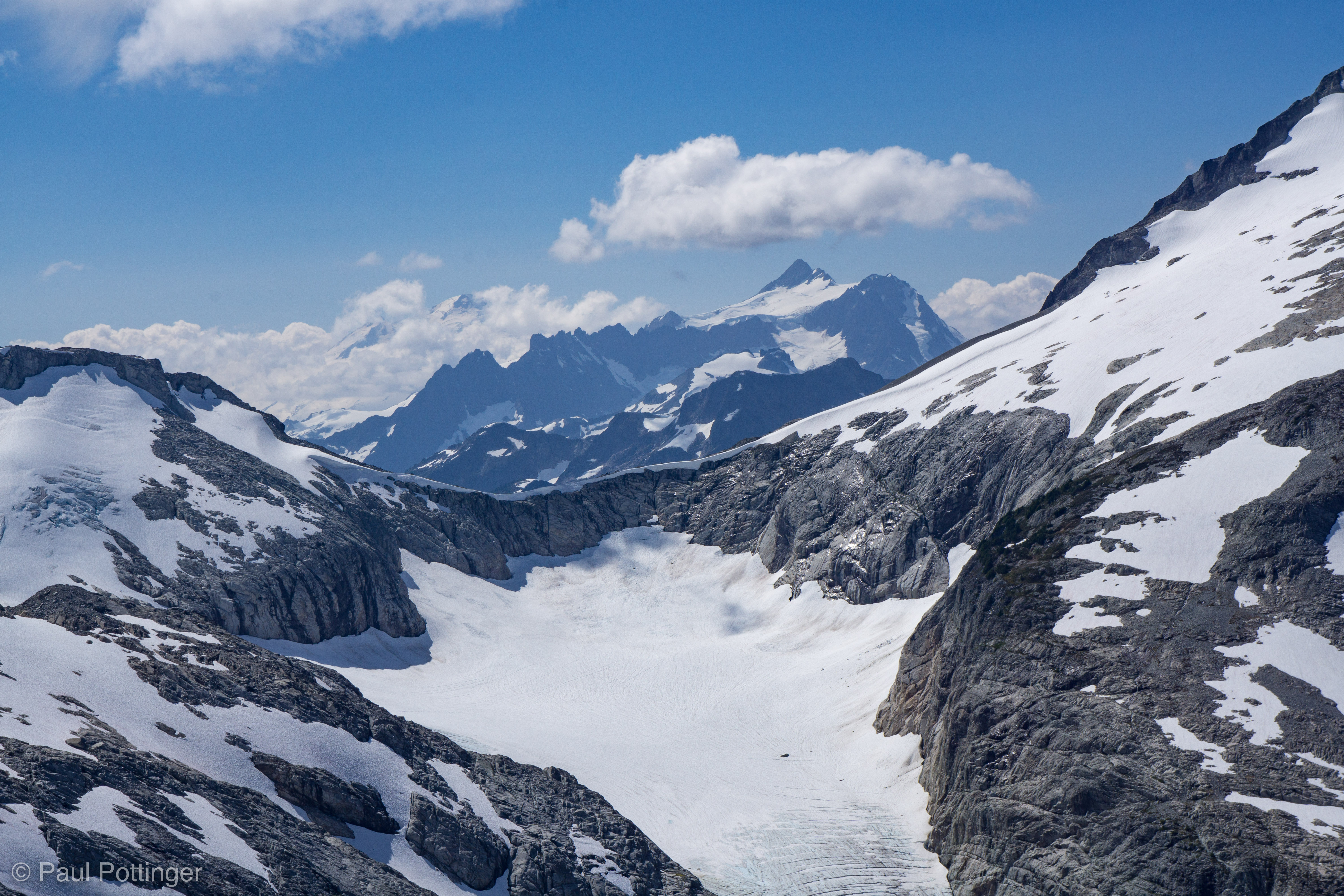
By 9:20 AM, about an hour after we left the lake, we arrived at the rim of the summit basin, and our route to the top was revealed: A beautiful glacier climb that led straight to the summit block. Across the basin, my old nemesis: Perfect Pass. John, Tom, and I had been so close to it, within a mile the last time we tried from the other side, but had been flummoxed by dense fog. As if on queue, we watched a fog bank rise up and spill over the pass into the basin, like dry ice welling up from a witch’s cauldron decoration on Halloween. The other side is less painful than this approach, no question about it… but, at least we would not get trapped in that fog bowl again!

Justin susses out the summit massif. True summit is the tiny dark stone peak on the left.
Whatcom presides over Perfect Pass.
That damned Perfect Pass has dogged us for years when approached from the other side. It looks so benign from here… oops, yeah, here comes the fog now.
Crossing a talus band, Whatcom and the fog over Perfect Pass in the distance.
Forrest, meet your new Insta profile photo.
Forrest and Justin ponder our next moves.
Passing watermelon snow on our way towards the upper mountain.

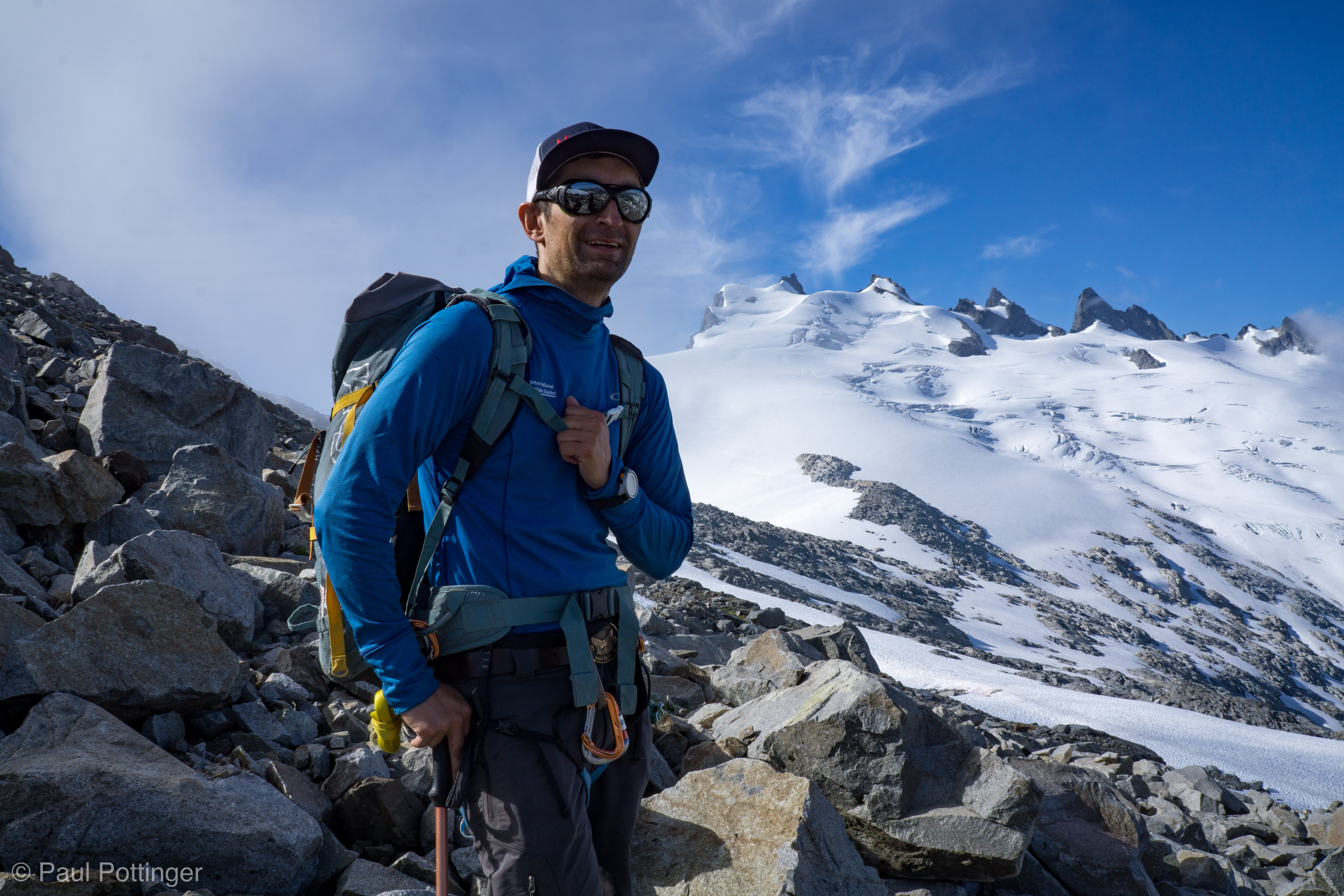
One last break at a rock band at the base of the steep glacier slope. I stashed a pole and got ready for the final section. The sun was up now, and it got hot. No worries, all I have to do is hydrate, eat…. but, my stomach was not having it. Just, not having it. Most anything I put into my mouth triggered waves of sudden, legit nausea. This is very rare for me, and I have never had it this bad, not even close. This is not good. Was it… Food poisoning? Dehydration? Reflux? Stress? I could not suss it out. I managed to put some fluid in my belly, even some calories… but, not much. There was nothing to do but climb the mountain. And so, we did.

Selfie as we get ready for the final push to the summit block.
Summit… so… close……….
Justin finds the nicest lines.
Making progress on the upper mountain.
Justin’s view looking back on me and Forrest.

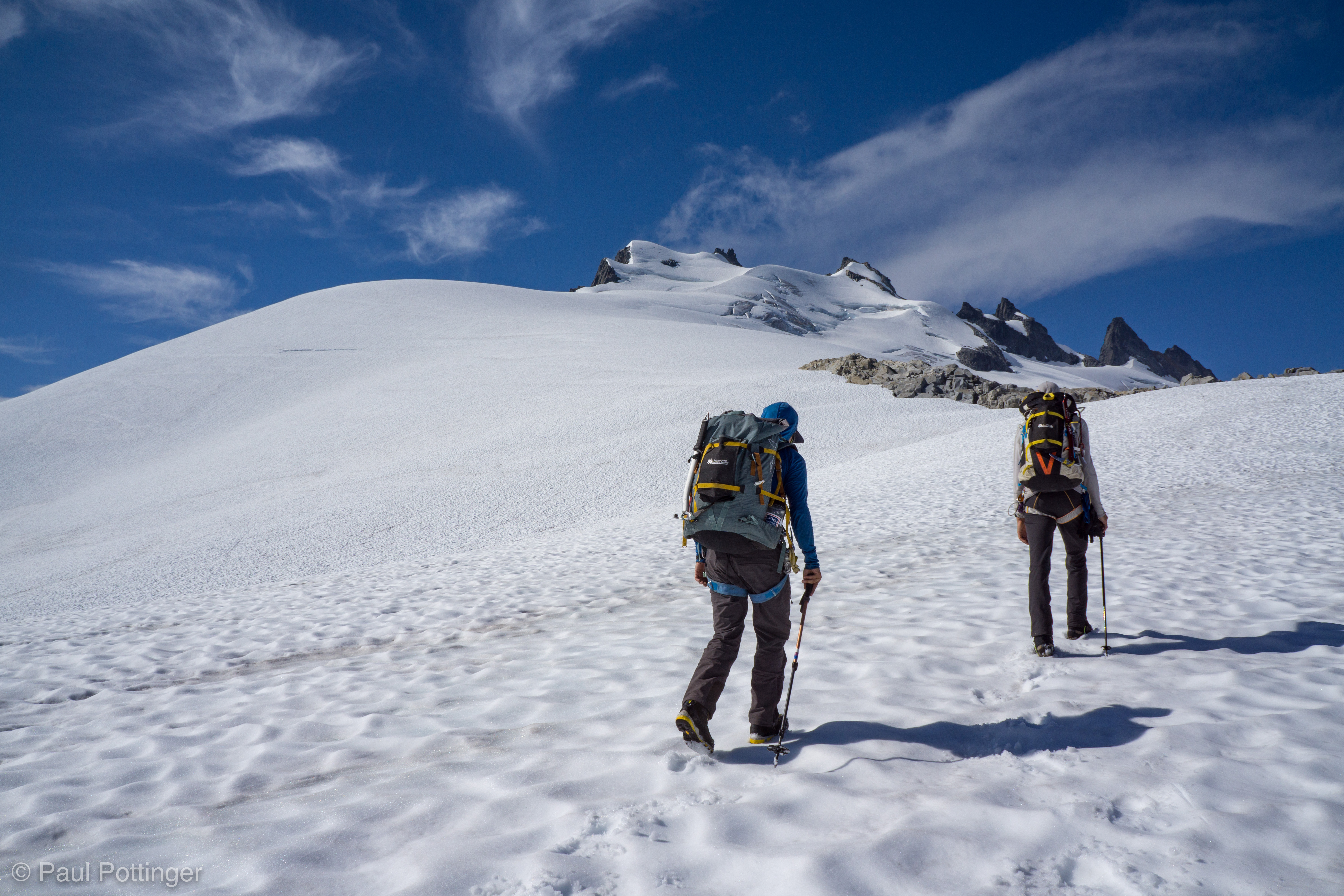
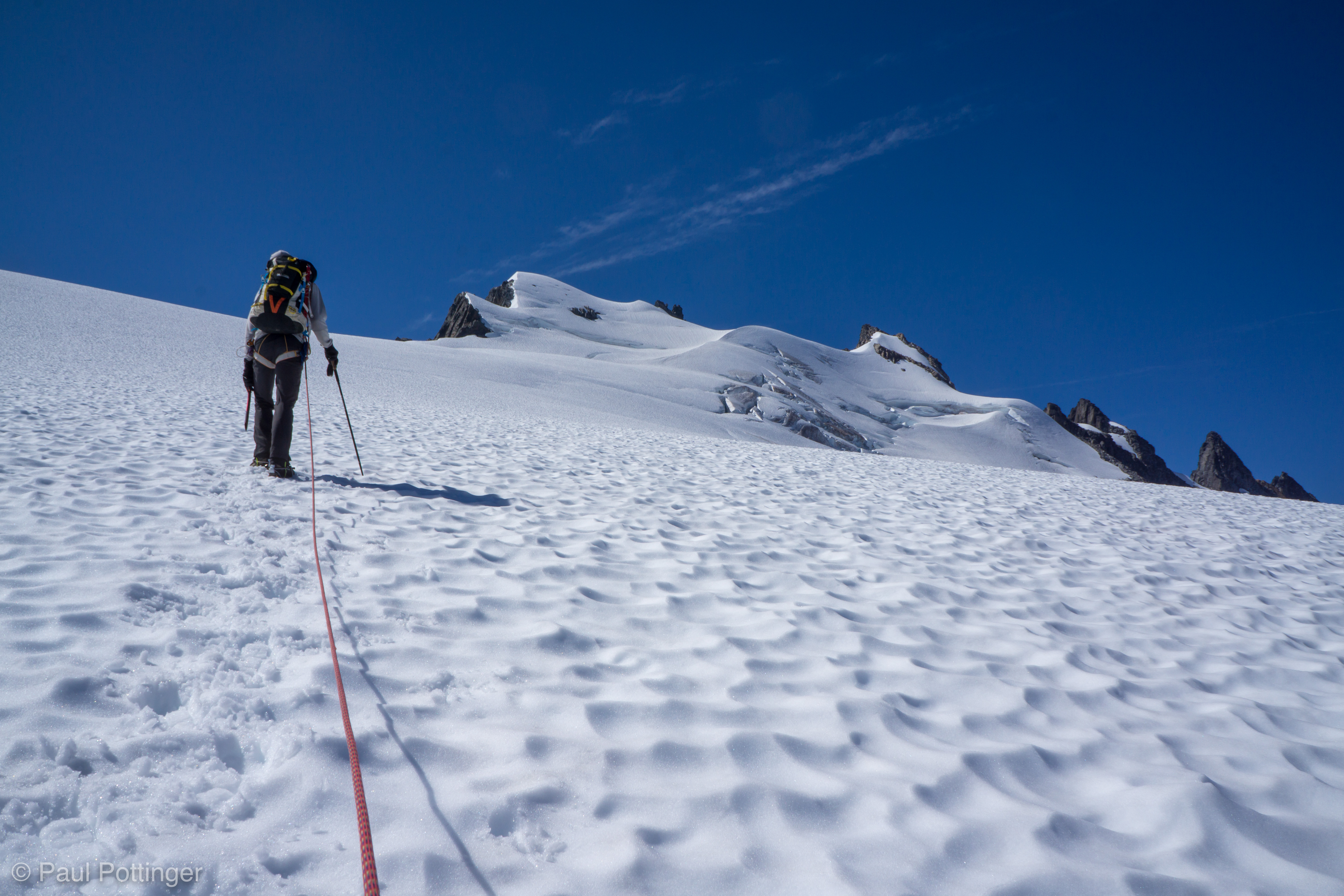
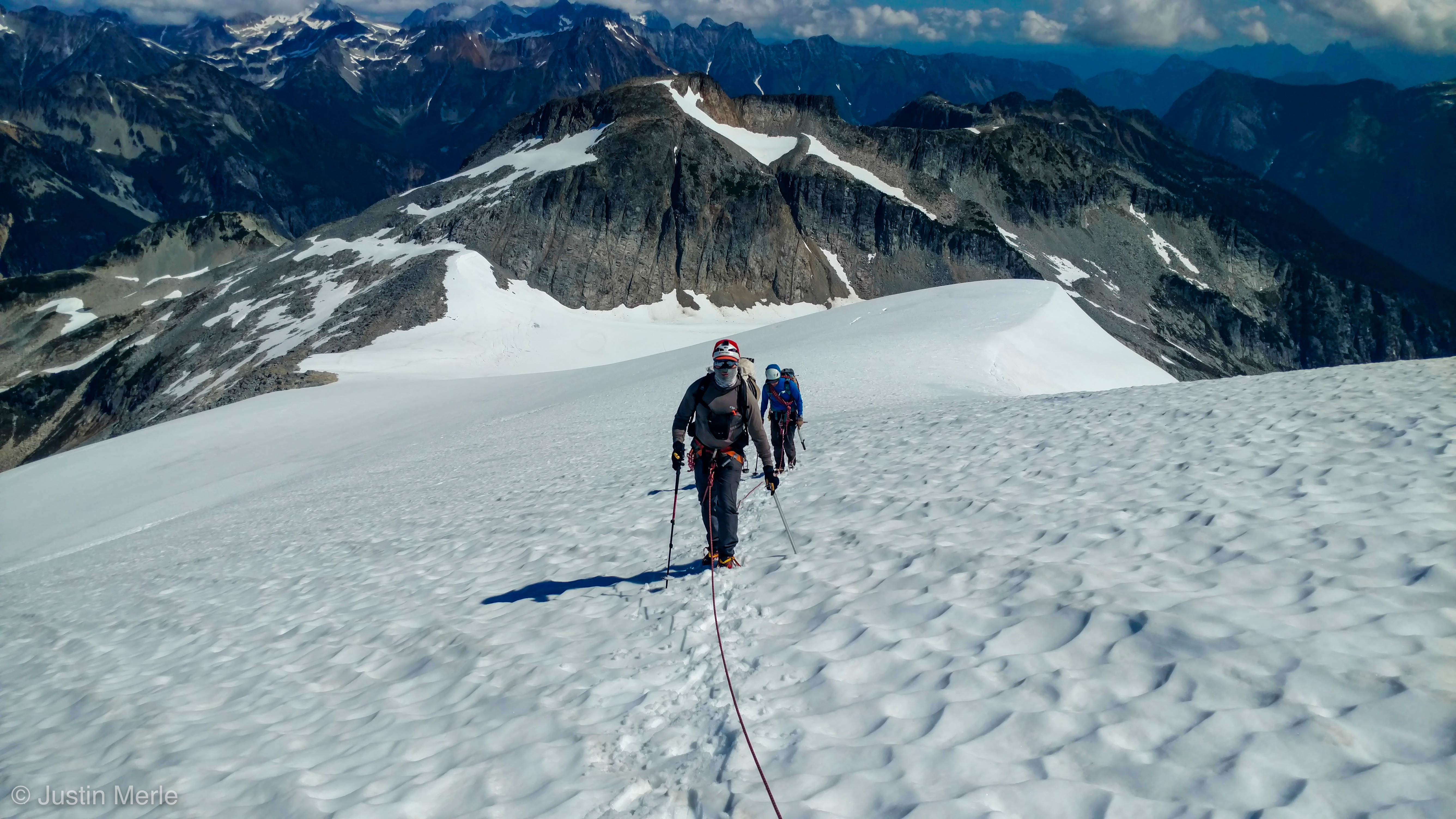
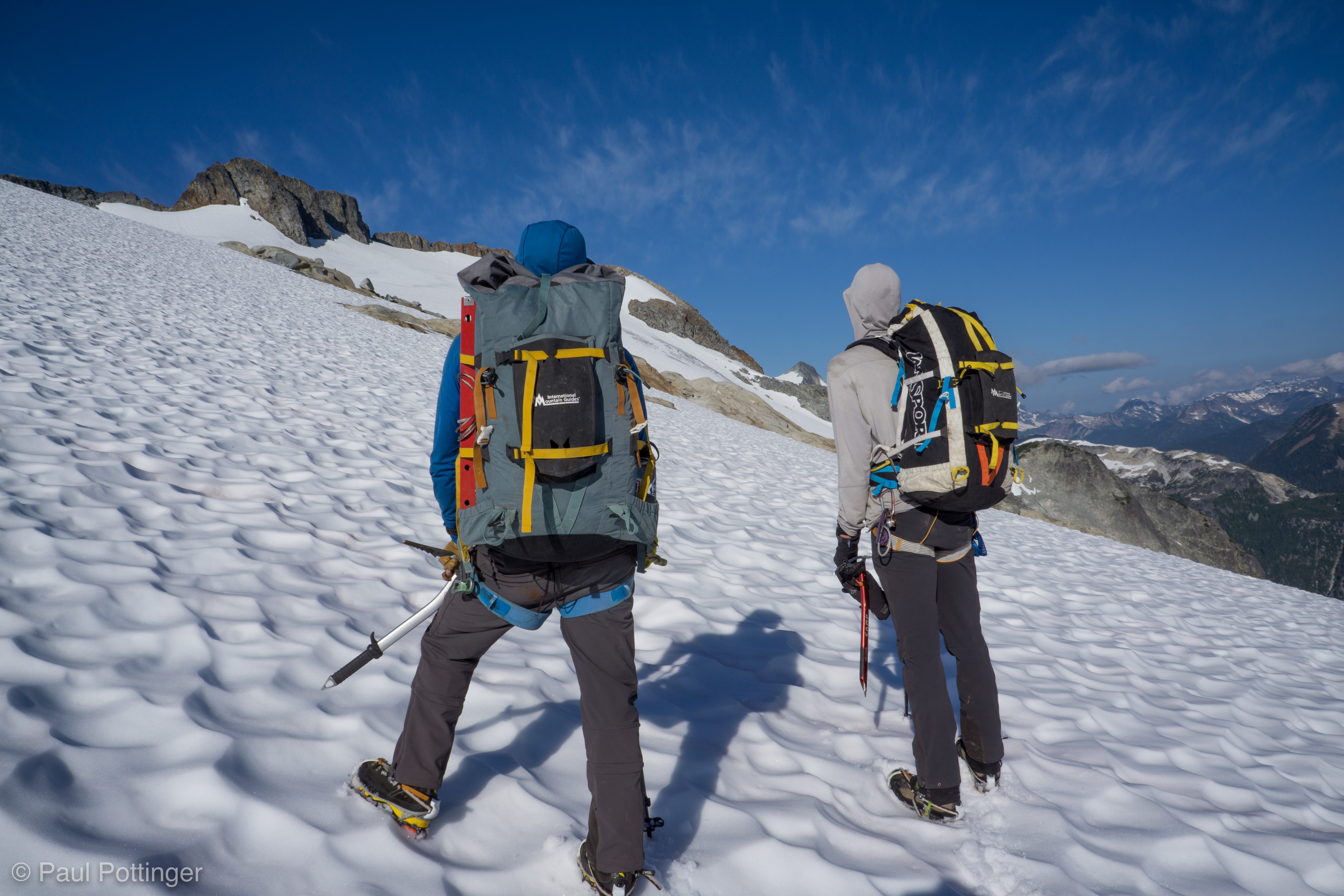
A spectacular section, with sweeping views all around. One foot, then the next. The snow was soft enough to take the axe spike, but firm enough to prevent us from sliding backwards. Essentially, perfect conditions.

In the distance, a totally unexpected site: Another party of three, heading for the summit from Perfect Pass. We had heard from the rangers of another party up here, who left a day before we had, and wondered if we would see them: Sure enough, here they come… headed for the top at the exact same moment as us! We would get there first, but not by long.

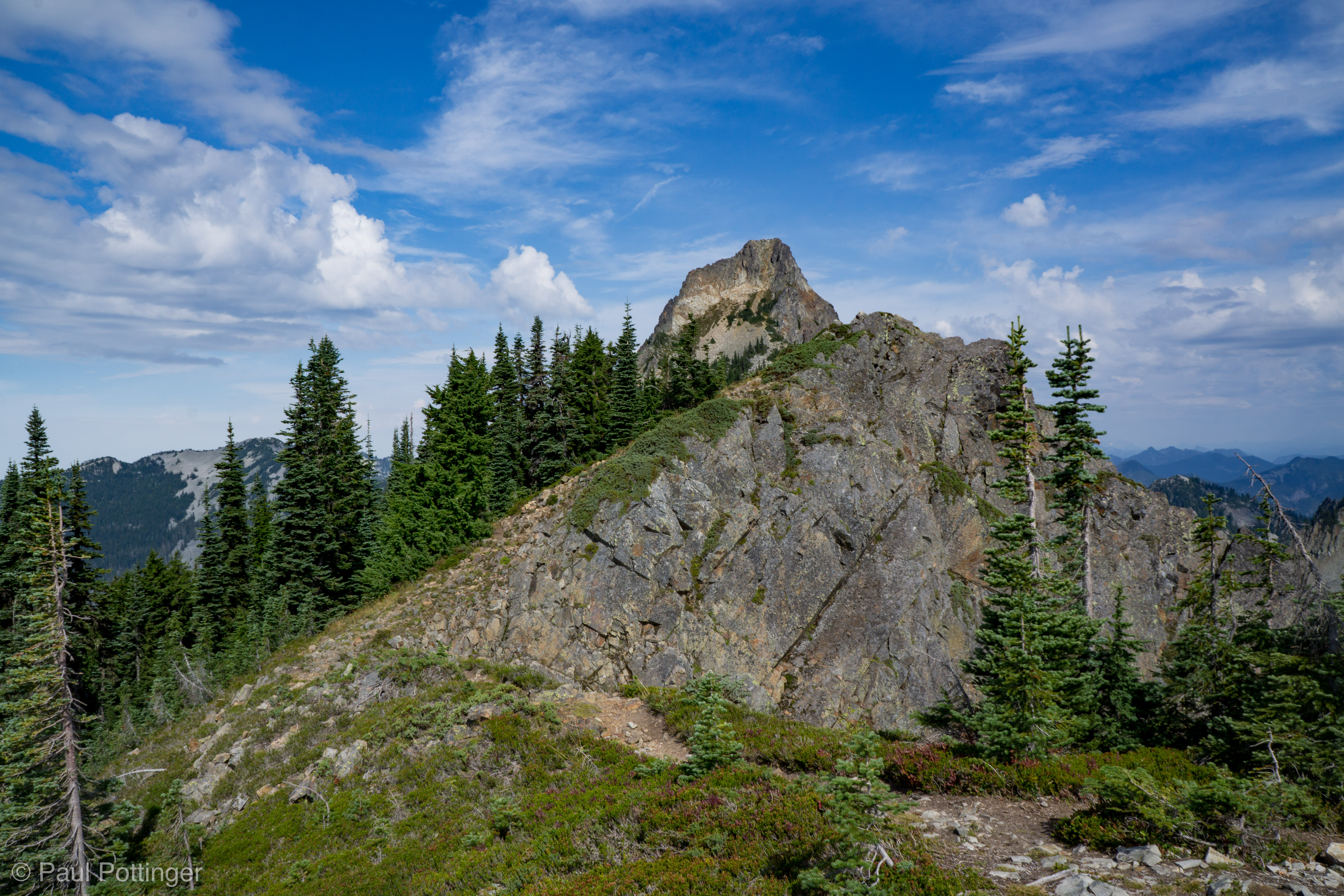
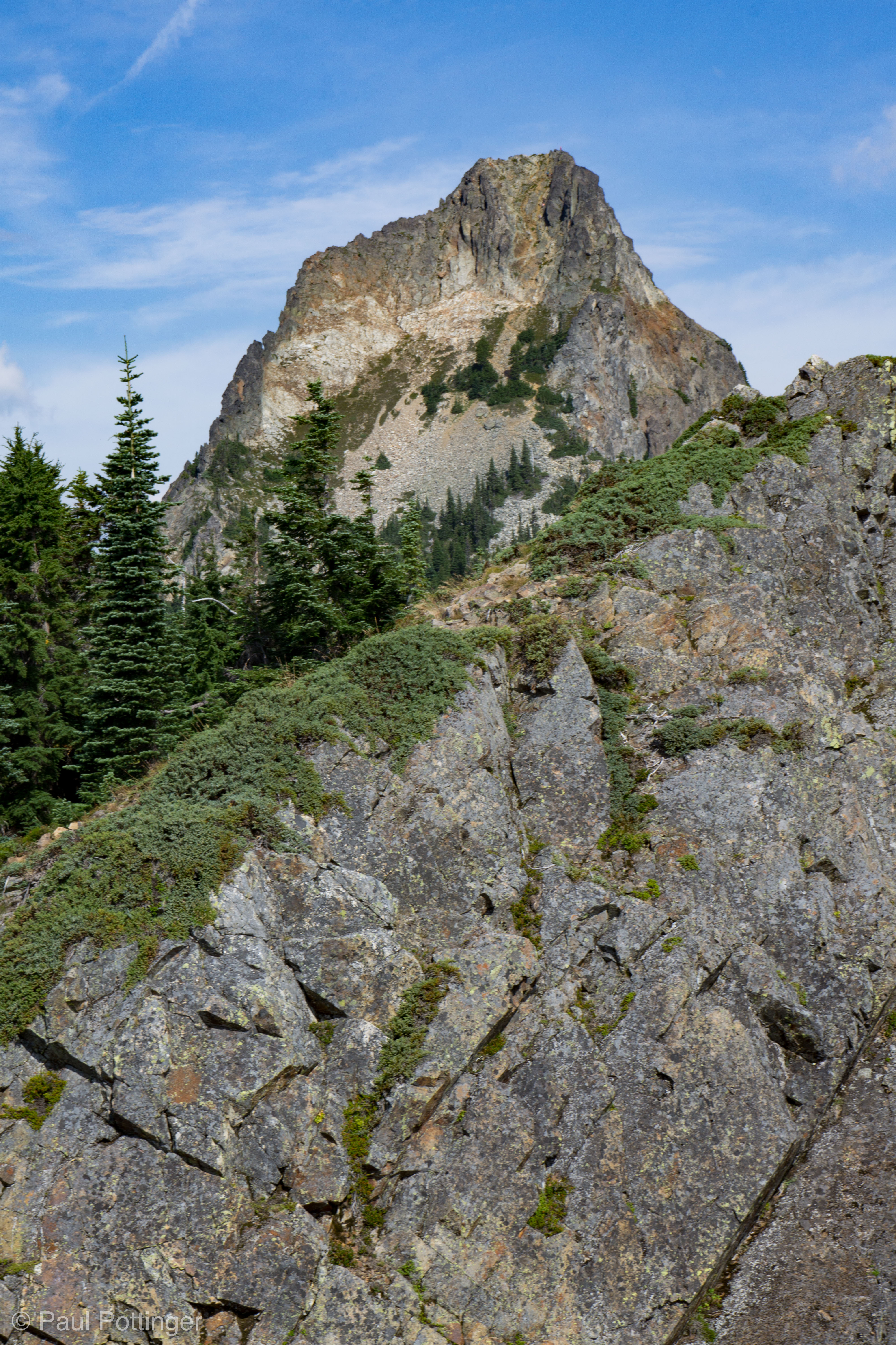
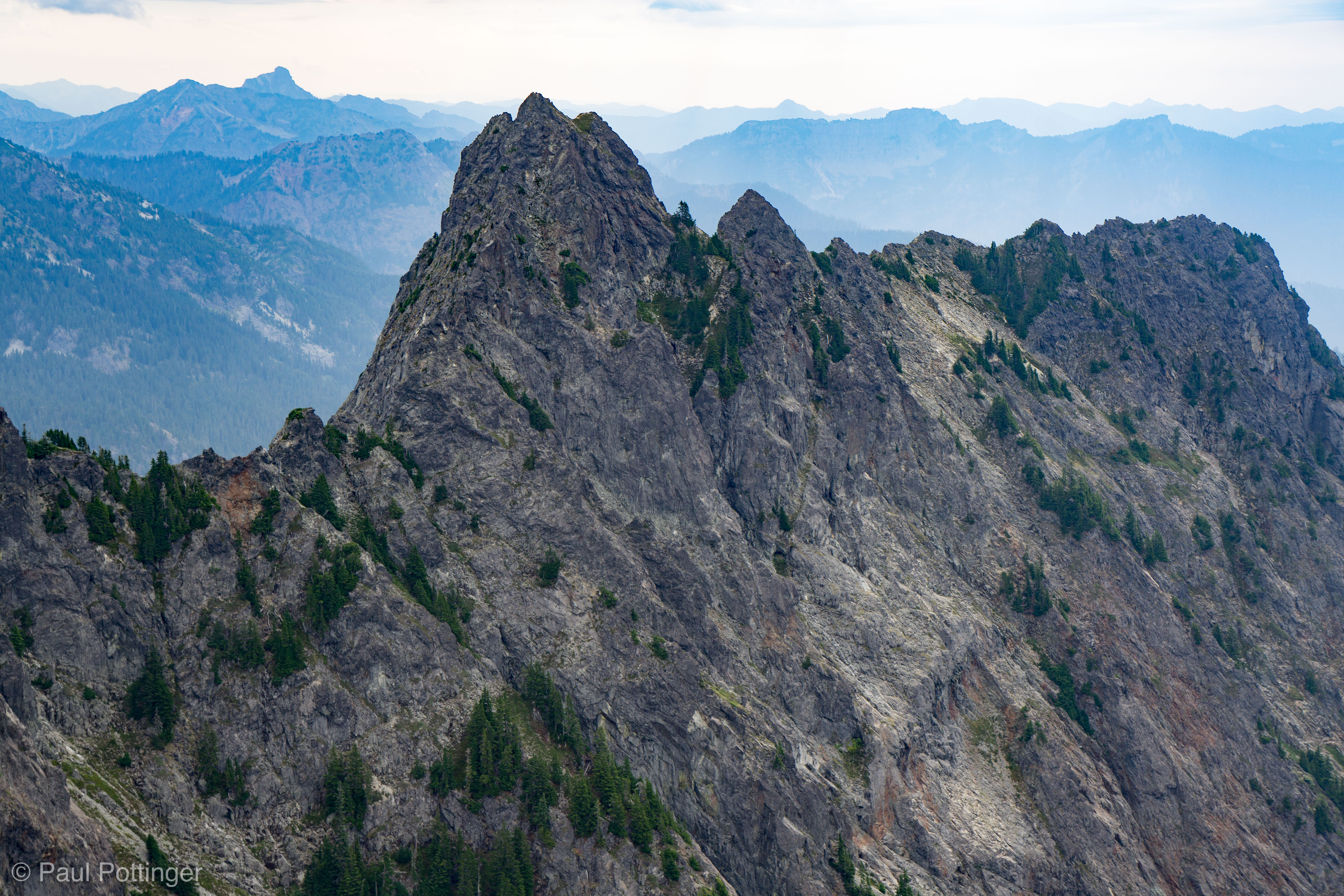
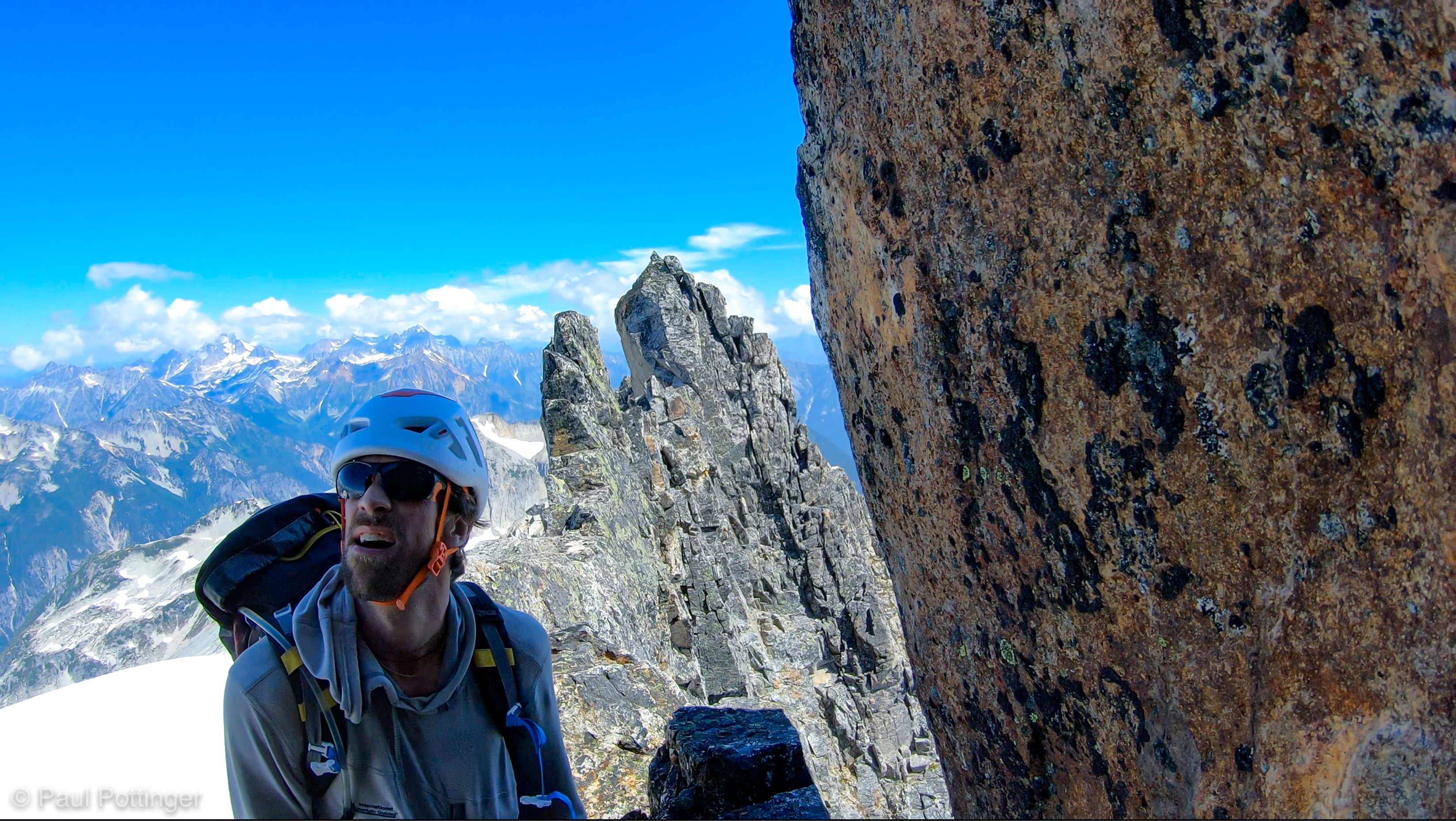
As we approached the final Summit Block, I said, “Wait, that’s it? The damn thing can’t be more than 30 feet tall!”

“That’s not the summit,” Justin said, “It’s farther ahead.” Indeed, what we could see from the glacier was in fact the little end of a larger ridge, extending away to the West… like the view an ant would have of a rooster’s comb when looking at it from the front while sitting on its beak.

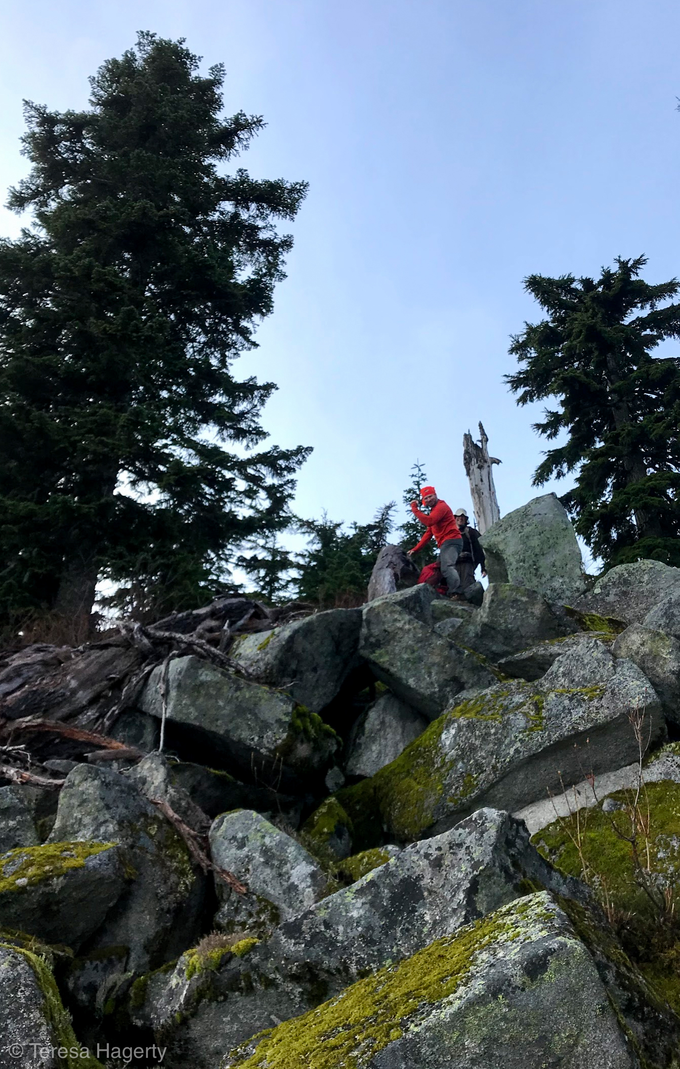
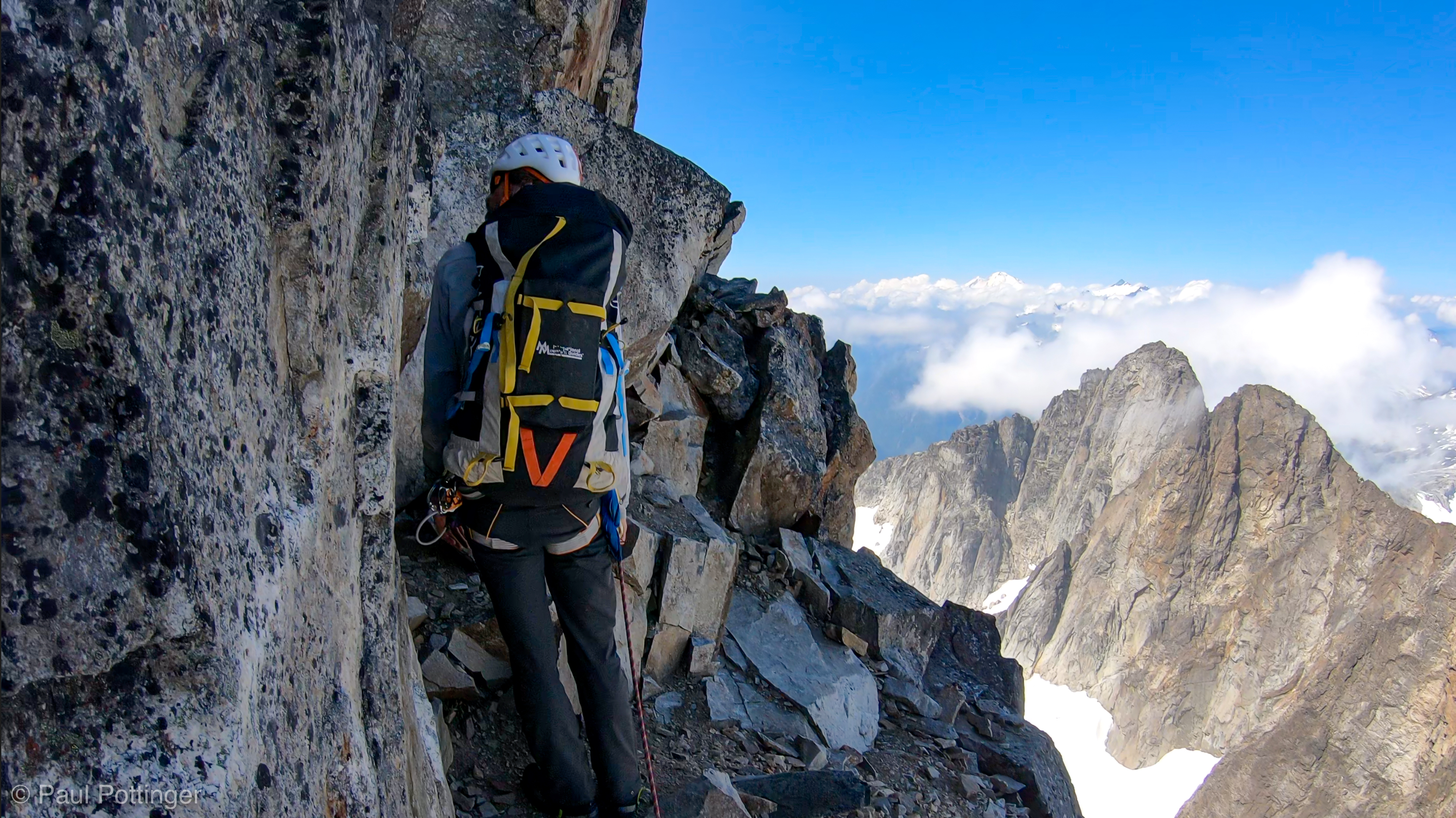
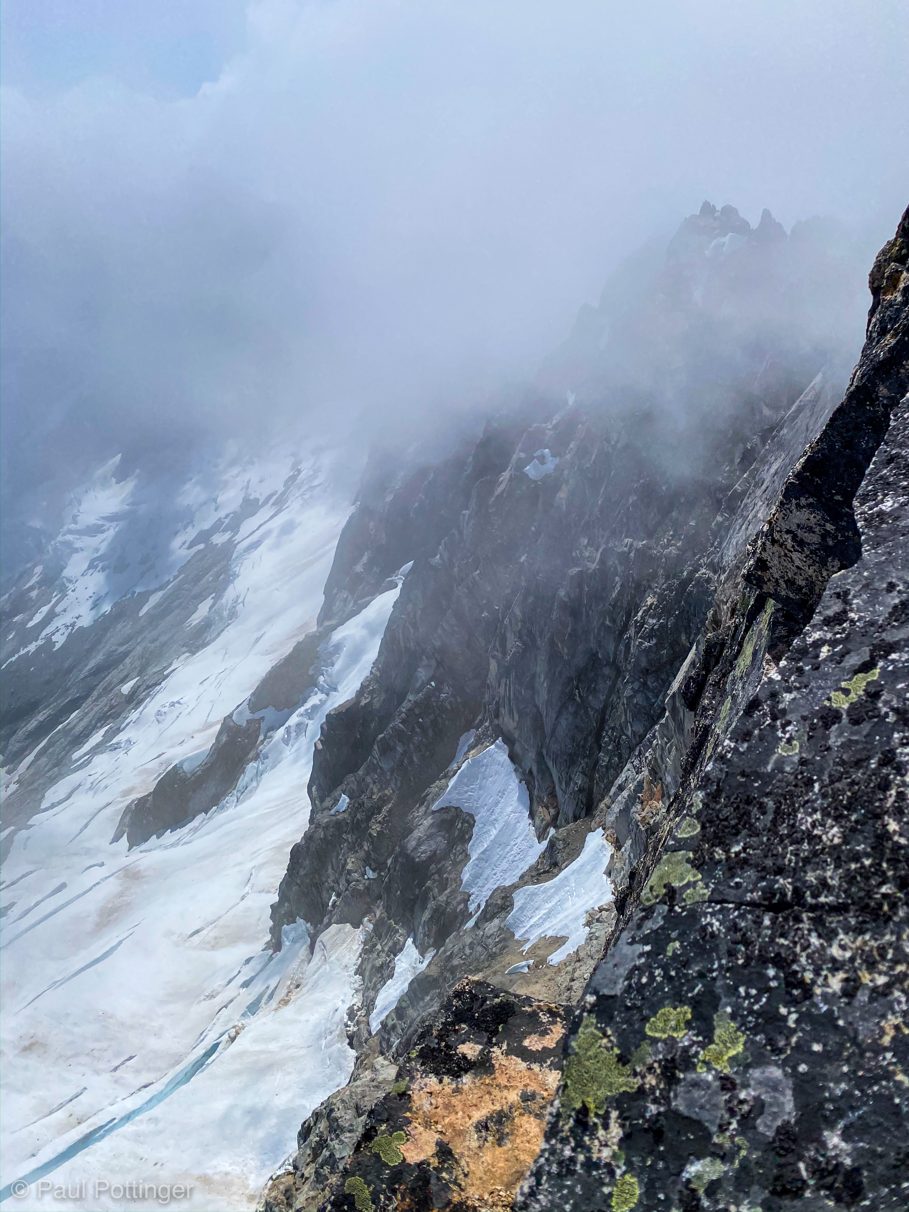
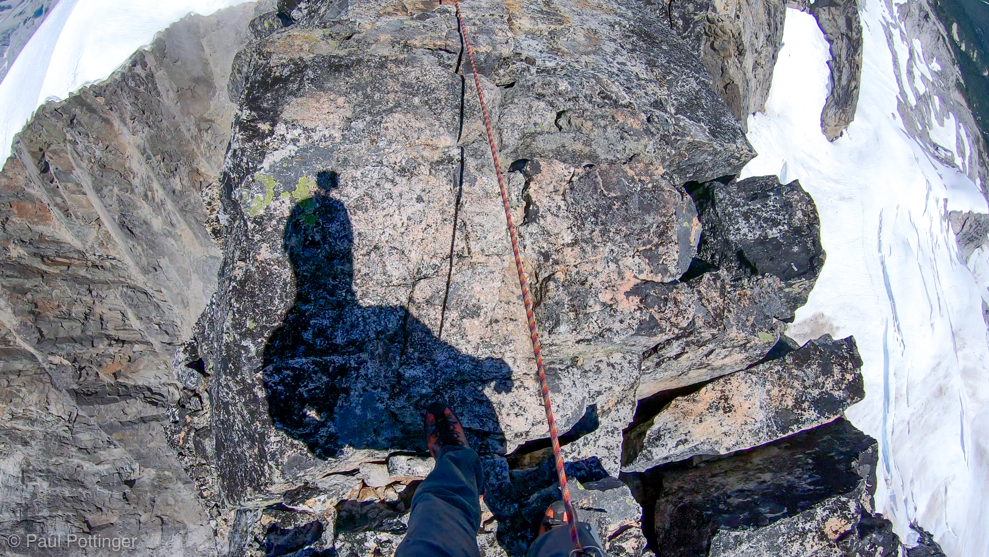
A predictable problem came into focus: How would we transition from glacier to granite? The North Cascades are notorious for the “moats” that separate snow from stone. As the stone soaks up solar radiation during the day, it melts the snow, just a bit, day by day, until eventually a big gap opens up. Sometimes, the gap is truly big, man-eating size. Here, on Challenger, the moat was not bad at all, and a big step onto the jumbled debris of the Block would do it. The trick was to not fall on the way there, because a snow ridge about 10 meters long separated us from the moat… and it was very exposed to the right, where the glacier pitched steeply down hundreds of feet into a ravine, the bottom obscured from view by clouds. Justin reminded me what I already knew: If I fell, all I had to do was holler and he would dive into the moat, arresting my fall, a classic alpine maneuver for au-cheval ridges that everyone understands and no one wants to perform. But, no matter: We would not slip here. Justin kicked wide steps perpendicular to our direction of travel, right across the snow ridge, and they were easy to match with my own steps. Forrest of course had no issue at all in third position. Once Justin was across the moat he slung a horn and provided a quick belay for me as I matched his moves: Clatter, scrabble, and scrape went my crampons and ice axe as they touched stone.

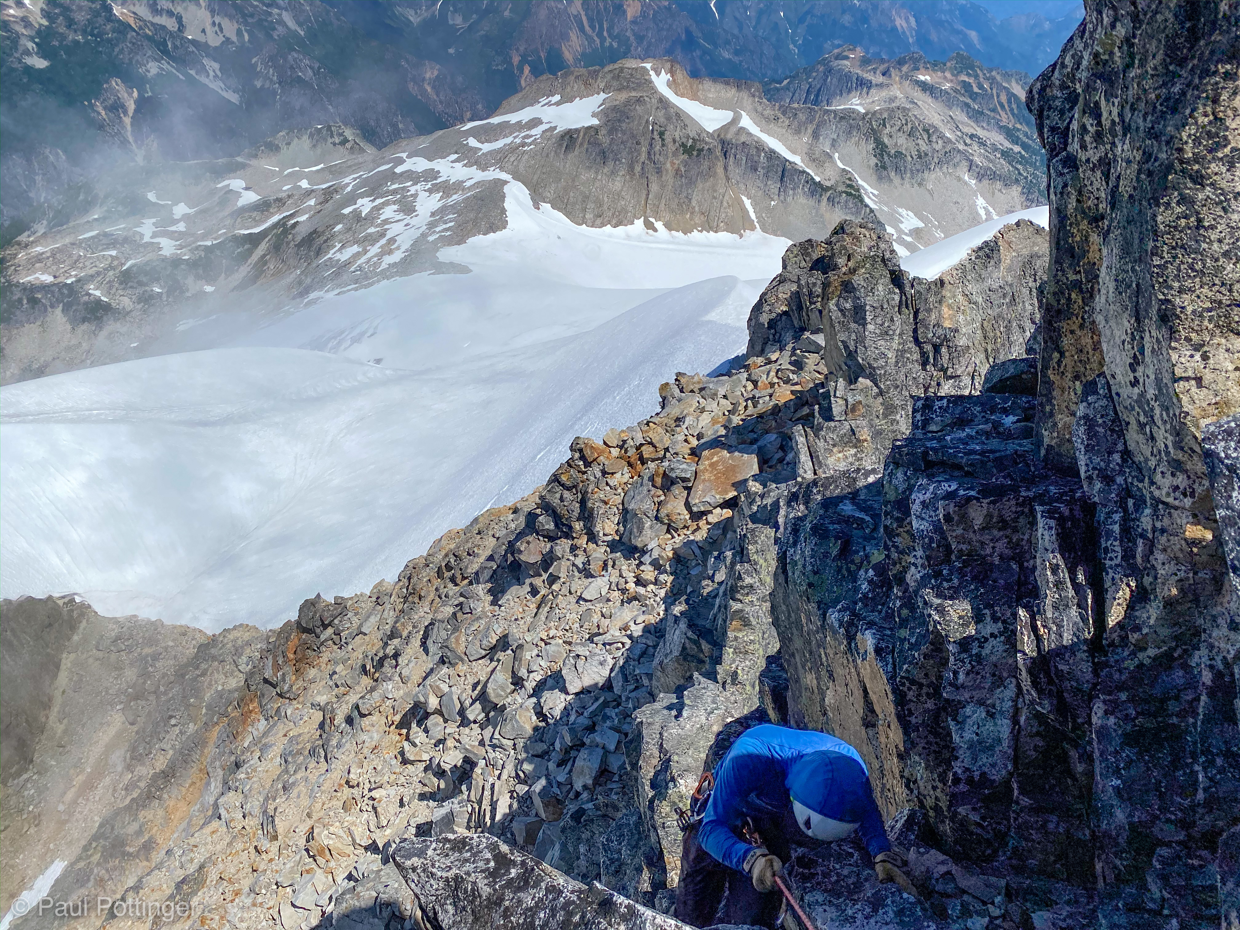
A quick transition to get the spikes off and leave them and our poles and axes behind, and we began a scenic traverse in the shadow of the final block. The route was a bit slidey and scree-ish, but there were beautiful hands on our left. Eventually, this pathway petered out, and there was nowhere to go but up. Justin looked up to his left and spied a nice ledge about at eye-level. Quick scramble up and he was able to establish a horn-anchor and belay us up from above.

Video of the summit section:

Justin spies a good spot to dump our packs, a small ledge just above his head on the left.
Forrest mantles up to join us on the pack ledge.
Justin at the pack ledge.
Justin ponders this mountain’s single pitch from the Pack Ledge.

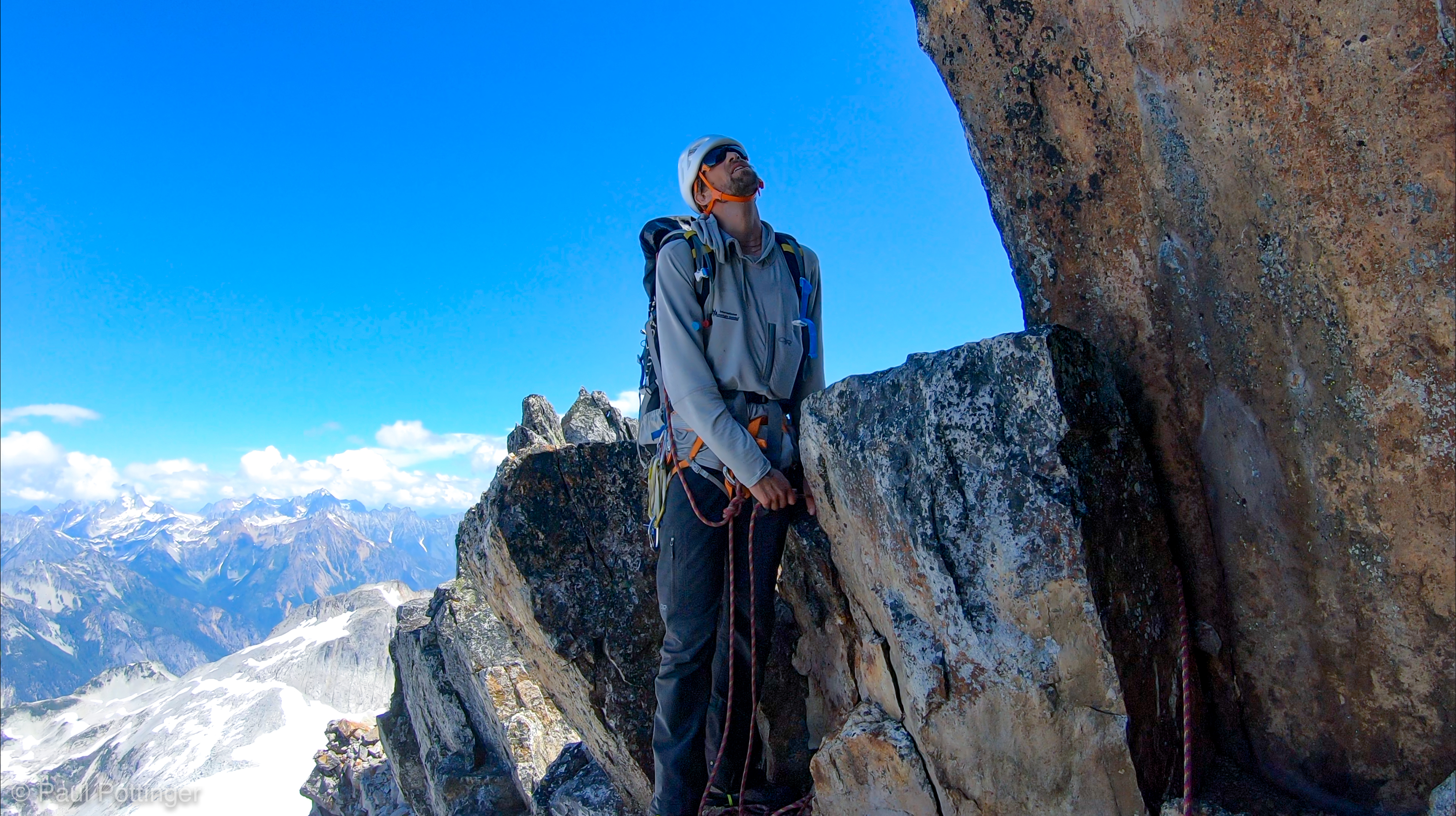
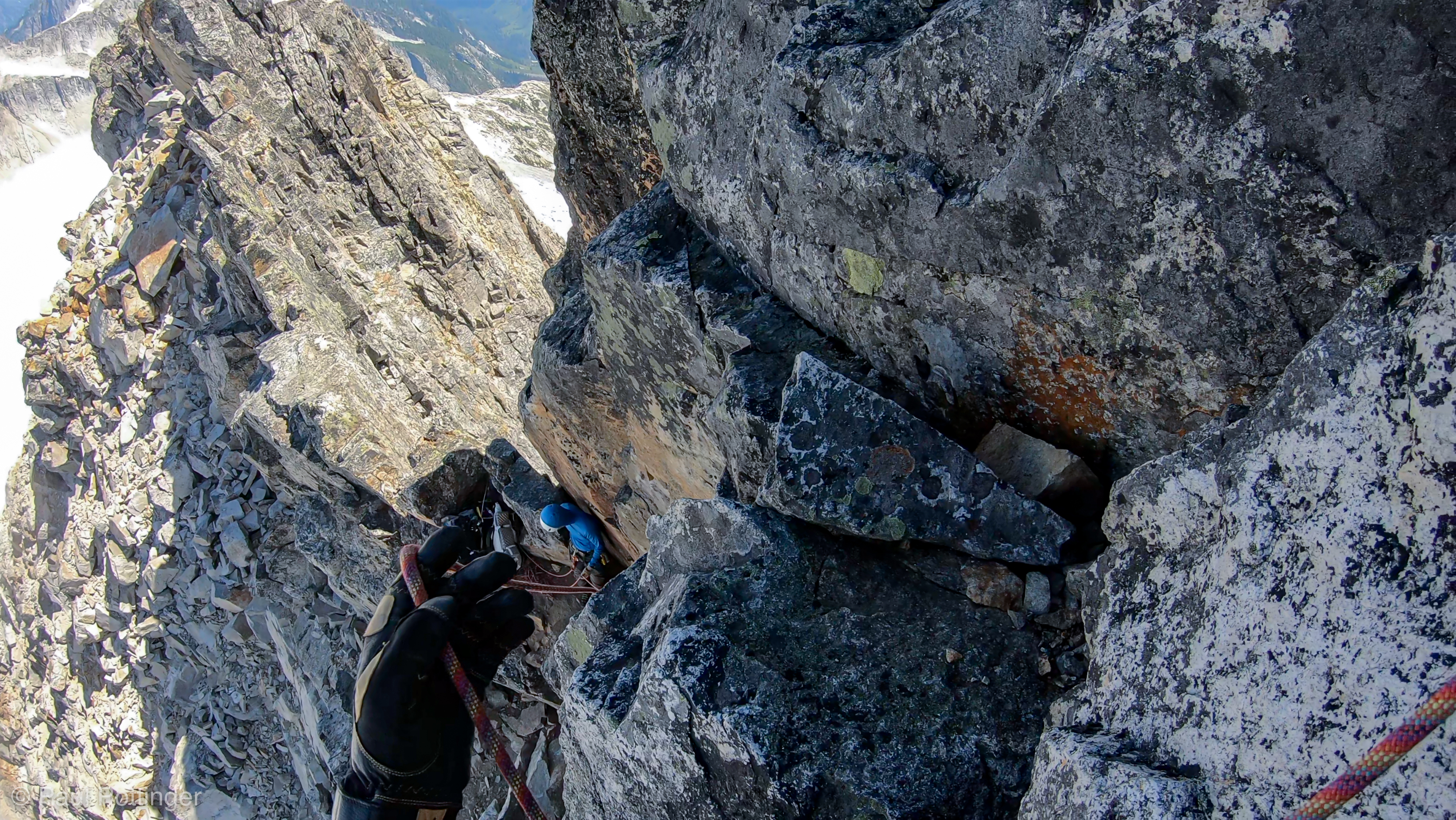
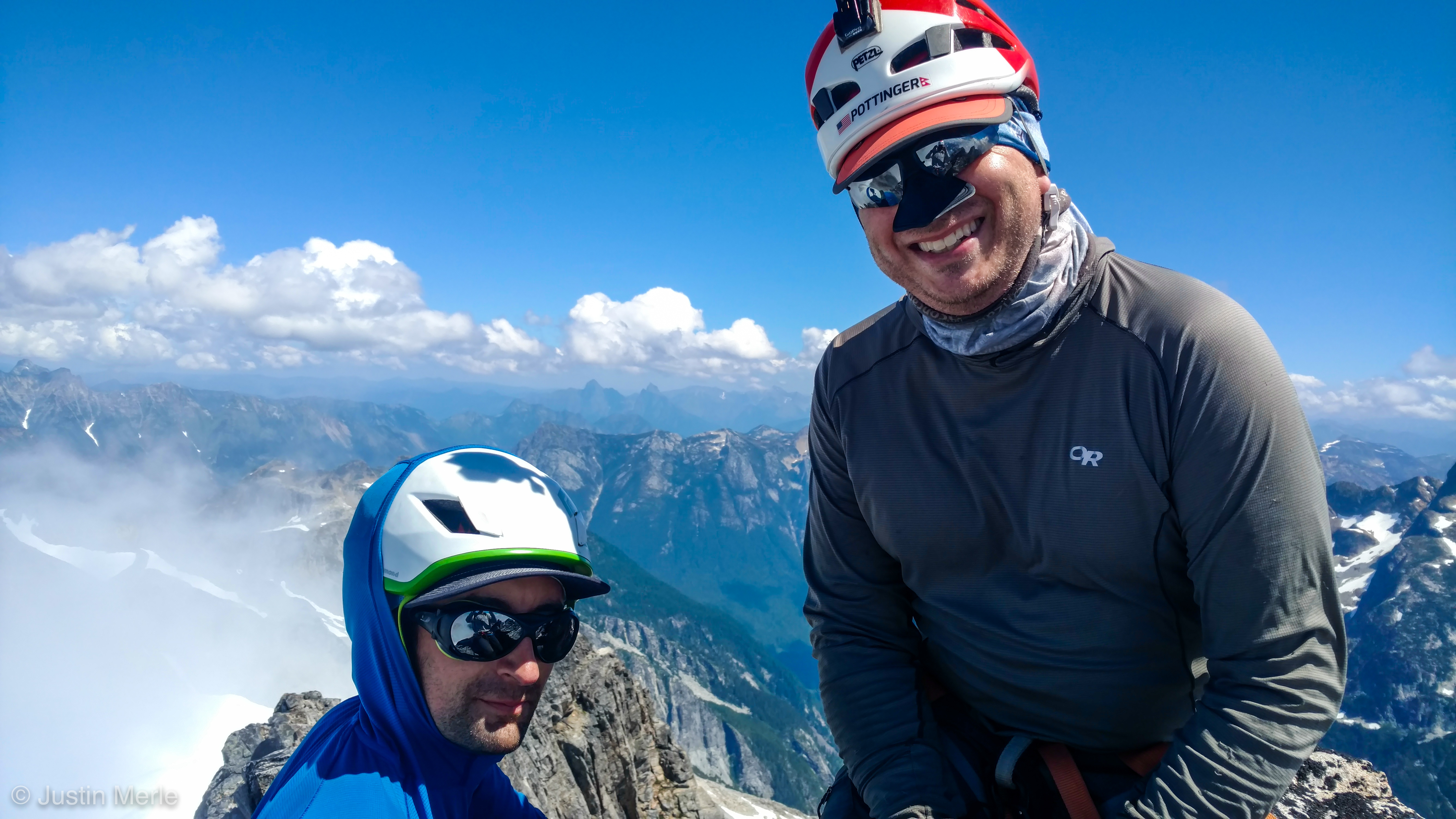
Tight quarters on the ledge, and all the awkwardness of having three dudes with backpacks on a space smaller than a kitchen counter, but very safe and it worked fine as a  spot for a quick break while we prepared for the last push. Above, a beautiful dihedral rose steeply up towards the sky (which was intermittently bright blue and filled with wispy clouds scooting past silently at an alarming speed). For the first time I wondered how much room would be on the summit, which was still obscured from here. Justin reassured me that there’d be room for all three of us.

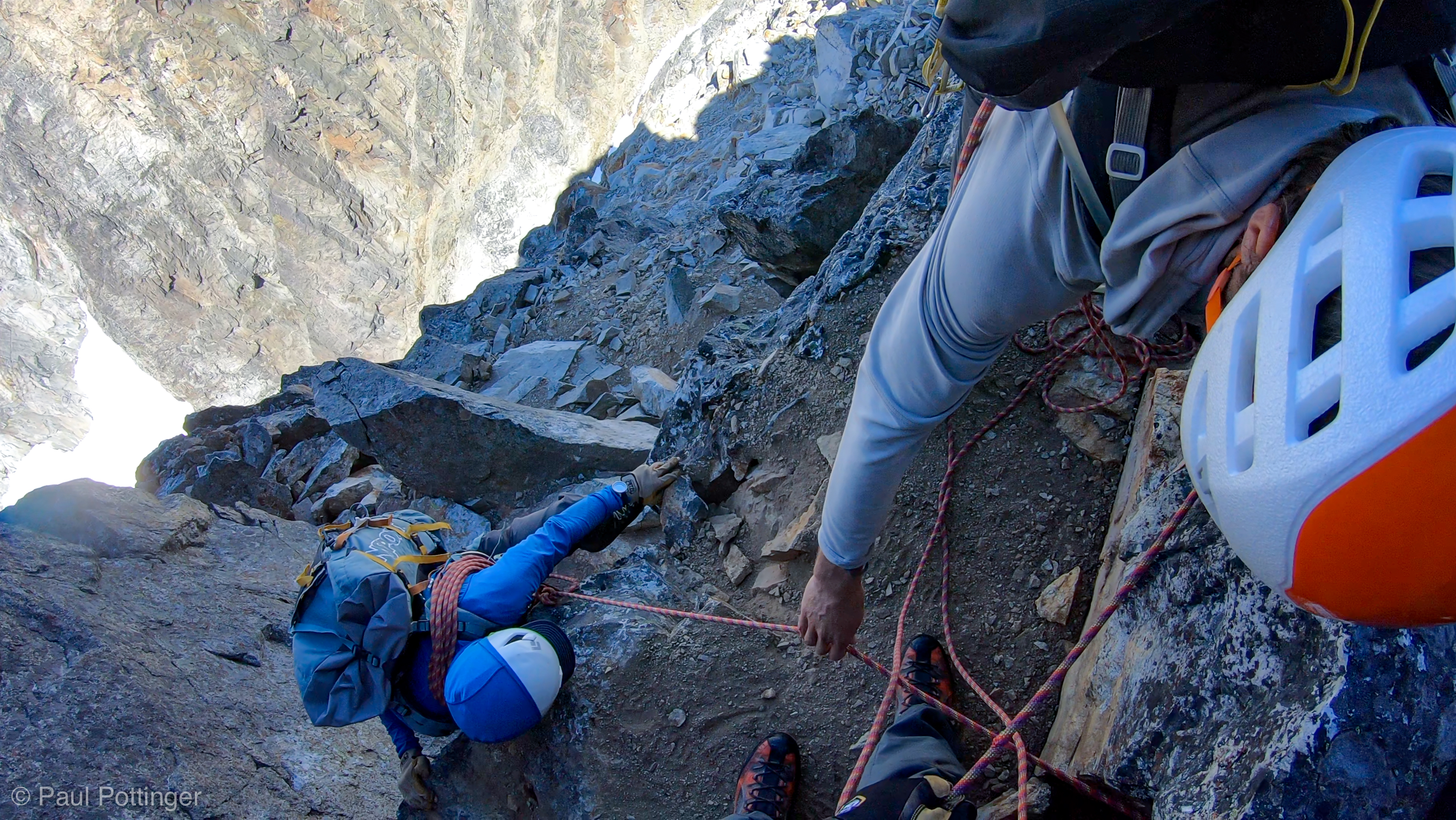
A thin crack separated the left from the right dihedral faces, like the deep cleft in the pages of a book stood up on edge, and it made for a happy home for a series of ancient pitons that Justin was able to clip for protection. There was one obvious problem about 20 feet above the ledge, a relatively blank section of granite that would require some “finesse,” which Justin climbed with ease, thanks in part to his supernaturally long legs. Forrest shook his head while belaying, “How in the hell are we gonna do that?”

Justin maneuvers his way around the cruxy bit.

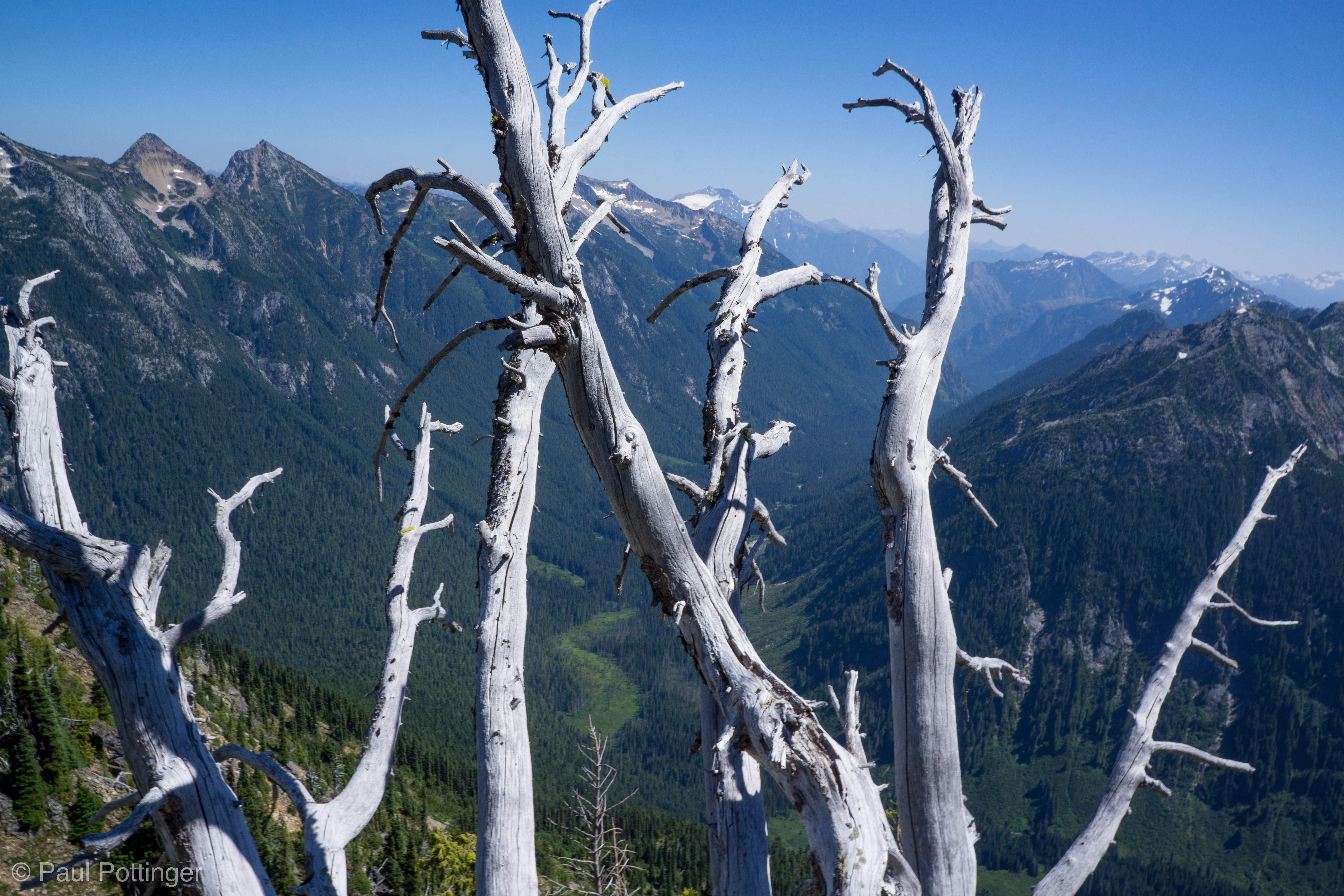
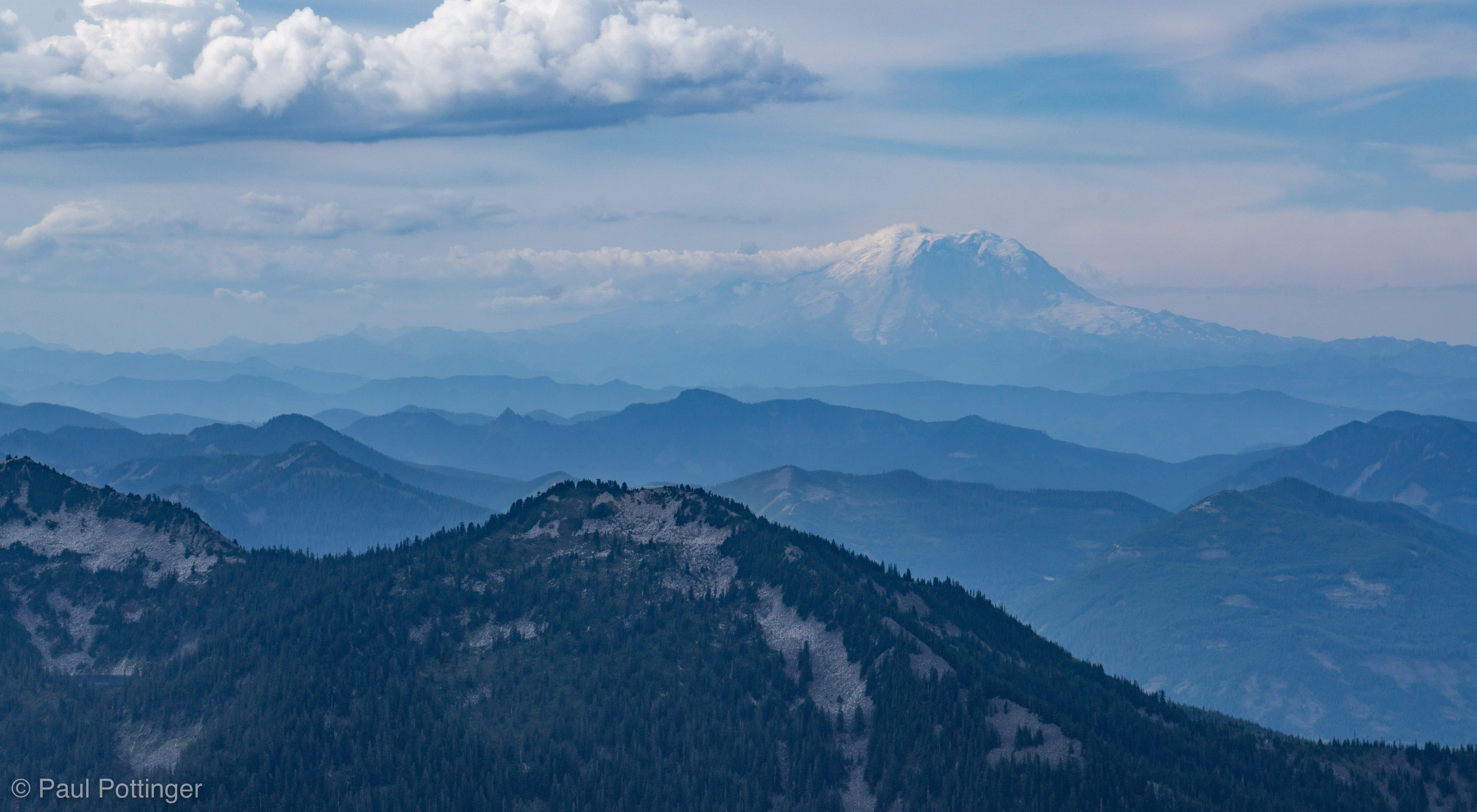
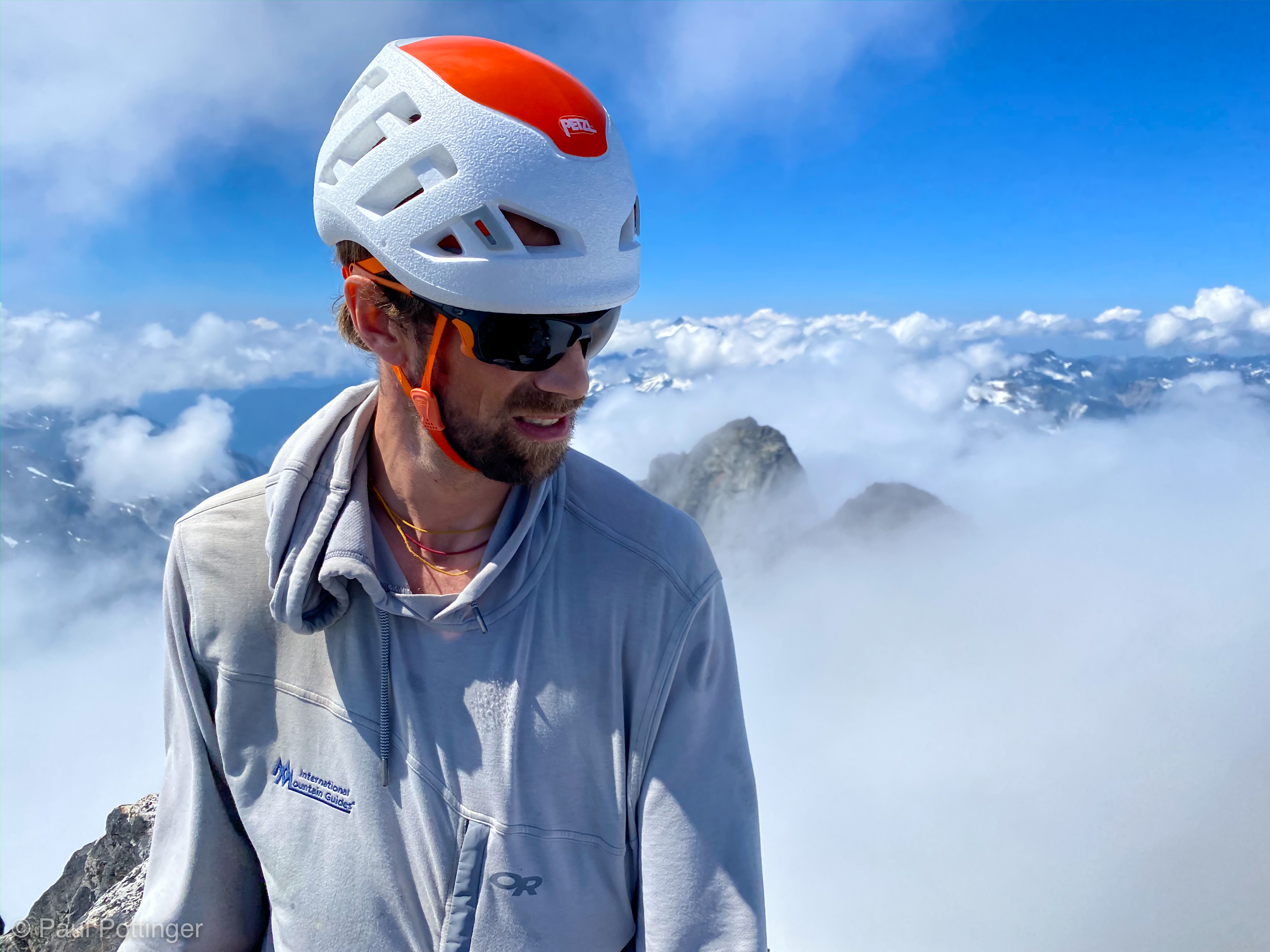
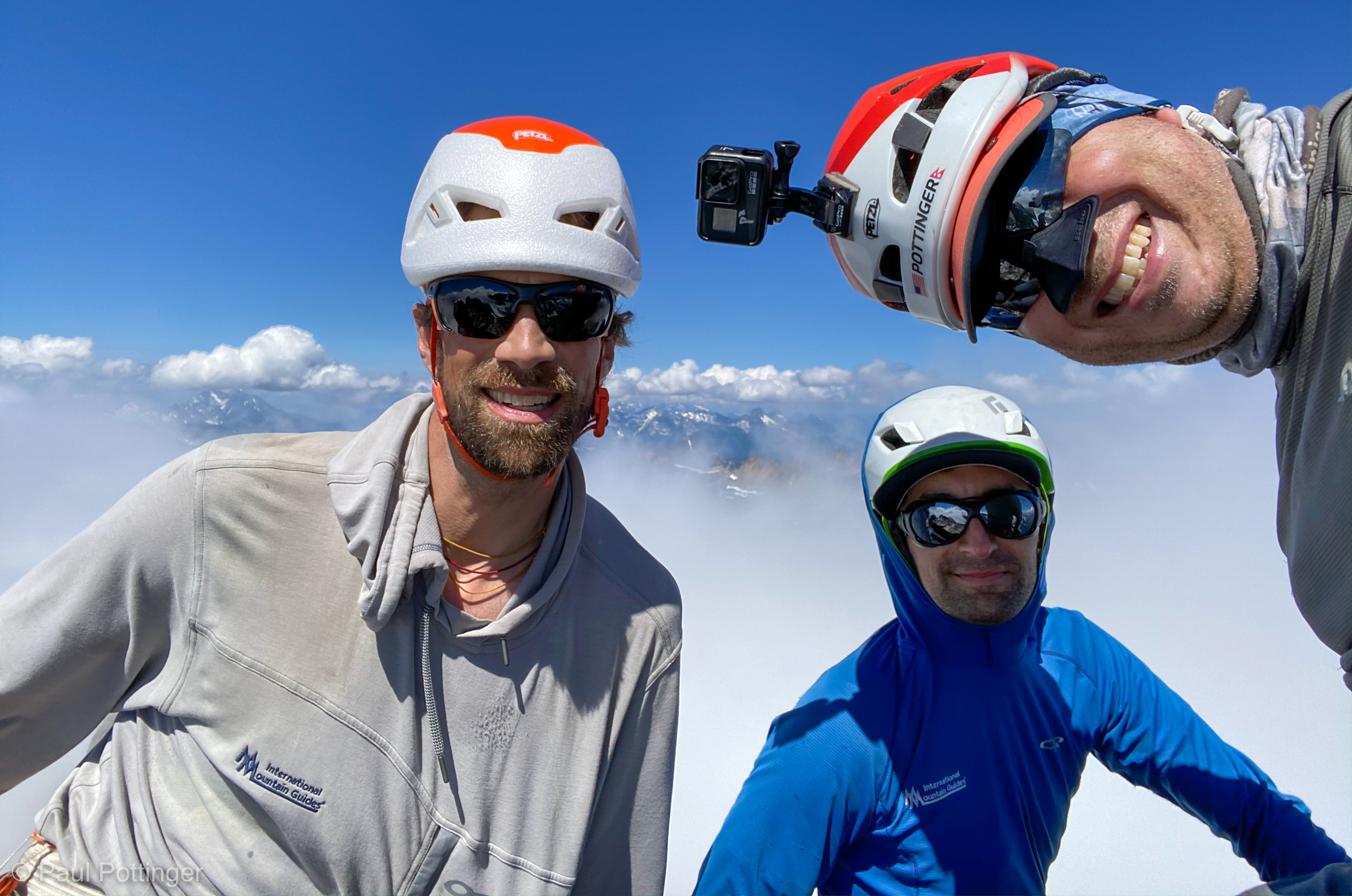
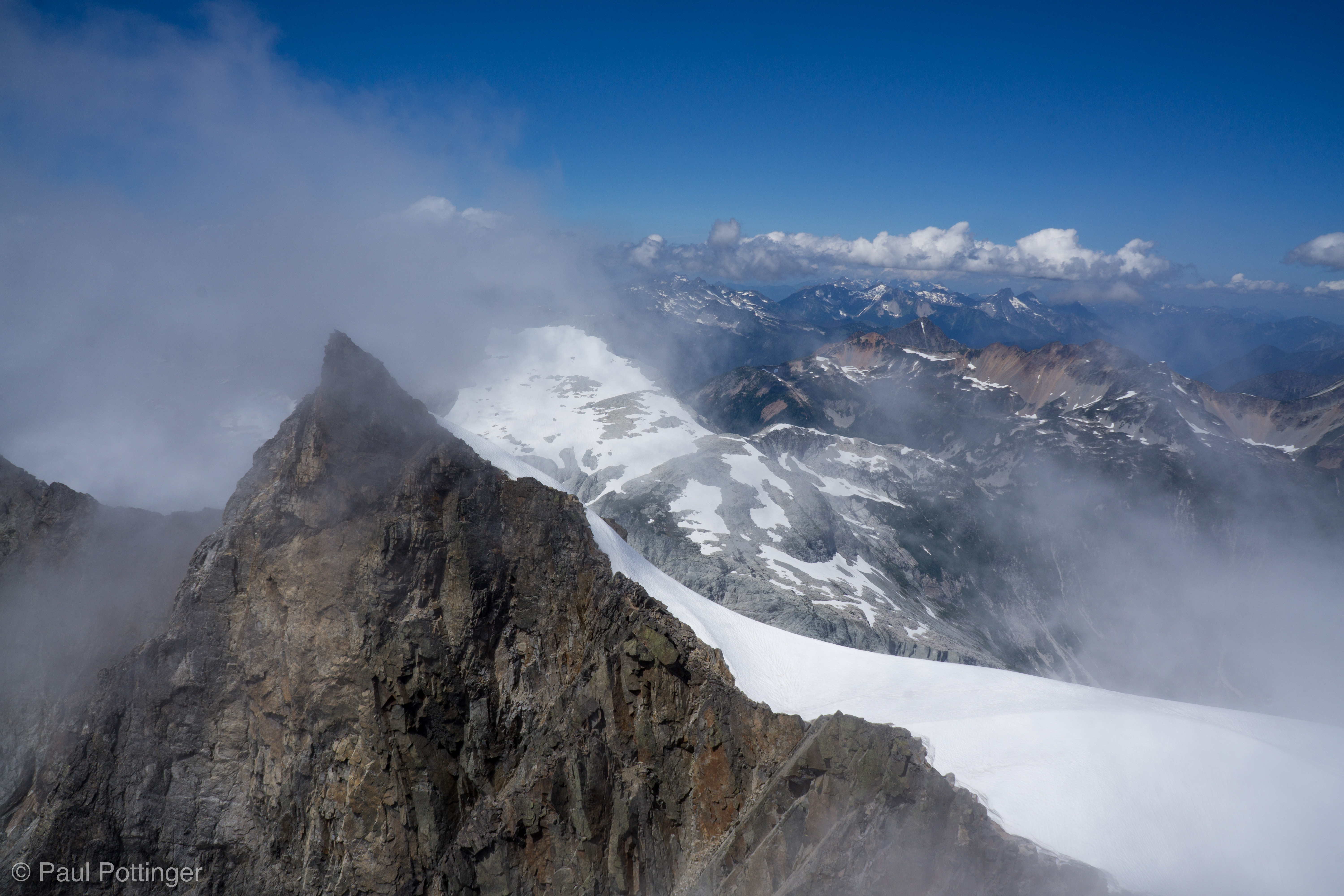
It was actually no worries, even for those of us with “normal” strides, just a bit of a mantle move and nothing more required. I reached the belay station and Justin welcomed me to the final ridge. I got settled while he prepared to belay Forrest up, and I took in the scene: A world out of the shadows, dazzling blue sky, clouds scudding quickly past, and the Northern Pickets Ridge finally revealed up close: Severe, razor-sharp, oh-so-very-spectacular. We presided over the deep basin of glaciers, talus, scree, and tarns hundreds upon hundreds of feet below. “I have been in that little office for all these months, that little 7′ x 7′ x 7′ cubicle… I wasn’t sure I’d ever get outside again, really outside like this….” The contrast with my fluorescent-lit hospital office was so stark. I had been in there for so months, focused on COVID-19… the relief at being up high again was almost more than I could bear, and I took deep breaths, literally breathing in the freedom, the joy of the high mountain air. So many lives lost, so many protocols built, so many colleagues to be reassured and comforted… so much sadness, rage, fear, and inspiration, day after day, week after week, month after month… all the death threats and hate mail from the cowardly legions of scrotus, the deep and unrelenting embarrassment for what we had become as a nation of weak, whiny morons… I was totally, completely spent, in every way. And now, Challenger would start filling me up again.

Forrest at our Pack Ledge, seen from the “crux.”
Looking back at Forrest at the rap station, seen from the summit.

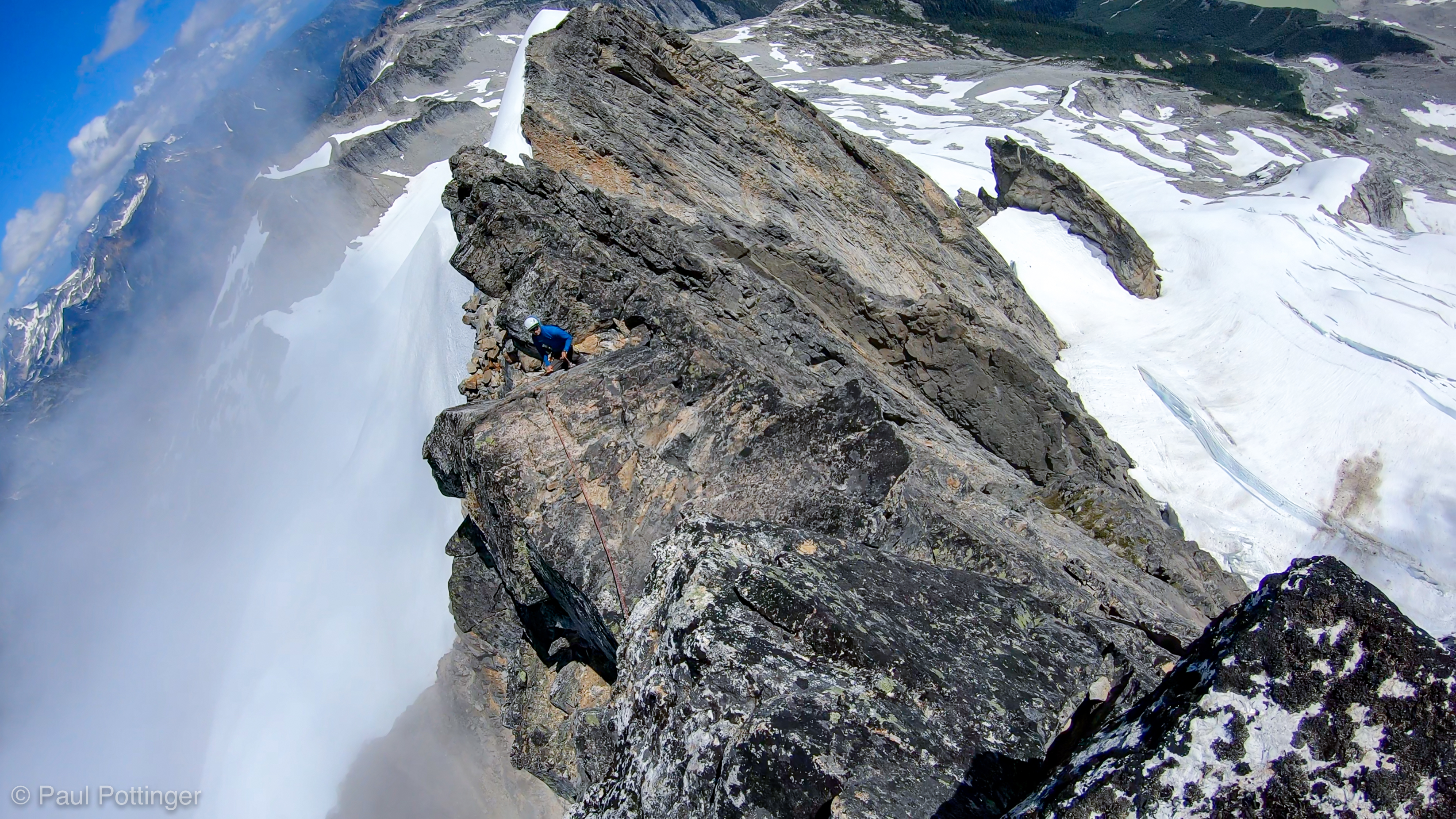
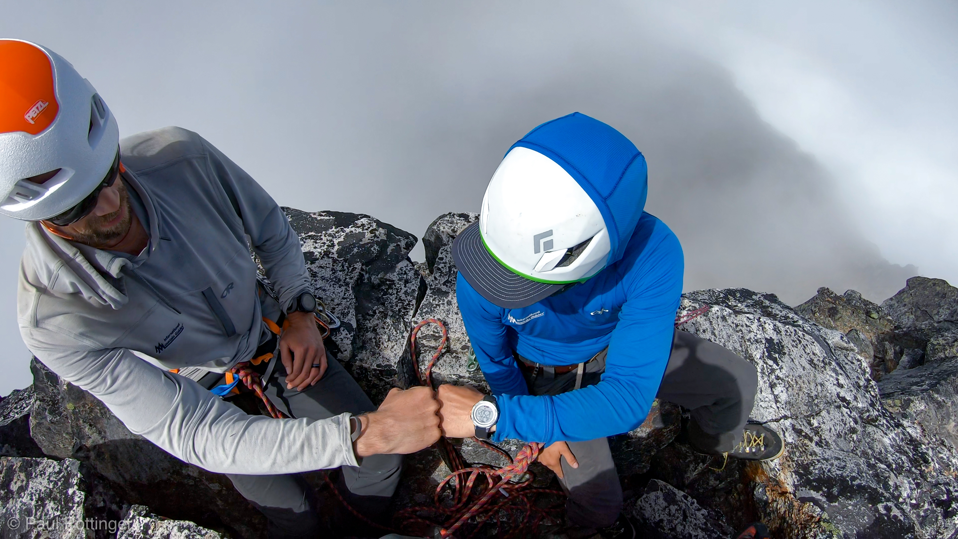
There was little time to reflect at the belay station, because Forrest made quick work of the climb. Next, Justin needed to traverse a short ridge, about 3 feet wide, to the final true summit, which looked like an old sedan lying on its side. A rap station consisting of a cord and some rings flapped in the breeze. He built a new anchor (using some insanely light BD cams, these things are cray-zee light) and I belayed him out to the summit. He slung a horn and then belayed me out. This was so very reminiscent of Forbidden’s North Ridge (although that climb has more exposure). I laughed as it felt like I had stepped 2 years back in time to that expedition.

The catwalk between the rap station and the summit, just a few feet above.
I took this photo on Forbidden’s North Ridge in 2018. So very, very similar, no?

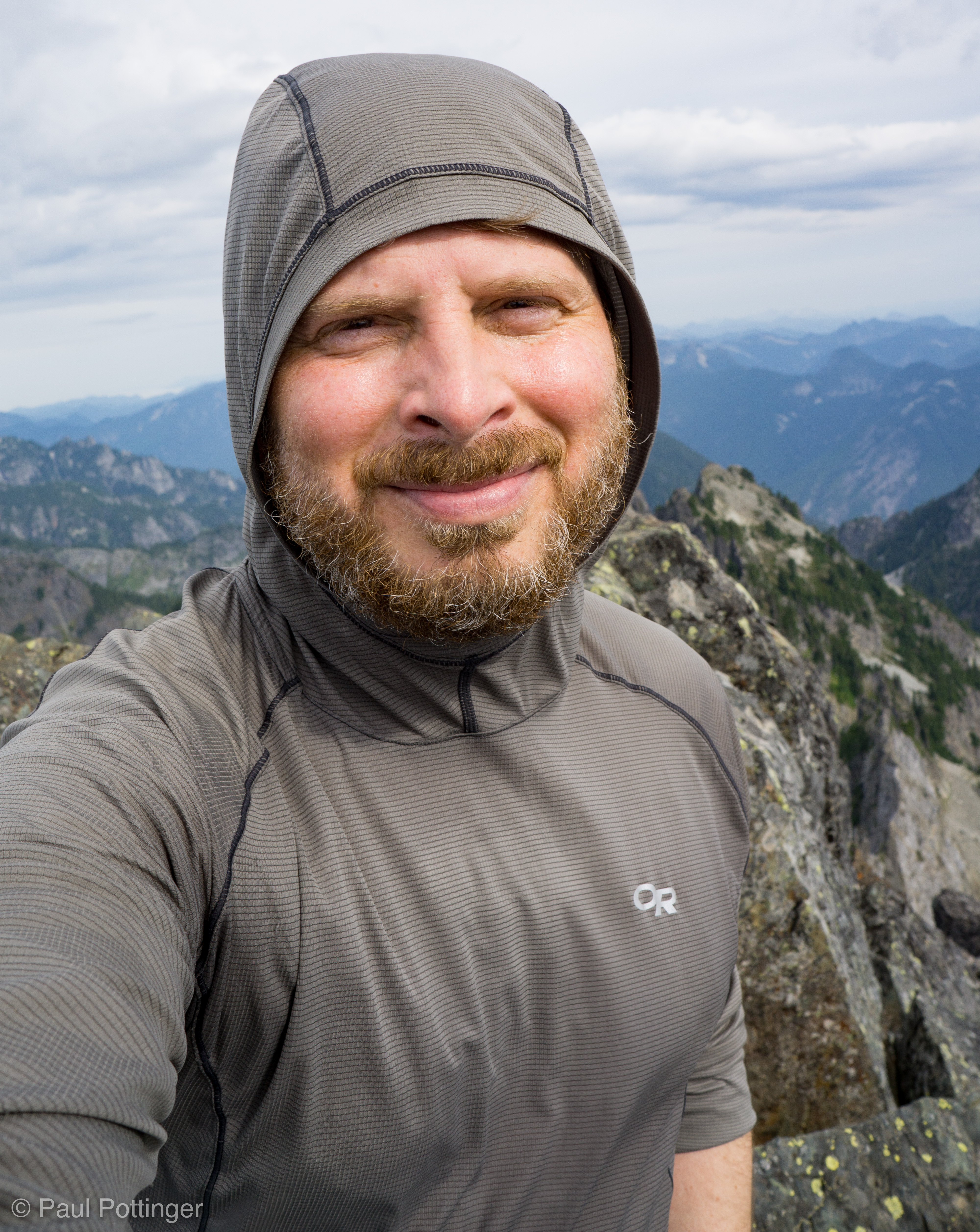
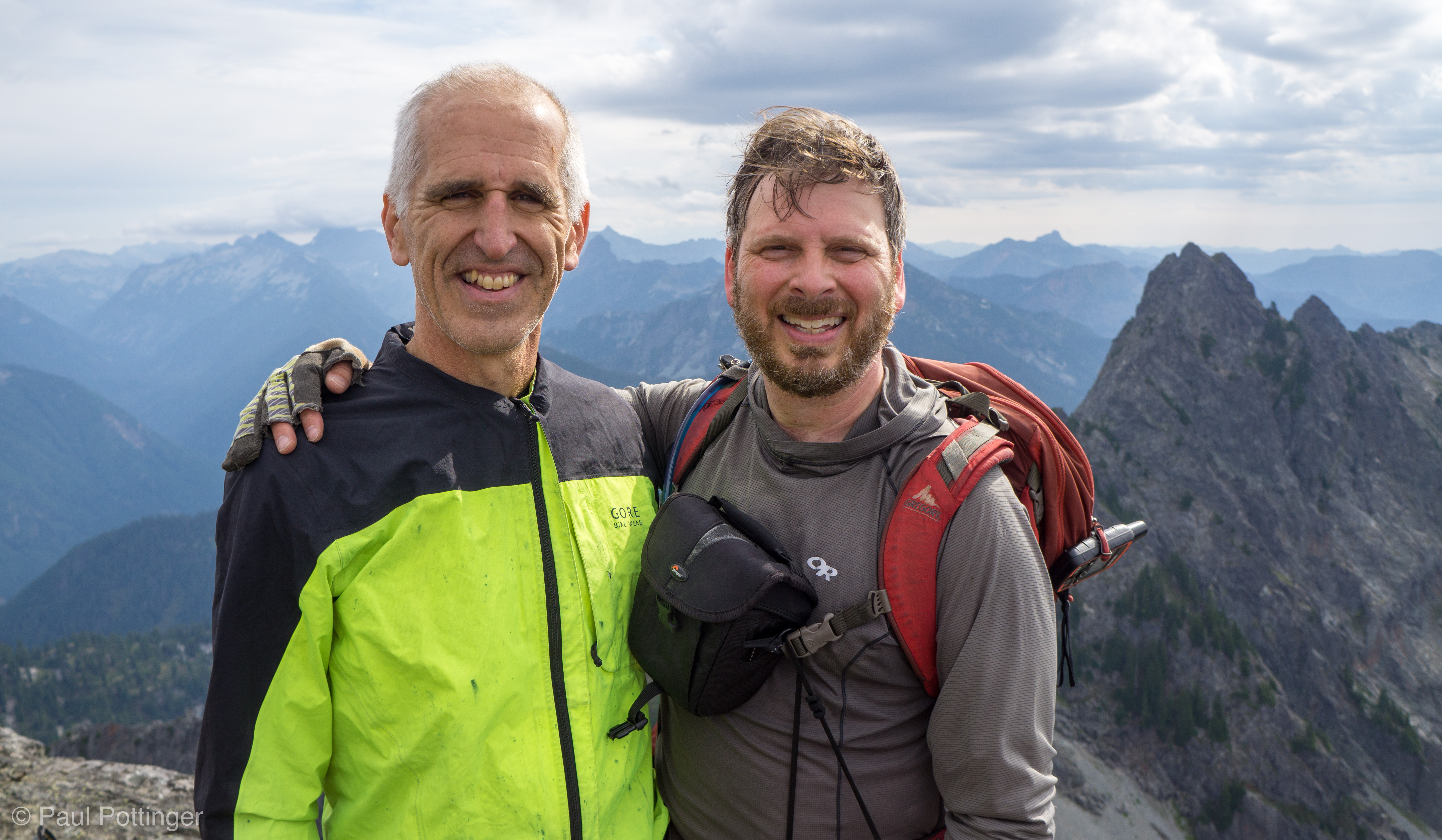
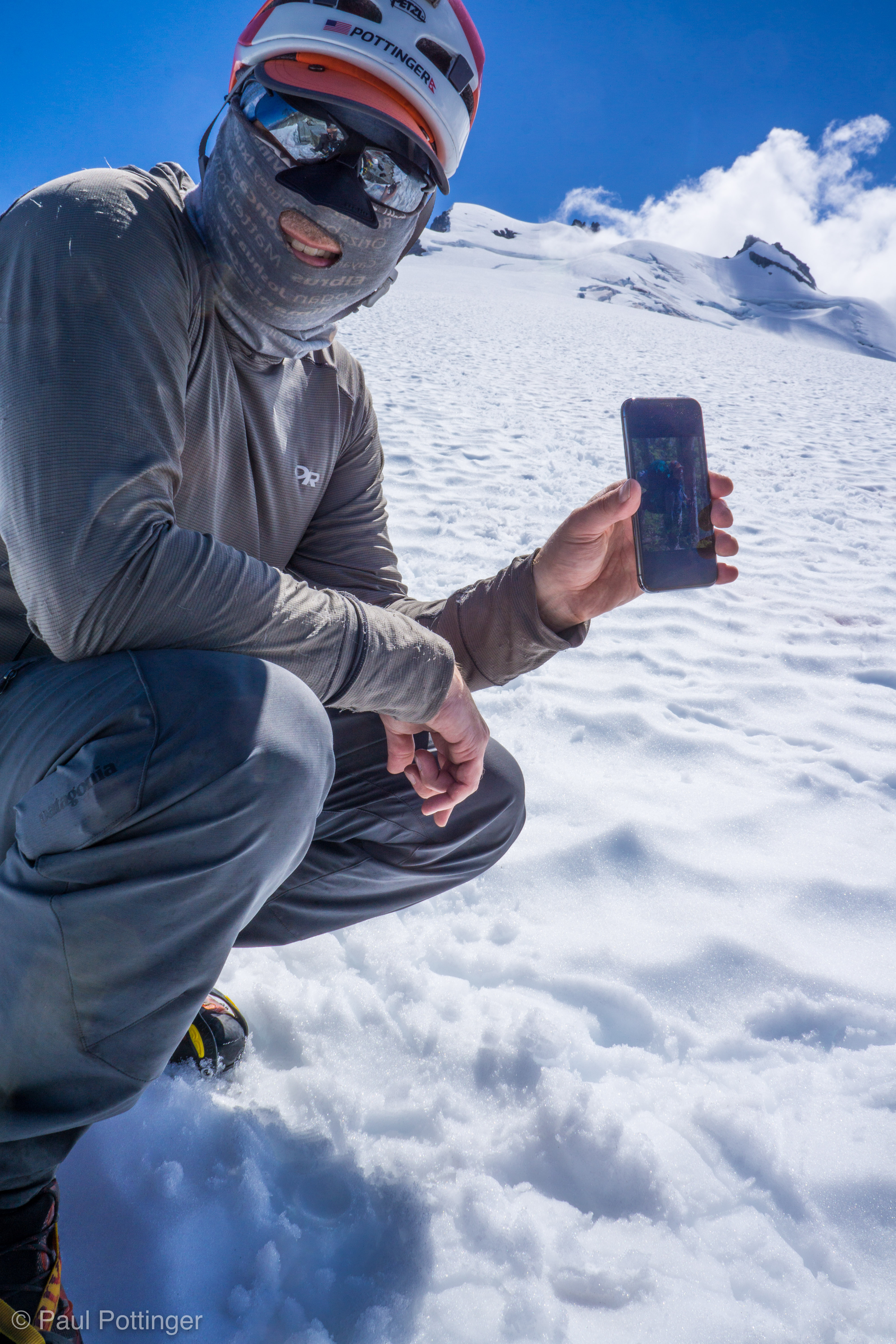
I topped out at 12:48 PM. From the summit, it seemed we could see forever. I had envisioned this view for years now… I really wished that Teresa had been able to make this last section, but knew she had decided wisely. We looked back at the traverse, and imagined where camp would be… could she see us here, miles away? We sent her a message via InReach. I wished John and Tom were here, too. We had always planned to do it together… breaking that plan was painful, but the right call. It was worth it. I thanked Justin and Forrest for their guiding and friendship. It was a great moment.

Justin belays Forrest up to the summit.
Summit selfie.
Peering over the summit towards the glacier far below, in Luna Basin.
Forrest and me on the summit.
Fists of glory on the summit.
3 Amigos on top.
Looking towards Crooked Thumb and the rest of the Northern Pickets.
Wide angle of the Northern Pickets, I think the largest dark peak at center is Fury.
Looking towards Whatcom in the distance.
Looking back along the summit ridge. In the distance, miles away on that green slope, camp awaits us. But, long to go before we can rest.

I looked back at the green ridge to the East: High Camp. Teresa was there, probably basking in the sun and snoozing. Well, we were halfway home, and eager for the comforts of camp. Just… one foot in front of the other, and we would get there.

Video of our descent:

Walking from the summit back to the rap station.
Looking back at the summit, occupied by Merlicious.

Our prediction came true: As soon as we reached the summit, the first member of that other party gained the belay station. By the time we climbed down to it, we had a veritable traffic jam, with five people on a small piece of rock. We all marveled and laughed about going days without seeing another soul, then getting into a jam up here at the top. Nice people, and easy to negotiate around them as we set up for our rappel.

Forrest raps down towards our pack ledge.
Justin raps.

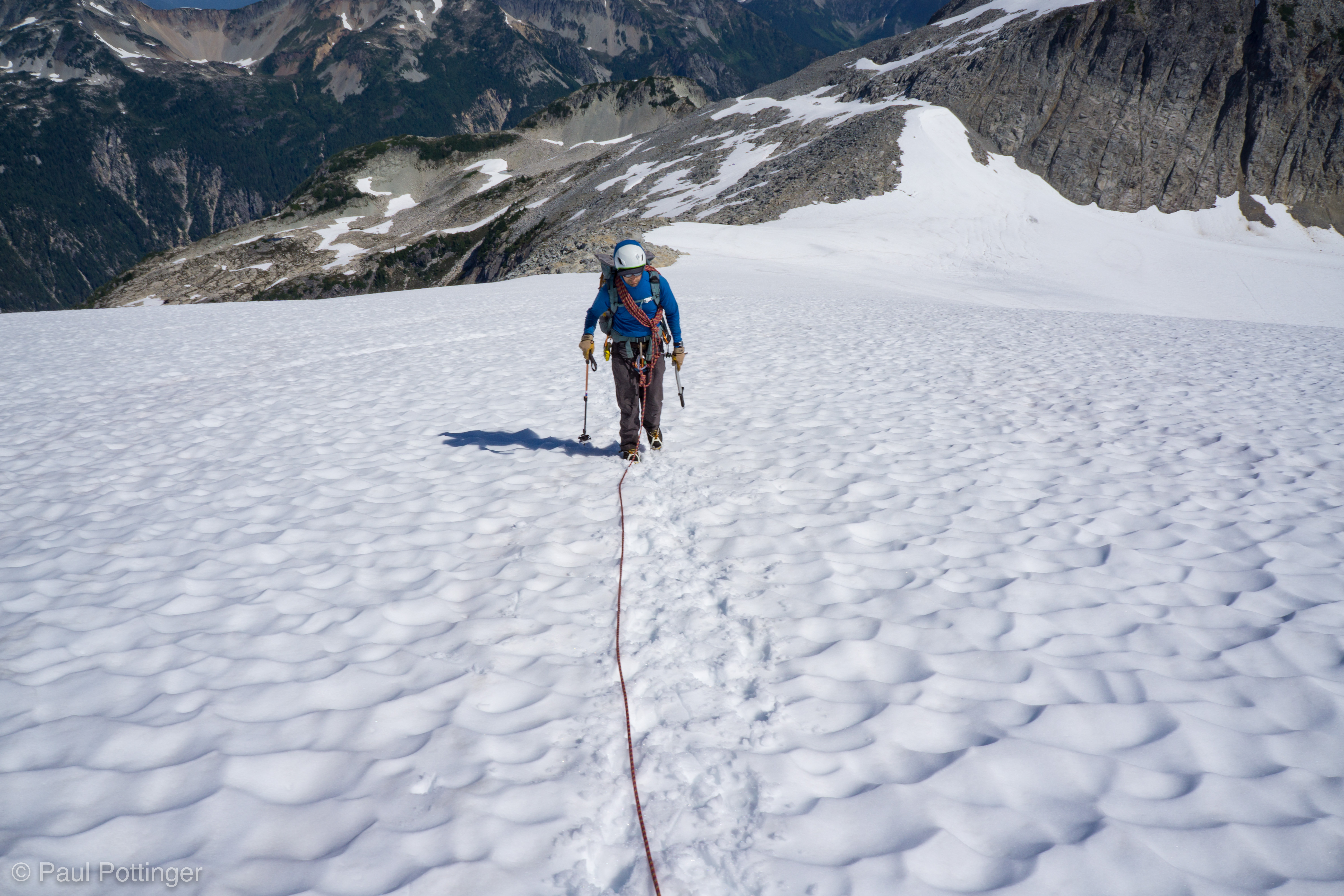
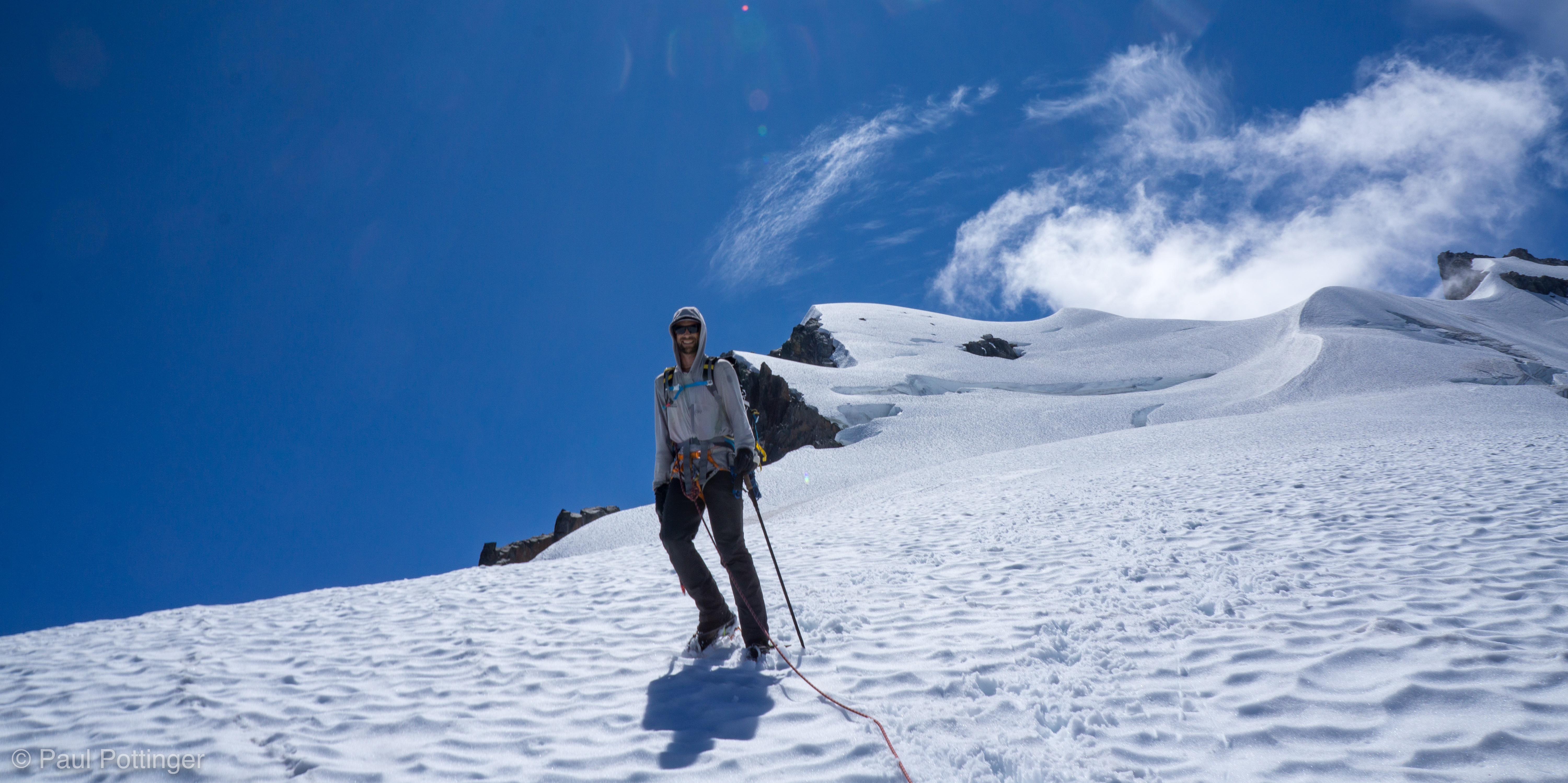
After we regained our packs, we traversed back along the base of the shattered summit block, crossed the moat, and plopped down in the snow for a break. It was really hot here, and again I felt dehydrated and under-fed. I tried to remedy both issues, while taking in the really incredible views on all sides. We saddled up and descended easily, no trouble identifying a handful of snow bridges. The conditions remained essentially perfect.

Looking back at the summit block from our break spot.
Forrest leads us down from the upper mountain.
Justin looks happy to be headed downhill.
In my left hand I hold our fourth team member, the amazing T$, taken the previous day during our bushwhack!
Me holding a picture of me on the summit of Vinson holding a picture of Ann Sparks, kissing her ice axe. This is meta. This is how we roll.
For scale: The three other dudes can be seen at center, approaching the lip of the glacier, which they plan to downclimb on their way to Luna Lake.
Closer view of the threesome making their way towards the cirque.
Starting our circumnavigation of this sub-peak
OK I need to get a closeup of this for John and Tom….
There it is, finally seen clearly: Perfect Pass, and beyond Shuksan and Koma Kulshan hiding in the clouds past that.
Luna seen across the valley from Magic Camp.

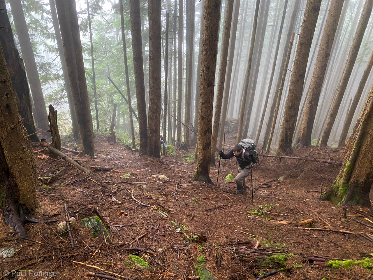
The return trip felt long. We had all the daylight in creation, with perfect conditions, and a clear path home. All that was required was stamina. And yet, I admit that I was genuinely exhausted. Oh Pickets, you are a harsh taskmistress! I just could not put enough water or food in my stomach without triggering waves of nausea… so very unpleasant. Was there ever a time on the way back to camp when I thought I would just sit down and collapse, when I would just “give up” and crump? No. I’m not very strong, and I’m certainly not fast, but I never stop. My buddy John said that once, that this was my “super power,” the dogged determination to just put one foot in front of the next, until the objective appears. Sensible breaks periodically? Hell, yes. Water, calories, sunscreen, foot care… the basics… then, saddle up and go. But no unplanned stops or misery sessions. How could one be miserable here? The valley is so, so spectacular, truly an alpine wonderland. And, no matter how rotten my stomach felt, and no matter how stiff my legs became, no matter how clinging the branches we ‘schwacked through, no matter how cloying the biting flies and insects, no matter how merciless the sun, the truth could not be denied: We had just climbed Challenger, and the comforts of camp drew closer with every step.

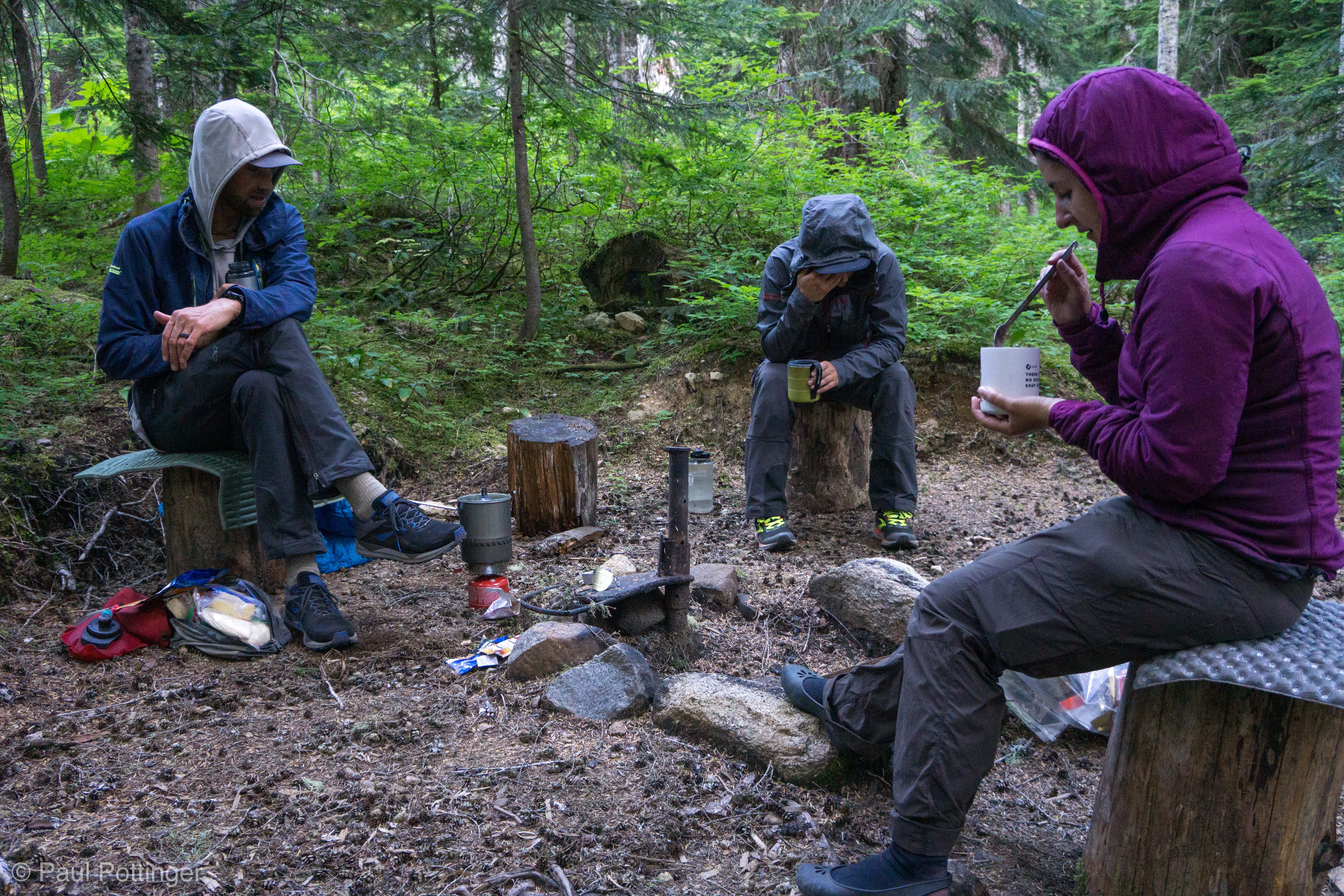
At 7:20 PM, 14 hours after departing, we arrived back in camp. Teresa was doing great. The water source was flowing again. All was in order. The boots came off (what Justin calls “bootgasm”). A fresh top layer. Evening light. And, a decision: Would we move camp now, and avoid the rain that was forecast for tomorrow morning? Or, would we stay here and risk a wet traverse and downschwhack the next day? I was cooked… We chose to risk it, and get an early start. This turned out to be the right call. For tonight: Dinner. And sweet, blissful rest.

Challenger 2020: Day 2

Video digest of the day’s travel:


We were all tired, and it was soooo tempting to sleep in that morning, but there was much ground to cover (none of which was on trail), and the slope would get hot early when hit by the AM sun… we resolved to start walking by 7 AM. So, up at 5:30 it would be. I slept pretty well, and awoke feeling largely replenished. This was good news, because I predicted day 2 to be our most challenging day of the trip. It would involve (slightly) more elevation gain than the other days, we would still be relatively heavy, and it involved climbing a slope that was notorious for its difficult terrain: would there be Devil’s Club? Nettles? Sumac? Thistles? Slide Alder? Moss? Rotten tree limbs? Loose rock? Time would tell. I recalled how bad my buddies looked one season after they had tried to take a shortcut down from Hannigan Peak, and I did NOT want to look like that. Ever.

Good morning, people! Yes… it was that kind of breakfast.
Through the canopy above, hints of a blue sky awaiting us.
Justin noticed that dent in my helmet right away… I reminded him it happened on transfer via yak to EBC in 2016. No TBI here yet (that I know of).

On went the boots, and we were off. First stop: The Emergency Shelter a few meters uphill, where we chose to cache a bit of gear we planned not to touch again until we returned here for the last night. Losing the approach shoes and our last meals lightened our loads nicely. This is probably against regulations. I did not care.

Our cache in the HantaHut.
Bummer. But, surely, there’s room for some last-day booty in here, right?
Stoked to have dropped a few pounds of load here.
The Pig of Adventure watches over our cache with diligence and care.

Nothing left to do but leave the trail and head into the woods! We had a track from a prior party, who was kind enough to leave it online. It helped… mostly. But, really it was Justin who figured things out, with a skill that is hard to describe. I guess guiding outdoors for a whole career will do that… he just seemed to know the least bad way forwards. We were very grateful to follow him. Initially, the terrain was actually OK, meaning lots of tall trees and little brush in between. And, the slope was not too steep, either.  We discovered the truth: There is no Sasquatch, for if there were, then truly he would live here. It was quite beautiful, and deeply shaded.

Justin? Sasquatch? You decide.
T$ makes this look easy.
I’m certain he knew exactly where we were headed, at all times. Absolutely certain….
Devil’s Club! Let’s stay the hell out of there.

Eventually, of course, things changed. First, the pitch steepened substantially, and it felt like climbing a ladder of loose dirt and pine needles, punctuated with roots and chossy rock. While carrying > 40 lbs on your back. In the heat. Under assault of a jillion, squillion biting insects. So, so many bugs! Getting bitten was actually not the top concern, because we could cover most of our flesh under clothing. No, the worst part was their tendency to enter our eyes, ears, and respiratory passages. Breathe through your nose, and they will get caught in your turbinates, or occasionally make it to a sinus and buzz for a while until they died. Breathe through your mouth, and they will certainly become swept into the trachea and mainstem bronchi. They did not stay long, of course, because this triggered violent wet coughing fits. But, an unpleasant feeling for sure. Put on more bug repellent if you choose, but it will sweat off in a hurry. For me, 20% picaridin worked well but only in camp; underway, it just could not fend them away well enough, nothing would have. And all the while we crashed and thundered through branches that reached out and grabbed us, getting snagged on our gear, whipping us in the face with their leaves, tripping us up on their slick, lubircated bark. The only good thing about the trees seemed to be their ability to afford shade… and their offer of abundant, reliable veggie belays. Oh, and I’m allergic to whatever tree pollen they have up there. Still, we made fine vertical progress–we had to, considering how steep the terrain was.

Much of the terrain in the first half of the climb looked like this: Steep, untouched, slidey, but totally passable.
Watching every step.
Hints of a view to come, obscured by the forest.
We have met the beast, and truly he was us.
Justin.
Forrest.
T$.
Selfie on the way up.

There were three distinct mossy cliff bands that required extra negotiation and effort. One in particular was so steep that we chose to take a drainage to the right, meaning we climbed up a waterfall for over 100 vertical feet. This was daunting given how overgrown the canopy was, and how slick the mossy bottom. But, the handholds were firm and there was really no other option. Up we went….

Justin leads us up the green gully.
This waterfall gully is a world of moss.
Nearing the creek exit.
Looking up the green gully… things seem to open up just ahead.

Eventually we emerged from the World of Moss into a bright, shiny meadow of wildflowers. Perfect place for a break! Food, water, sunscreen, picaridin, and other self care. This included clearing my nostrils of the most curious obstructions: Casts of an unspeakable mixture (inspisated mucus, blood, mosquitoes, sunscreen, dirt, and other horribleness) blocked both airways. Snot-Shots alone would not clear them, this required deep probing up to what felt like my first knuckle. For those who consider climbing Challenger via Big Beaver, please remember my tale of the Big Boogers. You have been warned.

Making our way up the steep, sunny meadow above the dank forest.
I toast the team from the shade.
T$ enjoys the sunshine.

Anyhow, after saddling up again we made our way higher and higher, and enjoyed ever greater views. More forest scramble time awaited us, but eventually we truly broke free into an alpine landscape of heather, scrub, boulders, and all the fresh air anyone could ever hope for. (And still, the mozzies persisted.)

We can finally see across Beaver Creek to the range we had skirted along the prior day.
First good look at Luna Peak.
We were not certain what to expect above this rampart, but hoped it would be scenic and airy. We were correct.
Looking north from the ridge above the rampart.
Looking to our Northeast.
Selfie above the forest slope.

Our next problem presented itself: A large gendarme blocking our progress towards the ridgecrest. Justin reviewed the topo lines and felt that there was no reason to go higher here; instead, we could traverse at our current elevation (roughly 6,400 feet) and enter a series of ravines in the distance. But, below the gendarme we faced a new issue: Exposure to climber’s left. This was a steep meadow that fell away precipitously… truly, a “no-fall zone.” Absolutely no worries, we could handle it: Just proceed carefully, step by step, and eventually we would make it across. And, of course, we did.

My sun protection system seems to be working well!
Ridge walking.
Making good progress on this beautiful, but exposed, meadow traverse.
Justin’s perspective looking back after we have traversed.
Looking back at the first portion of the traverse.

Beyond the traverse, another surprise: Steep, terrain separating us from the deep ravine beyond. We determined that the least bad way down was to follow the ridge nose, to our left, through a world of choss and scree and sharp, catchy conifer branches, until eventually we made our way to the top of a steep meadow wall, which we could safely descend towards a rocky stream, perfect place for a break.

In fact, it was the perfect place for high camp. This was short of our planned camp location, at either Eiley or Wiley Lakes. But, they were probably 2 hours away… it had been a long day already… we were within striking distance of the summit regardless… and camping here meant a lighter traverse and ascent the following morning. We put our packs down and settled into one of the world’s great campsites.

The bugs were still aggravating, but it did not matter. We were in position for Challenger! The re-re-match was going to happen. All I had to do was take care of myself and rest up. Although this day should have been tougher than the prior one, I actually felt better. This was happening. I dreamed of the upper mountain, preparing myself for what we would find.

In fact, the true upper mountain was even more beautiful than I had imagined. But, I would have to wait until the next day to find out.

T$ takes the last steps into our new camp.
I’m glad to call this home for now.
Our camp, COVIDstyle.
The sun is moments away from dropping behind the next ridge, providing us with sweet shade.
Justin’s tent and the North Pickets beyond.
Luna and the Pickets from Justin’s tent.
T$ makes this place feel like home.
Our guides ponder their nutritional options.
Camp time is good time.
Getting my bearings before bedtime.
Luna, with a profile from here that looks so much like an orca’s dorsal fin.
The Pickets.
East and West Fury.
The Pickets await us… Challenger summit at far right.
Luna, in alpenglow.

Challenger 2020: Day 1

Our Plan: For our annual PNW trip, Justin, Ann, and I would Climb Challenger via Big Beaver. I had tried twice from the Hannigan side, and had been skunked by the weather both times. My buddies John and Tom had actually tried THREE times and had not made it.  We swore that we would never try it again unless we had five days and a perfect weather forecast. And, surely, Big Beaver was the ticket. This would be a new route and new mountain for all three of us, so adding the route finding aspect to this trip would make it more “epic.”

Our Reality: COVID-19 made travel to Seattle unsafe for Ann. This was such a disappointment, especially after she had already missed a shot at Everest for the same reason.

Our New Plan: Invite another amazing friend to join us: Teresa (AKA T$). IMG has a rigorous infection prevention protocol that I approve of. This could be done safely.

T$’s Answer: She was IN and super psyched to climb with us!

T$’s Reality: Injured in a hit-and-run car wreck some weeks before. Carrying a heavy pack for $50 miles, with thousands of feet of vert gain and loss would have been a mistake.

Our Synthesis: Bring a second IMG guide to help share the load. Forrest fit the bill, and was eager to climb for the first time in the Pickets, too. We had five days. The forecast was perfect except for that pesky fourth day which looked like rain… no worries, that should be on our way down, anyhow. THIS WAS HAPPENING.

A video synopsis of the first day:

Pack is packed. 44.8 lbs. #painful #couldbeworse

Fueling our expedition at 4:45 AM, courtesy of Memo’s Everett.

We met Justin and Forrest at the Marblemount RS at 7 AM Monday. I have been there many times… never have I seen a line at 7 AM. But, today there was indeed a line of people waiting to register. One poor Ranger was stationed under a tarp, part of the new COVID-19 austerity. These strategies really work, and I am glad to see them taking this seriously. T$ and I had done the same, wearing masks and riding with the windows open all the way from Seattle. Anyhow, while waiting our turn we did a quick gear check and ate our mega-burritos for breakfast. I could trim a few odds and ends, and picked up a couple tiny times of shared gear, but basically my fate was sealed at 44.8#. This was my first expedition since Ecuador in January 2020, and I knew it would hurt, so the goal had been to come in under 40#. I just could not make it happen.

Quick work getting registered, and it turned out that there was one other party registered to be in the Challenger Basin at the same time as us, although we did not know whether they would approach via Hannigan. We loaded the cars and caravanned up to the Ross Lake Trailhead, where we secured the vehicles, saddled up, and started auspiciously downhill towards the water taxi landing.

First steps below the parking lot, on our way down to the Ross Lake Water Taxi landing.
Waiting for the Taxi, breathing in the high alpine air.
The dock is not fancy, but it works.
Forrest contemplates his burrito breakfast as we wait for the taxi. Physical distancing on display.

The taxi driver was awesome, and gave us some beta on the quick trip to Big Beaver TH. He had taken one other party up that way a couple days ago, but by LITTLE Beaver. It sounded as though we might have this side to ourselves. “Challenger? Yeah, almost nobody climbs it. It’s not that hard of a mountain, I think.” We knew this was a single pitch of 5th class climbing, so there is no doubt the pyramid would be “not that hard.” The question is, can you survive the approach? As we zipped along in the speedboat, we passed scenic campsites on locations such as Cougar Island (“Ann would have loved it here!”) People were fishing, canoeing, kayaking… lounging in the sun. And I thought, That’s not a bad option, actually. But, as always, we had chosen the path of pain.

Can this thing take us all the way to the summit?
T$ riding in high style.
Is Forrest glad to be on this expedition? Yes. Yes, I think he is.
Justin enjoys the ride.
Breathing the fresh mountain lake air!
New vistas revealed as we round another bend.
A fresh crew at the trailhead….
And the boat leaves us in silence…
… and the forest awaits.

This day is pretty straightforward: March “12 miles” to Beaver Pass, on a maintained trail, to an established campsite about 2,000 vert higher. And, it truly was spectacular. Just, incredibly beautiful, so reminiscent of the Hoh, but without other humans (we saw a single party of teenagers on their way back down, unclear where they had been but certainly not off-trail like us.) There were so many beautiful features, such as a meadow surrounded by beaver-chewed trees, and every teeny-tiny baby toad on the planet crossing our path on their way to the water (we called it The Toadening). The issues are: Firstly, according to Gaia it was closer to 15 miles, not 12. Secondly, man, it was a hot, heavy, buggy approach. SO MANY BUGS it was DAFT. The only worse place I have encountered is the Boundary Waters. This was by FAR the most buggy I have come across in the PNW. They did not bite every time, but wow they were aggravating. And, it was a hard day for me. I chose to ascend in Altra LonePeak trail runners, with my Trango Cubes lashed to the pack, and it was a reasonable decision. But holy moly those LonePeaks have a soft, supple sole that did me no favors with such a heavy load. Plus, I am too heavy myself now (Covid-Bod) and it was too much to ask of the poor trail runners to keep my feet from feeling like clay. And, no matter how much I drank I could not keep up with the sweat output, and as often happens I fell behind in my calorie intake. With less than 2 miles to go before camp, on the final section that is slightly uphill, I just had to take an unscheduled break. #sad.

Hour after hour, mile after mile of primeval, stunning beauty.
Some of these trees are true giants.
The trail was maintained superbly.
#everythingisawesome
They call this Big Beaver for a reason.
Teresa negotiates one of many creek crossings, always with ease.
Prettiest National Park welcome sign I have seen in a long while.
My NaCl replenishment system in hand (6 kinds of roasted almonds, cashews, wasabi peas), at a break halfway through the day.
Fitting for us to camp here, I truly smelled like stock.

By the time we pulled in to the Stock Camp (human camp was booked, although I suspected empty), I felt baked. Or, at least, nicely toasted. Dinner was my usual first night special: cold Margherita pizza from Cafe Lago. (No shared cuisine this trip as part of COVID-19 prevention bundle). It was really good… although I could not finish all my pizza crusts, a bad sign for my calorie intake. Anyway, a beautiful if mad-buggy camp, with great people, and clear skies shaded by majestic trees. I slept pretty soundly in the QuarterDome lent to me by T$. And I thought of our next day’s tasK: Bushwhacking > 2,000 feet up a dense slope of forest to the mountain proper. This would be our crux, our hard day. And I already felt so tired! Let’s see if sleep will make everything better….

Bootalicious (aka AlderSex)

Our agenda was simple: Train for the upcoming Ecuador expedition. Someplace close to home. Someplace quiet. Someplace challenging. Someplace not overrun with hipster d-bags. This may sound like a tall order, but we have a secret weapon: Teresa, Queen of Logistics… Soothsayer of Occult Terrain… Keeper of Secret Routes. And thus, the genesis of our adventure: BOOTALICIOUS PEAK. Mostly unheard of, rarely discussed, virtually unclimbed. Purrrrrrrrfect.

True, the weather was predicted to be grody, with heavy fog in the area, but that is no issue for us. We thought it auspicious, and might help ward off other interlopers from our adventure.

In fact, that it did. That it did indeed. Not a single other hiker did we see all day.

With good reason. In fact, with multiple good reasons.

First, these woods are haunted. Or stalked by serial killers. Or both.

Second, the fog. Did I mention that?

Third, the mud.

Fourth, the Slide Alders.

Let me show you….

Queue the two-string banjo in 3, 2, 1….
We think this tree is nourished by corpses hidden in its roots. Please prove us wrong.
Brilliant use of wood to protect the steel decking beneath.
Liking the lichen.

After leaving the cars (with some regret, engendered by the overwhelming creepiness of the scenery) we marched for a couple miles along Bessemer Road, a logging road closed to motorized traffic. But, apparently not closed to serial killers… at least, that was our conclusion upon discovering two perfectly preserved, laceless leather boots in the middle of the road. Filled with moss (and no feet… we checked). This truly was BOOTalicious. Or perhaps they belonged to Big Foot? Had a moonshiner heard the authorities and run from his still for hills? Hilarious / terrifying.

Bootalicious indeed.
Wondering what depraved realm of motherf*cking nature we have entered now….
These woods look Grimm.
A very beautiful, if haunting, landscape.

From there, the road continued until it intersected with a creek, which we promptly crossed. We knew that the best trail peeled off soon after the creek… but where? No proper trails to be found here, let’s poke around in the trees a bit more….

“Hey,” Chris said, “Is this a toy? A Tonka truck?” He rooted about in the rotting leaves and revealed an oddly-shaped piece of tan plastic.

“No,” I said, “It looks like an old chainsaw! What does it say?”

“Takes multiple fuel sources….”

“Yeah,” I agreed, “both the souls of damned and the innocent. Very versatile.”

He said, “I guess the souls go in here.”

“Yep. That’s the SoulHole.” And thus, a hashtag was born. #SoulHole. You are welcome.

There was a trailhead near the SoulHole, but it went impossibly steeply up a slick, muddy face. No way could that be the intended trail, but just to be sure let’s check the GPS… yep, Gaia shows the intersection a bit farther over… here we so. (Little did we realize, dear reader, that the proper trail is indeed marked by the SoulHole, defended perfectly by that steep muddy incline… by far the steepest section of the entire trail. The tall trees interfered with our GPS reliability… and thus we began the day off-route.)

Team Hagerty negotiates a stream crossing near the CCC road.
Crossing this wet, wobbly log at the start of the hike was unwise of me. But, I have rarely been accused of being wise, and it worked out fine.
The maps call it Big Blowout Creek, but to us it was the Rubicon….
Teresa and Chris ponder the chainsaw wreckage.
#soulhole

Up we went, into a silent world of old-growth stumps, beautiful needle carpet underfoot, enchanting ferns… and, soon enough, no discernible trail. It looked like the proper way up was on climber’s right, but a steep creek filled with alders blocked our path. The solution: Climb higher, and bear right ASAP. Thus, the seduction of the unknown, an imaginary route that never materialized, and terrain that grew ever steeper. The creek became a cataract, and eventually cliffed out. There was no way but to go LEFT towards a different trail that appeared on our maps.

Fine. Or, not. We needed to cross a couloir full of alders and cold water… only to find a dense thicket of alders on the other side, flanking steep, wet, slippery granite. And if the alders were not bad enough, the mud here was severe. Mud? More like quicksand. More like Lindsay Graham puckering up to the Orange Goon on a Saturday Night: It really SUCKED. At one point, while trying to clamber up a dripping-wet grantie face, I felt my foot begin to sink. I looked down… and there it went, my boot disappearing beneath a layer of brown ooze, resisting my desperate tugging to get it out again. I instantly thought of Ross Perot, and said, “Hey Guys! You know that sucking sound you hear? It’s not our jobs going to Mexico….” Eventually the muck did give up the booty, so to speak. Each of us found our way up independently, always in hollering distance of the others, though shrouded in cloying fog.

Our reward? An abandoned road, littered with more alders, apparently not touched by human influence in decades. But, passable. In fact, we soon found an intersecting trail that would, eventually, come close to linking up with the intended route. My mantra became, “All trails lead to the summit.” In large sections of the upper mountain, the trail was actually in great shape, and took us through charming second-growth forests with soft dirt underfoot. This part of the hike was fun.

Leaving the road behind. Little did we realize, but we were perhaps 100 meters past the true trailhead (at SoulHole). Let the adventure begin….
These trees are mostly vegetarian, right?
I’m not scared, you’re scared…
Conifer? Devil’s coatrack? You decide.
Ascending past the remains of fallen giants.

Nothing will stand in our way.
Santa? Satan? You decide….

So, too, was the moment we broke out from the woods and gained the upper section of the forest road we had left behind all those hours ago. Like all forest roads this one was wide, easy, and headed towards the top in a meandering way that will drive all hikers crazy. But, eventually, we reached the literal end of the line: The road stopped cold at the edge of a massive boulder field. To our left, rare glimpses of Cascades, hidden mostly in thick cloud. Ahead: Suggestions of an upper mountain which we could not see. Per topo, we knew that our objective was about 700 vertical feet above, and perhaps half a horizontal mile away. Can’s see it? No worries. Just follow your nose to the top.

Our first glimpse of sky all day, seen from the upper road.
Somewhere close to Stegosaurus Ridge, I think.

Up the boulders we went. Easy scrambling… seductively easy… much easier-looking than crossing a treeline to climber’s left. Why not just gain the summit ridge and then ridge-climb to the top?

Because it is impossible, that is why. Because slide alders blanket every square meter of the upper mountain, thickest along the ridge… hidden from view by dense conifers, only to be revealed when we were upon them. Those of you who have climbed in the Cascades are well acquainted with the slide alder… but, I hope, not as acquainted as we became that day. Intimately acquainted. Branches probed for any holes they could find. Nostrils… tear ducts… yes, the nether regions, too. Slippery with moisture from the fog, and angled down the slope at a wicked, man-killing angle. Occasionally, it was interrupted by devil’s club, or poison sumac, or wet smooth granite clad in breakaway sheets of moss, but mostly there was just more and more alder. The good news here was that a handful of them was certain to protect against falling backwards down the face, because they were rooted so deeply. I trusted them like I would trust a bolted route on 5th class terrain.

At one point while I paused to catch my breath, a beautiful pair of birds alighted just out of reach. They nibbled on alder buds without a care in the world. Stout and mighty, they looked almost like parrots, although I suspect they belonged to the finch family. Often, they roosted next to each other, looking like lovebirds. A nice respite from the work at hand.

The ridge was literally defended from assault by these alders. At least, I thought of them in military terms. Chris had a different idea: This was Gaia attempting to cross-breed with humans. His perspective is understandable, because the alders literally ripped his pants off. Various body cavities were probed deeply, and intimately, by the alders. Why they preferred Chris, we will never know. He decided that if he delivered children through some unconscionable mechanism, he would name them Alder and Hemlock. Thus, his proposed name for this peak which I greatly prefer: AlderSex.

Looking back at road’s bitter end.
Chris hustles over the talus past the road.
Moss is good, because it means the rocks have been here for quite some time.
Some of these rocks are bigger than we are.
A touch of blue sky… and the seduction of gaining the ridge directly above, rather than entering the tree line on climber’s left. This was a mistake.
My lovely mountain parrot / fat finch.
‘Squatchin’
Obscured glimpse of territory to our north. Beautiful.
Welcome to the realm of Treebeard.

The hour was growing late—it was past 1 PM and we still had a few hundred feet of ridge to negotiate. Turn for home? NEVER. Bootalicious would give it up for us… press on we did, until the proper route revealed itself: A wide, beautiful boulder field on the East side of the mountain, the way we should have ascended in the first place. If we had known it existed, we would have done that.

Lovely views awaited us. A short break at the summit, quick change into dry top layer, and we were off again. This descent would be easier than the way up (it could not possible be harder), due mostly to the wisdom we had gained in the prior hours.

Last steps up the mossy talus to the summit.
Sentinels along the summit ridge.
Pano of our view from the summit.
Pano from just below the summit.

Proof that we stood atop this piece of sh*t.
Chris discovers that duct tape will not stick to wet nylon. Good to know.

Down we went, into the fog, into the gloaming, into the night. It was so dark that we needed headlamps by 4:30 PM. It mattered not. All that mattered was the car… and Rhodies Smokin’ Barbeque thereafter.

You may have questions. Questions such as, “Why do you do this?” “Should I climb Bootalicious?” “Is Beyonce really there?” And, “WTF?”

Our replies: “You will probably not understand why we do this, because we ourselves do not understand.” And, “No.” And, “No, not that we have seen.” And, again, “We cannot explain.”

T$ shot this of me and Chris as we prepare to descend the talus field from the summit.
T$ descending a tongue of grass in the talus. Road visible in the distance, top center view.
Cloudsea rises towards us.
“My, what big glaciers you have.”
“All the better to tempt you with, my dear.”

Selfie after regaining the road.

Dropping into the gloaming.
iPhone 11 does a great job compensating for low light. In reality, it was almost impossible to see here with naked eye… we got out the headlamps a few minutes later.

Was it painful? Sure. Did it “suck”? Yeah. But, truthfully, I have not laughed so hard in a long time. This was a hilarious, profane, knee-crushing, crotch-thwapping, sufferfest. And we loved it.

#Ecuadoriscoming

Kaleetan Peak

It has been a great summer for my mountain pursuits. So far I have been fortunate to bag a number of training climbs, plus Wy’East… Tahoma… Olympus… Loowit… backpacking in the Alpine Lakes…. What more could I ask for?

Kaleetan, that’s what.

Tom proposed a group outing to the North Cascades, but only I was able to join… and the weather really did not look like it would cooperate, with thunderstorms predicted for Saturday afternoon… these are very unusual here in Western Washington. But… perhaps we could thread the needle and get up and down Kaleetan before things turned ugly. I had climbed the “Little Matterhorn” years earlier with Doug, so I knew the route and we could be efficient. We decided to give it a go.

And so we did.

The Tooth… Tom and I climbed this years ago with our buddy Matt.
Waterfall below The Tooth.
Still plenty of wildflowers up here.
Chair Peak across the lake.
Looking across the lake at Bryant Peak.
Taking in the air above Melakwa.
Granite on the left, Tahoma in the distance.
Cloud cover is most welcome today.
Our route takes us directly up the center couloir to the true summit on the right side of flattish top.
Looking back at Melakwa from the base of the summit block.
Some rugged terrain below the summit block.
Quick selfie before the summit scramble.
Summit Panorama looking south.
Tahoma and the summit cairn.
Looking down at the Alpine Lake District.
The summit marker, placed here in 1930. Vectors to prominent peaks are featured.
Gem Lake! Zoe and I were there a few weeks ago!
Chair Peak seen from the top of Kaleetan.
Tahoma grows a cloud plume….
Summit selfie.
Buddies on the summit.
Heading down, Melakwa in distance on the left.

Just perfect conditions, and almost no one else up there. On the way down, below Melakwa, a sea of humanity… but, up high, only a handful. Beautiful cap to a really special summer climbing season for me. That night we were amazed to watch scores, in fact hundreds, of major lightning strikes land all around us. Better to watch this from the comfort of home than atop a mountain.

https://www.cnn.com/videos/weather/2019/09/08/seattle-washington-lightning-strikes-vo-vpx.cnn